Parnaroo, South Australia facts for kids
Quick facts for kids ParnarooSouth Australia |
|||||||||||||||
|---|---|---|---|---|---|---|---|---|---|---|---|---|---|---|---|

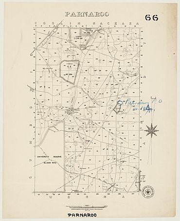
Hundred of Parnaroo, 1897
|
|||||||||||||||
| Postcode(s) | 5422 | ||||||||||||||
| LGA(s) | District Council of Peterborough | ||||||||||||||
| Region | Yorke and Mid North | ||||||||||||||
| County | Kimberley | ||||||||||||||
| State electorate(s) | Stuart | ||||||||||||||
| Federal Division(s) | Grey | ||||||||||||||
|
|||||||||||||||
| Footnotes | Adjoining localities | ||||||||||||||
Parnaroo is a small rural area in South Australia. It is located to the east of a town called Peterborough. The name Parnaroo comes from an Aboriginal word. It means "rain of little stones." This name was first used for a sheep farm in the area in 1854.
The modern area of Parnaroo was officially named in August 2000. It kept the name that had been used there for a long time.
Parnaroo's Early History
Long ago, the land of Parnaroo belonged to the Ngadjuri people. They were the original inhabitants of this area.
European Settlement Challenges
When Europeans first settled in South Australia, a small community started in Parnaroo. However, this settlement never grew very large. Today, only ruins of it remain.
Farmers in Parnaroo faced many difficulties in the 1880s. The land was tough, and there wasn't much rainfall. This area is north of Goyder's Line. This line marks where farming becomes very hard due to low rain.
Schools and Post Office
Parnaroo once had its own schools and a post office. These services helped the small community.
- Parnaroo School was open from 1890 to 1930.
- Parnaroo South School operated from 1895 until 1911.
- The Parnaroo Post Office opened on July 27, 1871. It closed on November 30, 1916.
Today, the land in Parnaroo is mostly private land used for farming and grazing animals.
 | Janet Taylor Pickett |
 | Synthia Saint James |
 | Howardena Pindell |
 | Faith Ringgold |

