Parts of Holland facts for kids
| Lincolnshire, Parts of Holland | |
 |
|
| Geography | |
| Status | Administrative county |
| 1901 area | 268,992 acres (1089 km²) |
| 1961 area | 267,847 acres (1083 km²) |
| HQ | County Hall, Boston |
| History | |
| Created | 1889 |
| Abolished | 1974 |
| Succeeded by | Lincolnshire |
Quick facts for kids Demography |
|
|---|---|
| 1901 population | 77,610 |
| 1971 population | 105,685 |
| Politics | |
| Governance | Holland County Council |
 |
|
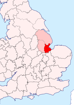
The Parts of Holland is a special historical area in Lincolnshire, England. It covers the southeastern part of the county. Even today, people in the area still know this name. You can even find it in the name of the modern district called South Holland.
How the Parts of Holland Were Governed

Long ago, Lincolnshire was split into three main parts. These were Holland, Lindsey, and Kesteven. Each of these "Parts" had its own local government. They held special meetings called 'quarter sessions' to manage their areas.
In 1888, a new law created a 'county council' for the Parts of Holland. This council helped run the area. It continued to do so until 1974. After that, the three separate councils were combined. For the first time, Lincolnshire had one big county council.
Before 1888, Holland was divided into smaller areas. These were called 'wapentakes'. There were three of them: Elloe, Kirton, and Skirbeck. These divisions had been around since at least the 900s!
Later, in 1894, the administrative county of Holland was further divided. It got 'rural districts' for the countryside and 'urban districts' for towns. The big town of Boston stayed as a 'municipal borough'. Some of the rural districts included Boston, Crowland, and Spalding. Towns like Holbeach, Long Sutton, Spalding, and Sutton Bridge became urban districts.
The Land and Its Geography

The area that used to be the Parts of Holland is now covered by two modern districts. These are the Borough of Boston and South Holland.
This whole area is very flat and close to sea level. The highest points are only about five meters (16 feet) high. These higher spots are usually on the banks of rivers, built up by people. Because it's so low, the land needs careful drainage. This helps keep the farmland productive.
For a long time, it was hard to drain the land well. Farmers had to wait for steam engines to be invented. These powerful machines could pump water away. Before the mid-1800s, Holland was mostly used for grazing animals. Farmers would bring livestock from Scotland and northern England. They would fatten them up here before taking them to markets in places like London. Many old country roads are still called 'droves'. These were the paths where animals were herded.
Towns and Villages in Holland
- Algarkirk
- Boston
- Crowland
- Donington
- Gosberton
- Holbeach
- Kirton-in-Holland
- Long Sutton
- Swineshead
- Spalding
- Sutterton
- Sutton Bridge
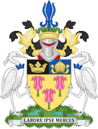
You might notice that the landscape in the Parts of Holland looks a bit like the Holland region in the Netherlands. Both areas are very low-lying. They are also both famous for growing beautiful tulips! However, the names have different meanings. Holland in England means "land of the hill spurs." The Dutch Holland comes from an old word meaning "wooded land."
 | Delilah Pierce |
 | Gordon Parks |
 | Augusta Savage |
 | Charles Ethan Porter |

