Pasto, Aibonito, Puerto Rico facts for kids
Quick facts for kids
Pasto
|
|
|---|---|
|
Barrio
|
|

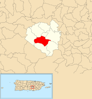
Location of Pasto within the municipality of Aibonito shown in red
|
|
| Commonwealth | |
| Municipality | |
| Area | |
| • Total | 3.29 sq mi (8.5 km2) |
| • Land | 3.29 sq mi (8.5 km2) |
| • Water | 0.00 sq mi (0 km2) |
| Elevation | 2,041 ft (622 m) |
| Population
(2010)
|
|
| • Total | 4,184 |
| • Density | 1,271.7/sq mi (491.0/km2) |
| Source: 2010 Census | |
| Time zone | UTC−4 (AST) |
Pasto is a special area, or barrio, located in the town of Aibonito, Puerto Rico. In 2010, about 4,184 people lived there. It's like a neighborhood within a bigger town.
Contents
History of Pasto
Puerto Rico used to be part of Spain. After the Spanish–American War in 1898, Spain gave Puerto Rico to the United States. This happened under an agreement called the Treaty of Paris of 1898. Puerto Rico then became a territory of the United States.
In 1899, the United States government counted all the people living in Puerto Rico. This was part of a census, which is an official count of the population. The census found that Pasto and a nearby barrio called Robles had a combined population of 1,459 people.
| Historical population | |||
|---|---|---|---|
| Census | Pop. | %± | |
| 1910 | 776 | — | |
| 1920 | 1,306 | 68.3% | |
| 1930 | 1,915 | 46.6% | |
| 1940 | 2,063 | 7.7% | |
| 1950 | 1,198 | −41.9% | |
| 1980 | 3,625 | — | |
| 1990 | 3,814 | 5.2% | |
| 2000 | 3,988 | 4.6% | |
| 2010 | 4,184 | 4.9% | |
| U.S. Decennial Census 1899 (shown as 1900) 1910-1930 1930-1950 1980-2000 2010 |
|||
Understanding Sectors in Pasto
In Puerto Rico, barrios are like big neighborhoods or divisions within a town. These barrios are then divided into even smaller local areas. These smaller areas are called sectores (which means sectors in English).
There are different types of sectores. Some are simply called sector. Others might be called urbanización (a planned neighborhood), reparto (a land division), barriada (a smaller neighborhood), or residencial (a housing project).
List of Sectors in Pasto
Here are some of the sectors you can find in Pasto barrio:
- Carretera 162
- Carretera 718
- Comunidad Monte Verde
- Comunidad Yura
- Hacienda Camila
- Parcelas Nuevas
- Parcelas Viejas
- Sector Bejuco
- Sector Cuchilla
- Sector Cuesta Blanca
- Sector La Playita
- Sector La Torre
- Sector Los Cardín
- Sector Palomas
- Sector Pasto
- Urbanización Las Delicias
- Urbanización Paseo de Algarrobo
- Urbanización Paseo de la Reina
- Villas de Algarrobo
Special Communities Program
Since 2001, Puerto Rico has had a special program to help communities that face high levels of poverty. These communities often don't have enough resources or opportunities. This program helps identify these places and work to improve them.
Initially, 686 places were identified as needing this special help. By 2008, this list grew to 742 places. These places can be barrios, communities, sectors, or even smaller neighborhoods. In 2004, some areas within Pasto barrio were added to this list. These included Parcelas Nuevas and Parcelas Viejas.
The program aims to help residents in these communities get the support they need.
See also
 In Spanish: Pasto (Aibonito) para niños
- List of communities in Puerto Rico
- List of barrios and sectors of Aibonito, Puerto Rico


