Patchel Run facts for kids
Quick facts for kids Patchel Run |
|
|---|---|
| Other name(s) | Tributary to French Creek |
| Country | United States |
| State | Pennsylvania |
| County | Venango |
| Physical characteristics | |
| Main source | Wolf Run divide about 2 miles northwest of Galloway, Pennsylvania 1,440 ft (440 m) 41°27′22″N 079°50′56″W / 41.45611°N 79.84889°W |
| River mouth | Foster Corner, Pennsylvania French Creek 984 ft (300 m) 41°24′42″N 079°51′10″W / 41.41167°N 79.85278°W |
| Length | 3.41 mi (5.49 km) |
| Basin features | |
| Progression | south |
| River system | Allegheny River |
| Basin size | 6.76 square miles (17.5 km2) |
| Tributaries |
|
| Bridges | US 322 |
Patchel Run is a small stream located in the state of Pennsylvania in the United States. It flows into a larger stream called French Creek. This stream was named after Edward Patchel, who was one of the first people to settle in the area.
Contents
Where Patchel Run Flows
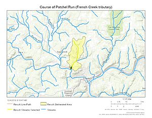
Patchel Run begins its journey in an area known as the Wolf Run divide. This starting point is about 2 miles northwest of a place called Galloway, Pennsylvania.
From its source, Patchel Run flows mainly towards the south. It continues its path until it reaches French Creek. This meeting point is near Foster Corner, Pennsylvania.
Understanding the Watershed
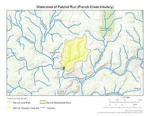
A watershed is like a big bowl that collects all the rain and snow that falls in an area. All this water then drains into a single stream, river, or lake.
The watershed for Patchel Run covers an area of about 6.76 square miles. This means that all the water that falls within this 6.76-square-mile area eventually flows into Patchel Run.
Rainfall and Forest Cover
On average, about 44.5 inches of rain fall in the Patchel Run watershed each year. This rainfall helps keep the stream flowing.
A large part of the watershed, about 79%, is covered by forests. These forests are important because they help keep the water clean. They also prevent soil from washing away into the stream.
Images for kids
 | Bessie Coleman |
 | Spann Watson |
 | Jill E. Brown |
 | Sherman W. White |


