Pathum Thani province facts for kids
Quick facts for kids
Pathum Thani
ปทุมธานี
|
|||
|---|---|---|---|
|
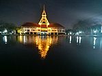
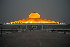
Clockwise from top left: Thailand National Memorial, A Royal Ploughing Ceremony exhibition in Golden Jubilee Museum of Agriculture, Tornado ride in the Dream World, Wat Phra Dhammakaya, National Science Museum, Thammasat University's pond.
|
|||
|
|||
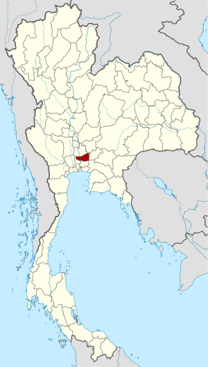
Map of Thailand highlighting Pathum Thani province
|
|||
| Country | Thailand | ||
| Region | Central Thailand | ||
| Capital | Pathum Thani | ||
| Largest City | Rangsit | ||
| Area | |||
| • Total | 1,526 km2 (589 sq mi) | ||
| Area rank | Ranked 70th | ||
| Population
(2019)
|
|||
| • Total | 1,163,604 | ||
| • Rank | Ranked 18th | ||
| • Density | 763/km2 (1,980/sq mi) | ||
| • Density rank | Ranked 5th | ||
| Human Achievement Index | |||
| • HAI (2017) | 0.6384 "high" Ranked 10th |
||
| Time zone | UTC+7 (ICT) | ||
| Postal code |
10xxx
|
||
| Calling code | 02 | ||
| ISO 3166 code | TH-13 | ||
Pathum Thani (Thai: ปทุมธานี) is a province in the central part of Thailand. It's located just north of Bangkok, the capital city. You might not even notice when you cross the border between Pathum Thani and Bangkok because both areas are very developed.
Pathum Thani is an old province with a rich history. Many Mon people live here. The province is home to 186 temples and many parks. You can also find the exciting Dream World amusement park here!
Contents
Geography of Pathum Thani
This province sits on flat land near the Chao Phraya River. This big river flows right through the area. Many small canals, called khlongs, crisscross the province. These canals help water the rice fields. Pathum Thani does not have any large forest areas.
History of Pathum Thani
The city of Pathum Thani started as a settlement around 1650. It was founded by Mon people who moved from Mottama in Myanmar. The original name of the settlement was Sam Khok.
In 1815, King Rama II visited the city. The people there gave him many beautiful lotus flowers. Because of these flowers, the King decided to rename the city Pathum Thani. This name means 'lotus flower town'.
Symbols of the Province
Every province in Thailand has special symbols.
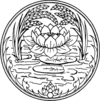
- The provincial seal of Pathum Thani shows a pink lotus flower. Two rice stalks bend over the flower. This design represents how fertile and rich the province's land is.
- The provincial tree is the Indian coral tree (Erythrina variegata).
- The provincial flower is the lotus (Nymphaea lotus).
Education and Technology Hub
Pathum Thani is a very important place for learning and new inventions. It has many universities and colleges, especially those focused on science and technology. There are also many industrial parks and research centers, like the Thailand Science Park. This makes Pathum Thani a major center for education and technology in the region.
Academic Institutes
Many famous schools and universities are located here:
- National Science Museum
- Asian Institute of Technology
- Bangkok University (Rangsit Campus)
- Eastern Asia University
- North Bangkok University (Rangsit)
- Pathumthani University
- Rajamangala University of Technology
- Rangsit University
- Shinawatra University
- Sirindhorn International Institute of Technology
- Thammasat University (Rangsit Center)
- Valaya Alongkorn Rajahbhat University
Research Centers
Important research happens in Pathum Thani at places like:
- Thailand Science Park
- National Science and Technology Development Agency (NSTDA)
- National Center for Genetic Engineering and Biotechnology (BIOTEC)
- National Metal and Materials Technology Center (MTEC)
- National Nanotechnology Center (NANOTEC)
- National Electronics and Computer Technology Center (NECTEC)
- Thailand Institute of Scientific and Technological Research (TISTR)
Industrial Parks
These parks are areas where many factories and businesses are located:
- Software Park Thailand (located nearby in Nonthaburi)
- Nava Nakorn Industrial Promotion Zone
- Bangkadi Industrial Park
- Techno Thani (a "Technology City" managed by the Ministry of Science and Technology)
Administrative Divisions
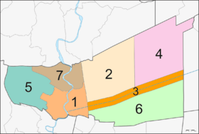
Pathum Thani province is divided into seven main areas called amphoes. These districts are then split into smaller parts called communes (tambons) and villages (mubans).
The seven districts are:
- Mueang Pathum Thani
- Khlong Luang
- Thanyaburi
- Nong Suea
- Lat Lum Kaeo
- Lam Luk Ka
- Sam Khok
Local Government
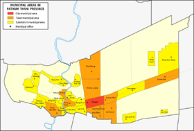
The province has one main administrative organization. It also has 29 municipal areas.
- Rangsit is the only area with city status. It is the largest populated place in the province.
- Ten areas have town status.
- Eighteen areas have subdistrict status.
Human Achievement Index 2017
The Human Achievement Index (HAI) measures how well people are doing in different areas of life. It looks at things like health, education, and income. Since 2003, this index has helped track progress in human development.
In 2017, Pathum Thani province had a "high" HAI value of 0.6384. This placed it 10th in the ranking among all provinces. This means Pathum Thani is a good place for people to live and grow.
See also
 In Spanish: Provincia de Pathum Thani para niños
 | Delilah Pierce |
 | Gordon Parks |
 | Augusta Savage |
 | Charles Ethan Porter |


