Paw Creek (Charlotte neighborhood) facts for kids
Quick facts for kids
Paw Creek
|
|
|---|---|
| Nickname(s):
"Tank Town"
|
|
| Country | |
| State | |
| County | Mecklenburg County |
| City | Charlotte |
| Council District | 2 |
| Annexed | 1979–Ongoing |
| Elevation | 234 m (768 ft) |
| Time zone | UTC-5 (Eastern (EST)) |
| ZIP code |
28130, 28214
|
| Area code(s) | 704, 980 |
| GNIS feature ID | 991951 |
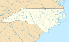
Paw Creek is a community and neighborhood in the northwest part of Mecklenburg County, North Carolina. It is mostly inside the big city of Charlotte. Some parts are still considered a "township" of North Carolina. A township is like a local area with its own government.
Contents
The Story of Paw Creek
The Paw Creek community gets its name from a little creek that flows through the area. Long ago, there was also a community called Thrift nearby. It was located where Old Mount Holly Road and Freedom Drive meet today. Thrift was on state maps until the 1980s. That's when Charlotte grew and took over (or annexed) that area.
Local Library
Paw Creek has its own branch of the Public Library of Charlotte and Mecklenburg County. This library is a great place to find books, study, and learn new things. You can find it on Hoyt Galvin Way. It is close to the intersection of Brookshire Boulevard and Rozzelles Ferry Road.
Getting Around Paw Creek
Paw Creek has several important roads and ways to travel.
Main Roads
- Brookshire Boulevard (NC 16)
- Freedom Drive / Mount Holly Road (NC 27)
- Senator W. Craig Lawing Freeway (I-485)
Public Transportation
The Charlotte Area Transit System (CATS) helps people get around. They offer local bus service in the Paw Creek area. This is a good way to travel without a car.
Home Services
Most homes in Paw Creek get water and trash pickup from the city of Charlotte. Some newer neighborhoods might use different companies. Electricity is provided by Duke Energy. Natural gas comes from Piedmont Natural Gas. For internet, phone, and TV, residents can choose between AT&T and Time Warner Cable.


