Paxton, California facts for kids
Quick facts for kids
Paxton
|
|
|---|---|

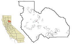
Location in Plumas County and the state of California
|
|
| Country | |
| State | |
| County | Plumas |
| Area | |
| • Total | 0.334 sq mi (0.864 km2) |
| • Land | 0.334 sq mi (0.864 km2) |
| • Water | 0 sq mi (0 km2) 0% |
| Elevation | 2,969 ft (905 m) |
| Population
(2020)
|
|
| • Total | 0 |
| • Density | 0/sq mi (0/km2) |
| Time zone | UTC-8 (Pacific (PST)) |
| • Summer (DST) | UTC-7 (PDT) |
| ZIP code |
95971
|
| Area code(s) | 530 |
| FIPS code | 06-56182 |
| GNIS feature ID | 1656210 |
Paxton is a small community in Plumas County, California, United States. It is known as a census-designated place (CDP). This means it is an area that the government counts for population, but it is not an officially organized city or town. In 2010, only 14 people lived in Paxton.
History of Paxton
Paxton has an interesting past. It was once called Soda Bar. A post office was opened in Paxton in 1917. This post office served the community for many years. It finally closed its doors in 1952.
Geography of Paxton
Paxton is located in California, within a county called Plumas County. You can find it at these coordinates: 40°2′12″N 120°59′45″W / 40.03667°N 120.99583°W.
The community covers a very small area. It is about 0.3 square miles (0.8 square kilometers) in total. All of this area is land, meaning there are no large bodies of water within its boundaries.
Paxton's Population
The number of people living in Paxton has changed over time. In the year 2000, there were 21 residents. By the 2010 census, the population had decreased to 14 people.
Who Lives in Paxton?
According to the 2010 census, all 14 people living in Paxton were White. About 28% of the residents identified as Hispanic or Latino. The community is very small, with a low population density.
See also
 In Spanish: Paxton (California) para niños
 | Sharif Bey |
 | Hale Woodruff |
 | Richmond Barthé |
 | Purvis Young |


