
Paynes, Mississippi facts for kids
Quick facts for kids
Paynes, Mississippi
|
|
|---|---|

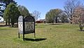
A historical marker in Paynes, Mississippi.
|
|

Paynes, Mississippi
Location in Mississippi

Paynes, Mississippi
Location in the United States
|
|
| Country | United States |
| State | Mississippi |
| County | Tallahatchie |
| Elevation | 177 ft (54 m) |
| Time zone | UTC-6 (Central (CST)) |
| • Summer (DST) | UTC-5 (CDT) |
| ZIP code |
38920
|
| Area code(s) | 662 |
| GNIS feature ID | 675521 |
Paynes is a small place in Tallahatchie County, Mississippi. It is known as an unincorporated community. This means it does not have its own local government like a city or town. Instead, it is part of the larger county.
Paynes is located in the northwestern part of Tallahatchie County. It is about 7 miles (11 kilometers) northwest of a place called Cascilla. Paynes is also about 6 miles (10 kilometers) south of Charleston. You can find Paynes right along Mississippi Highway 35.
Contents
What is an Unincorporated Community?
An unincorporated community is a group of homes or buildings that are not officially part of a city or town. These areas do not have their own mayor or city council. Instead, they are governed by the county they are in. This means the county government provides services like roads and law enforcement.
How They Are Different
Cities and towns have their own local laws and services. Unincorporated communities follow the rules of the county. They might have a post office or a few businesses. But they do not have the same structure as a formal city.
Geography of Paynes
Paynes is located in the state of Mississippi. Mississippi is in the southern part of the United States. The area around Paynes is mostly flat. It is part of the Mississippi Delta region. This region is known for its rich soil.
Nearby Places
Paynes is close to several other small communities. These include Cascilla and Charleston. Charleston is one of the two county seats for Tallahatchie County. A county seat is a town where the county government offices are located.
Images for kids
-
Paynes Baptist Church located along Mississippi Highway 35

