Pennefather River facts for kids
Quick facts for kids Pennefather |
|
|---|---|

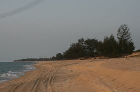
Near Pennefather River mouth, in southwest Cape York Peninsula
|
|
|
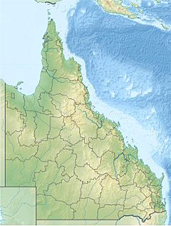
Location of Pennefather River mouth in Queensland
|
|
| Country | Australia |
| State | Queensland |
| Region | Far North Queensland |
| Physical characteristics | |
| Main source | Mapoon 20 m (66 ft) 12°19′53″S 141°52′22″E / 12.33147°S 141.87289°E |
| River mouth | Gulf of Carpentaria south of Mapoon 0 m (0 ft) 12°13′44″S 141°43′14″E / 12.22889°S 141.72056°E |
| Length | 11 km (6.8 mi) |
| Basin features | |
| Basin size | 3,009 km2 (1,162 sq mi) |
The Pennefather River is a river found on the western side of the Cape York Peninsula in Far North Queensland, Queensland, Australia. It's a special place with a long history, especially known for being the first recorded landing spot in Australia by a European explorer.
Contents
Where is the Pennefather River?
The Pennefather River starts where several smaller waterways, including Fish Creek, meet in the Port Musgrave Aggregation wetlands. These wetlands are areas of land that are often covered with water, like swamps or marshes.
River's Journey and Size
The river flows west, picking up water from other creeks like Turtle Creek and Dingo Creek. Finally, it empties into the Gulf of Carpentaria, which is a large, shallow sea north of Australia. The river drops only about 1 meter over its entire 11-kilometer (about 7-mile) journey. At its widest point, it stretches about 2 kilometers (1.2 miles) across!
The Pennefather River collects water from a huge area called a catchment area, which is about 3,009 square kilometers (1,162 square miles). A big part of this area, about 349 square kilometers (135 square miles), is made up of those important wetlands.
Who Named the Pennefather River?
The land around the Pennefather River has been home to the Yupanguthi Aboriginal people for thousands of years. Their language, Yupanguthi, is an Australian Aboriginal language spoken in this region. The Yupanguthi people have a deep connection to this land and its waterways.
First European Landfall
The mouth of the Pennefather River is famous because it was the site of the first recorded landing in Australia by a European explorer. This happened in 1606 when a Dutch explorer named Willem Janszoon arrived. He named the river R. met het Bosch, which means "River with the Forest."
A Mix-Up in Names
Later, in 1802, a British explorer named Matthew Flinders explored the area. He mistakenly thought the Pennefather River was the Coen River, which had been named by another Dutch explorer, Jan Carstenszoon, back in 1623. Because of this mix-up, maps in the 19th century often showed the Pennefather River incorrectly as the Coen River.
The confusion lasted for a long time! In 1880, a captain named Charles Edward de Fonblanque Pennefather realized there were now two rivers being called the Coen River. To fix this, in 1894, the authorities in Queensland officially named the river after him. However, some maps, like the British Admiralty Chart for the Gulf of Carpentaria, continued to use the name Coen River until as late as 1967!
 | John T. Biggers |
 | Thomas Blackshear |
 | Mark Bradford |
 | Beverly Buchanan |


