Pennsbury Township, Pennsylvania facts for kids
Quick facts for kids
Pennsbury Township
|
|
|---|---|
|
Township
|
|
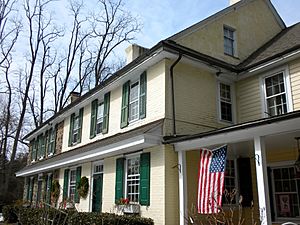
Pennsbury Inn
|
|
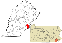
Location of Pennsbury Township in Chester County and of Pennsbury Township in Pennsylvania
|
|
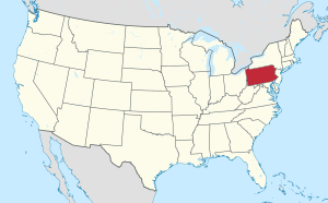
Location of Pennsylvania in the United States
|
|
| Country | United States |
| State | Pennsylvania |
| County | Chester |
| Area | |
| • Total | 10.05 sq mi (26.04 km2) |
| • Land | 9.92 sq mi (25.70 km2) |
| • Water | 0.13 sq mi (0.34 km2) |
| Elevation | 246 ft (75 m) |
| Population
(2010)
|
|
| • Total | 3,604 |
| • Estimate
(2016)
|
3,661 |
| • Density | 368.90/sq mi (142.43/km2) |
| Time zone | UTC-5 (EST) |
| • Summer (DST) | UTC-4 (EDT) |
| Area code(s) | 610 |
| FIPS code | 42-029-59136 |
Pennsbury Township is a community located in Chester County, Pennsylvania, in the United States. A "township" is a type of local government area, like a small town or district. In 2010, about 3,604 people lived here.
Contents
History of Pennsbury Township
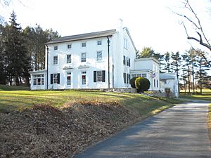
Pennsbury Township is home to several historic buildings and places. These special spots are listed on the National Register of Historic Places. This is an official list of places in the United States that are important to history.
Some of these historic places include:
- The Barns-Brinton House
- The Brinton-King Farmstead
- The Fairville Historic District
- The Pennsbury Inn
- And several historic homes and farms like the Peter Harvey House and Barn and Springdale Farm.
Geography and Climate
Pennsbury Township covers about 10 square miles (26 square kilometers). Most of this area is land, with a small part being water.
Part of a place called Chadds Ford is located in the eastern part of the township. However, the very old, historic village of Chadds Ford is just to the east, in a different township.
The weather in Pennsbury Township usually has hot summers. It's a place where you can find a mix of different plants and trees that grow well in this type of climate.
Population and People
| Historical population | |||
|---|---|---|---|
| Census | Pop. | %± | |
| 1930 | 678 | — | |
| 1940 | 660 | −2.7% | |
| 1950 | 686 | 3.9% | |
| 1960 | 936 | 36.4% | |
| 1970 | 1,763 | 88.4% | |
| 1980 | 2,604 | 47.7% | |
| 1990 | 3,326 | 27.7% | |
| 2000 | 3,500 | 5.2% | |
| 2010 | 3,604 | 3.0% | |
| 2020 | 3,876 | 7.5% | |
The number of people living in Pennsbury Township has grown over the years. In 1930, there were 678 people, and by 2020, the population had increased to 3,876.
In 2010, most people living in the township were White. There were also smaller groups of people who identified as Black or African American, Native American, or Asian. Some residents were of Hispanic or Latino background.
In 2000, about 26.6% of households had children under 18 living with them. Most households were married couples living together. The average age of people in the township was 49 years old.
Education
Students in Pennsbury Township attend schools within the Unionville-Chadds Ford School District.
Notable People from Pennsbury Township
Some interesting people have lived in Pennsbury Township:
- Joseph Bailey: He was a U.S. Representative for Pennsylvania in the 1860s. This means he was a leader who helped make laws for the country.
- Isaac Mendenhall: He was a farmer and an abolitionist. An abolitionist was someone who worked to end slavery. He also helped people escape slavery as a "station master" on the Underground Railroad.
Transportation
Pennsbury Township has many public roads. Some roads are kept up by the township itself, and others are maintained by the Pennsylvania Department of Transportation (PennDOT). PennDOT is a state agency that manages roads and transportation.
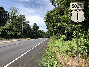
The main highway in Pennsbury Township is U.S. Route 1. It runs east to west through the northern part of the township. Other important roads include Pennsylvania Route 52 and Pennsylvania Route 926. These routes help people travel around and through the area.
See also
 In Spanish: Municipio de Pennsbury para niños


