Perkins, Missouri facts for kids
Quick facts for kids
Perkins, Missouri
|
|
|---|---|

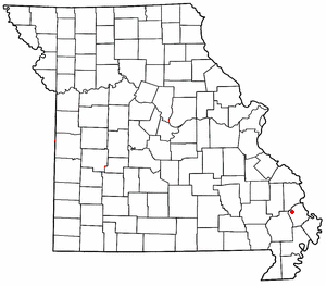
Location of Perkins in Missouri
|
|
| Country | United States |
| State | Missouri |
| County | Scott |
| Area | |
| • Total | 0.17 sq mi (0.43 km2) |
| • Land | 0.17 sq mi (0.43 km2) |
| • Water | 0.00 sq mi (0.00 km2) |
| Elevation | 338 ft (103 m) |
| Population
(2020)
|
|
| • Total | 123 |
| • Density | 745.45/sq mi (287.73/km2) |
| ZIP code |
63771
|
| Area code(s) | 573 |
| FIPS code | 29-57044 |
| GNIS feature ID | 724226 |
Perkins is a small community in Scott County, Missouri, United States. It is known as an unincorporated community. This means it doesn't have its own city government. However, it is also a census-designated place. This means the government counts the people living there for official records. Perkins is located about sixteen miles northwest of Sikeston.
How Perkins Got Its Name
Perkins got its name from a man named Amos Perkins. He was a businessperson who worked in the local lumber industry. The community has had a post office since 1890.
Perkins and the Railroad
In 1935, Perkins was an important stop on the St. Louis Southwestern Railway. It was listed as "Station I-24" on the railway's time table. The station was at milepost 23.76.
Perkins had a special track called a "siding." This siding was long enough for 20 train cars. This was about 900 feet long back then. There was also a "mail crane" at Perkins. This was a device used to pick up mail from moving trains.
Perkins was a "flagstop" for passenger trains #5 and #6. This means the train would only stop if someone waved a flag to get on or off. A nearby place called Randles had more services. It had a telegraph office and longer sidings for trains to meet.
Population of Perkins
| Historical population | |||
|---|---|---|---|
| Census | Pop. | %± | |
| 2020 | 123 | — | |
| U.S. Decennial Census | |||
According to the 2020 Census, 123 people lived in Perkins.
 | Ernest Everett Just |
 | Mary Jackson |
 | Emmett Chappelle |
 | Marie Maynard Daly |

