
Peters, Texas facts for kids
Quick facts for kids
Peters, Texas
|
|
|---|---|

Peters, Texas
Location in Texas

Peters, Texas
Location in the United States
|
|
| Country | United States |
| State | Texas |
| County | Austin |
| Elevation | 169 ft (52 m) |
| Time zone | UTC-6 (Central (CST)) |
| • Summer (DST) | UTC-5 (CDT) |
| ZIP code |
77474
|
| Area code(s) | 979 |
Peters is a small, unincorporated community in Austin County, Texas. This means it's a place where people live, but it doesn't have its own local government like a city. In 2000, about 95 people lived there. Peters is part of the larger Greater Houston metropolitan area.
Where is Peters?
Peters is located in Austin County, Texas. It's about 5.8 miles (9.3 km) north of Sealy. It's also about 7.7 miles (12.4 km) south of Bellville. You can find it along State Highway 36 (SH 36). Peters San Felipe Road crosses SH 36 here.
Nearby, you'll find Farm to Market Road 949. This road is about 1.0 mile (1.6 km) north on SH 36. Farm to Market Road 331 is about 1.6 miles (2.6 km) south. The BNSF Railway runs right next to SH 36.
On the west side of SH 36, Peters San Felipe Road goes south. It ends at Trenckmann Road. On the east side of SH 36, Peters San Felipe Road heads southeast. It goes for about 6.3 miles (10.1 km) to San Felipe.
Local Landmarks
You can find a few interesting places near Peters. The All Around Cowboy Church is on the east side of SH 36. The Christian City Fellowship is also nearby. Both are just south of Trenckmann Road.
Camp Brosig is a special place for the Boy Scouts of America. It is located at 1893 Trenckmann Road. This camp is about 1.6 miles (2.6 km) northwest of SH 36.
History of Peters
Austin County was first settled by Anglo-Americans in the 1820s. However, Peters didn't start until the 1880s. This was when the Gulf, Colorado and Santa Fe Railway was built. The railway line ran between Sealy and Bellville.
Peters became a station on this new railroad. In 1883, the community got its own post office. It was named after Albert Peters, who was an early settler in the area.
The number of people living in Peters changed over time. In 1925, the population reached 125 people. By 1943, it had gone down to 70. The post office closed in the 1940s. At that time, there were only two local businesses.
In 1968, about 100 people lived in the area. By the early 1980s, Peters had a hospital. It also had three businesses, a church, and a clubhouse. From 1990 to 2000, about 95 people lived there. Today, Peters has only a few homes. It also has the Boy Scout camp and two churches.
Education
Students in the Peters community attend schools in the Sealy Independent School District.
Gallery
-
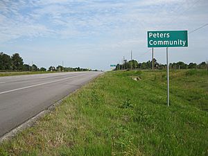
Peters Community sign is on State Highway 36, looking to the southeast.
-
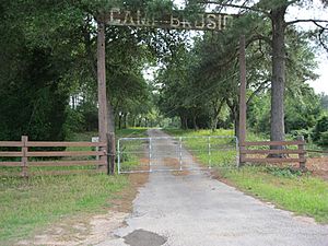
Camp Brosig on Trenckmann Road is owned by Sam Houston Area Council, Boy Scouts of America.
-
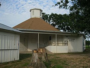
Peters Hall at Trenckmann and Peters San Felipe Roads is an old octagonal dance hall.


