Petexbatún Lake facts for kids
Quick facts for kids Petexbatún Lake |
|
|---|---|

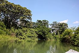
Petexbatún river near the site of Aguateca
|
|
| Location | Petén |
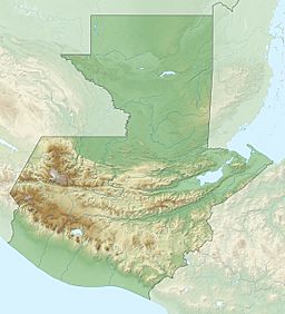
| Coordinates | 16°25′57″N 90°11′14″W / 16.432381°N 90.187283°W |
| Primary inflows | Riachuelo Aguateca, Riachuelo El Faisán |
| Primary outflows | Río Petexbatún |
| Basin countries | Guatemala |
| Surface area | 5.4 km2 (2.1 sq mi) |
| Surface elevation | 130 m (430 ft) |
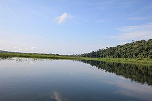
Petexbatún is a small lake in Guatemala. It is formed by the Petexbatún River, which flows into the larger La Pasión River. You can find this lake near the town of Sayaxché, in the southern part of the Petén department of Guatemala.
Contents
How the Lake Changes
The Petexbatún Lake and River have a special feature. In the winter, the La Pasión River gets very full. When this happens, the water in the Petexbatún River actually flows backwards!
It moves south, following the strong current of the La Pasión River. This also makes the water level in Petexbatún Lake rise.
Ancient Maya History
Archaeologists have given the name Petexbatún State to a group of ancient Maya cities. These cities were important during the Classic period of the Maya Civilization.
Cities of the Petexbatún State
Some of the cities in this group include:
- Seibal
- Itzan
- Dos Pilas
- Aguateca
- Tamarindito
- Punta de Chimino
- Nacimiento
The Maya Collapse
The Petexbatún State was one of the first areas to be left empty during the Maya Collapse. This was a time when many Maya cities were abandoned. It happened in a pattern from south to north.
However, the city of Seibal might have been settled again later. It could have been by a different group of people, possibly the Putún Maya. We know this from the style of the stelae (stone monuments) found there from that time.
The discoveries made by archaeologists in this area have taught us a lot. They have given us important clues about why the Classic Maya Civilization declined.
See also
 In Spanish: Petexbatún para niños
 | Delilah Pierce |
 | Gordon Parks |
 | Augusta Savage |
 | Charles Ethan Porter |


