
Sayaxché facts for kids
Quick facts for kids
Sayaxché
|
|
|---|---|
|
Municipality of Guatemala
|
|

Ferry across Río de la Pasión in Sayaxché
|
|

Sayaxché
Location in Guatemala
|
|
| Country | |
| Department | |
| Found | 1874 |
| Area | |
| • Total | 3,904 km2 (1,507 sq mi) |
| Elevation | 125 m (410 ft) |
| Population
(2012)
|
|
| • Total | 114,781 |
| Climate | Am |
Sayaxché is a town and a municipality in the El Petén department of Guatemala. It is located right by the Río La Pasión. The area of Sayaxché is about 3,904 square kilometers (1,507 square miles). In 2012, about 114,781 people lived there.
The town of Sayaxché was started in 1874. It was built to house workers for a logging company called Jamet Sastré. In 1929, it officially became a municipality.
Sayaxché is home to El Rosario National Park, which is just east of the town. You can also find important ancient sites like Ceibal and Dos Pilas within its borders.
Contents
Climate in Sayaxché
Sayaxché has a tropical monsoon climate. This means it is warm all year round. It also has a lot of rain during certain months. This type of climate is often found in tropical areas.
| Climate data for Sayaxché | |||||||||||||
|---|---|---|---|---|---|---|---|---|---|---|---|---|---|
| Month | Jan | Feb | Mar | Apr | May | Jun | Jul | Aug | Sep | Oct | Nov | Dec | Year |
| Mean daily maximum °C (°F) | 26.7 (80.1) |
28.0 (82.4) |
29.7 (85.5) |
31.5 (88.7) |
32.4 (90.3) |
31.7 (89.1) |
30.1 (86.2) |
30.5 (86.9) |
30.2 (86.4) |
29.1 (84.4) |
27.9 (82.2) |
26.7 (80.1) |
29.5 (85.2) |
| Daily mean °C (°F) | 22.4 (72.3) |
23.1 (73.6) |
24.9 (76.8) |
26.6 (79.9) |
27.7 (81.9) |
27.2 (81.0) |
26.0 (78.8) |
26.2 (79.2) |
26.0 (78.8) |
25.1 (77.2) |
23.8 (74.8) |
22.3 (72.1) |
25.1 (77.2) |
| Mean daily minimum °C (°F) | 18.2 (64.8) |
18.2 (64.8) |
20.2 (68.4) |
21.7 (71.1) |
23.0 (73.4) |
22.8 (73.0) |
22.0 (71.6) |
22.0 (71.6) |
21.9 (71.4) |
21.1 (70.0) |
19.7 (67.5) |
17.9 (64.2) |
20.7 (69.3) |
| Average rainfall mm (inches) | 86 (3.4) |
62 (2.4) |
42 (1.7) |
45 (1.8) |
160 (6.3) |
236 (9.3) |
216 (8.5) |
215 (8.5) |
268 (10.6) |
251 (9.9) |
144 (5.7) |
115 (4.5) |
1,840 (72.6) |
| Source: Climate-Data.org | |||||||||||||
Ancient Mayan Sites
Sayaxché is home to many ancient Mayan sites. There are thirty-two known archaeological locations here. Some of the most famous ones are El Ceibal, Dos Pilas, Aguateca, and Cancuén. These sites offer a look into the rich history of the Mayan people.
| Site | What You'll Find |
|---|---|
| El Ceibal | This site is about 22 km (14 miles) from Sayaxché. Experts from Harvard University worked to restore parts of it between 1963 and 1968. |
| Dos Pilas | Located about 28 km (17 miles) southwest of Sayaxché. It has two clear streams and well-preserved Mayan stone carvings. |
| Aguateca | Found in the same area as Dos Pilas. It is known for a clear natural crack in the earth. |
| Cancuén | This site is famous for its large, impressive buildings. It is located by the La Pasión river. |
Fun Things to Do (Tourism)
Sayaxché is a popular spot for visitors in the Petén Department. There are many exciting places to see and activities to enjoy nearby.
| Place | What You Can Do |
|---|---|
| Petexbatún | This is a big lagoon with clear water and untouched jungle. It's great for fishing, water sports, and studying animals. |
| San Juan Acul | Only 14 km (9 miles) by land or 16 km (10 miles) by boat from Sayaxché. This small lagoon is mostly unexplored. |
| Arroyo El Pucte | About 36 km (22 miles) by boat along the La Pasión river. Its clear water lets you see the bottom. |
| Salinas River | This river forms a natural border between México and Guatemala. It has long sandy shores. |
| El Rosario National Park | Located 4 km (2.5 miles) from Sayaxché. It has forests and a small lake. The park covers about 10.79 square kilometers (4.17 square miles). |
River Pollution Incident
In June 2015, people living near the Río La Pasión saw many dead fish floating in the water. This was a sad event for the river and the communities.
Authorities in Guatemala looked into the issue. They found traces of a chemical in the water that flowed from a palm oil company called "Reforestadora de Palmas de Petén, S.A." (REPSA). The company stated that heavy rain caused their water treatment areas to overflow into the river.
The pollution spread over 105 kilometers (65 miles) downstream. It affected about 5,600 families, which is around 30,000 people. These communities rely on the river for their water and for fishing. There was also concern that the pollution might reach the Usumacinta River and then other rivers in Mexico.
Where Sayaxché Is Located
The municipality of Sayaxché covers about 3,908 square kilometers (1,509 square miles). This is about 10.89% of the total area of the Petén Department.
 |
La Libertad, municipality of Petén Department | |
||
| Ocosingo, municipality of Chiapas, México | San Francisco, Dolores, Poptún and San Luis, municipalities of Petén Department | |||
| Chisec, municipality of Alta Verapaz Department |
Images for kids
-
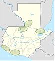
African oil palm plantation areas in Guatemala as of 2014.

See also
 In Spanish: Sayaxché para niños
