Pico Bolívar facts for kids
Quick facts for kids Pico Bolívar |
|
|---|---|

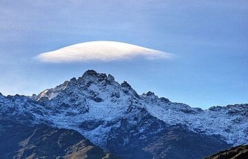
Peak Bolívar during snow season
|
|
| Highest point | |
| Elevation | 4,978 m (16,332 ft) |
| Prominence | 3,957 m (12,982 ft) Ranked 25th |
| Listing | Country high point Ultra |
| Geography | |
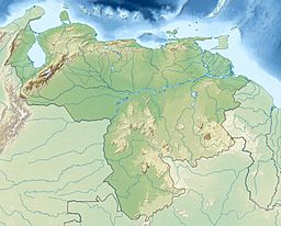
| Location | Mérida, Mérida, Venezuela |
| Parent range | Sierra Nevada, Andes |
| Climbing | |
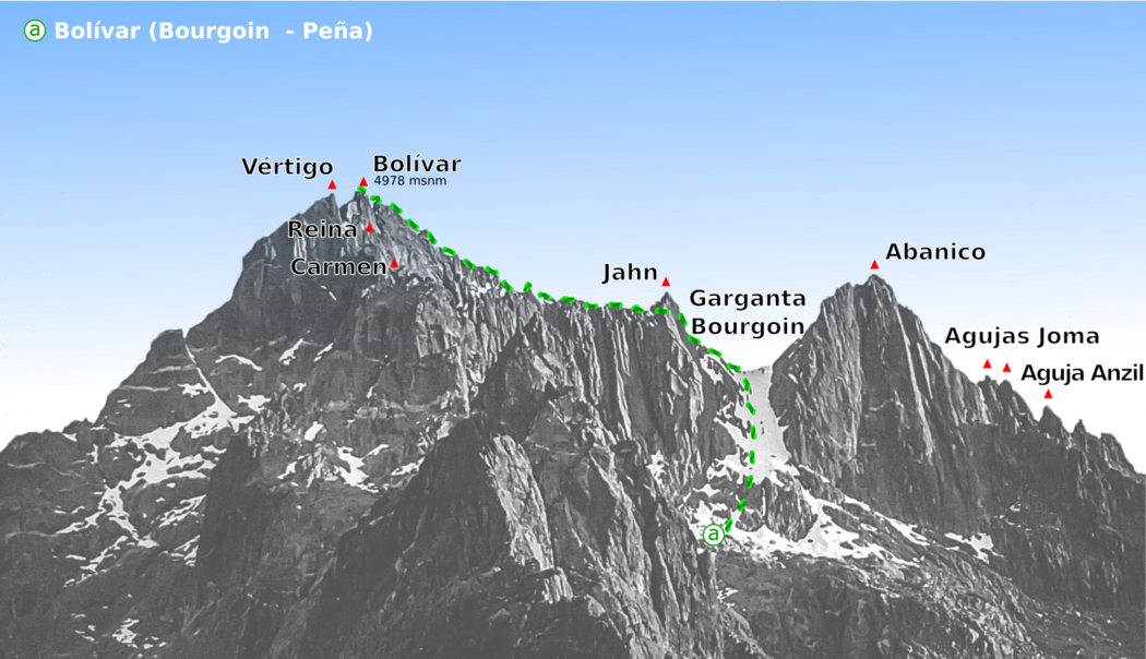
| First ascent | 1935 by Enrique Bourgoin, H. Márquez Molina and Domingo Peña |
Pico Bolívar is the tallest mountain in Venezuela, standing at 4,978 meters (about 16,332 feet) high. It is located in Mérida State and is a part of the Andes mountain range. This impressive peak is named after Simón Bolívar, a very important hero who helped Venezuela gain its independence.
Before it was called Pico Bolívar, the mountain was known as La Columna. It sits near other tall peaks like El León (4,743 m) and El Toro (4,695 m). The idea to rename it came from Tulio Febres Cordero in 1925, and it officially became Pico Bolívar on December 30, 1934.
Contents
Exploring Pico Bolívar: Venezuela's Tallest Mountain
How to Reach the Summit of Pico Bolívar
Reaching the top of Pico Bolívar is an exciting adventure, but it can only be done by hiking. While there is a famous Mérida cable car, which was once the highest and longest in the world, it only takes visitors up to a nearby peak called Pico Espejo. From Pico Espejo, climbers must continue on foot to reach the true summit of Pico Bolívar.
The first people to successfully climb Pico Bolívar were Enrique Bourgoin, H. Márquez Molina, and Domingo Peña in 1935. Their achievement marked an important moment in Venezuelan mountaineering history.
Measuring Pico Bolívar: How Tall Is It?
Early Attempts to Measure the Mountain's Height
Over the years, scientists and explorers have tried many times to figure out the exact height of Pico Bolívar. In 1912, an early measurement using a method called triangulation suggested the peak was 5,002 meters tall. Later, in 1928, another calculation put its height at 5,007 meters. This measurement was considered the official height for a long time.
Modern GPS Technology and Accurate Measurements
As technology improved, so did our ability to measure mountains more precisely. In the 1990s, scientists Heinz Saler and Carlos Abad used GPS (Global Positioning System) to measure the peak. Their findings suggested a height of 4,980.8 meters.
Even more accurate GPS measurements were taken in 2002. These studies found the height to be 4,978.4 meters, with a very small margin of error. These more precise results were officially published in 2005. The final measurement was a team effort, involving experts from different organizations, using advanced GPS equipment to ensure the most reliable information.
The Disappearing Glaciers of Pico Bolívar
Glaciers in the Past: The Ice Age and Beyond
Long, long ago, during a time called the Pleistocene epoch (which was an ice age), the area around Pico Bolívar was covered by huge glaciers. These ice sheets stretched over 600 square kilometers and covered mountains that were at least 3,000 meters high. As the ice age ended, these glaciers slowly began to shrink. It is thought that they might have even disappeared completely before a cooler period known as the Little Ice Age began.
Tracking Glacier Shrinkage Over the Years
By 1910, it was estimated that about 10 square kilometers of glaciers remained in the region. This ice was divided into two main areas: one around Picos Bolívar, Espejo, and Concha, and another around Picos Humboldt and Bonpland. There might have also been a small glacier on the northwest side of Pico El Toro.
Aerial photographs taken in 1952 showed that the glaciers had shrunk significantly. The area around Picos Bolívar, Espejo, and Concha had decreased to just 0.9 square kilometers. The glaciers on Picos Humboldt and Bonpland had also shrunk to 2.0 square kilometers.
Venezuela's Glaciers: A Recent Disappearance
The shrinking trend continued rapidly. By 2003, almost all the glaciers in the area had vanished. Only two small patches of ice remained: one on Pico Bolívar (about 7.48 hectares) and another on Pico Humboldt (about 35.81 hectares).
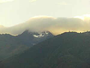
Sadly, by 2012, the last glaciers on Pico Bolívar had disappeared completely. More recently, by May 2024, the glaciers on Pico Humboldt had also vanished. This means that Venezuela became one of the first countries in the world to lose all of its glaciers. This change shows how much our planet's climate is warming.
 | Bayard Rustin |
 | Jeannette Carter |
 | Jeremiah A. Brown |


