Pico Jano facts for kids
Quick facts for kids Pico Jano |
|
|---|---|

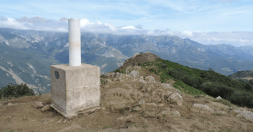
Trig point on the summit
|
|
| Highest point | |
| Elevation | 1,446 m (4,744 ft) |
| Prominence | 350 m (1,150 ft) |
| Geography | |
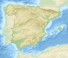
| Location | Cantabria, Spain |
| Parent range | Cantabrian Mountains |
| Climbing | |
| Easiest route | foothpath from Dobarganes |
Pico Jano is a mountain located in Cantabria, a region in northern Spain. It is a well-known peak in the Cantabrian Mountains.
Geography of Pico Jano
This mountain is part of a larger mountain range. This range separates the valleys of two rivers, the Deva and the Quiviesa. Pico Jano sits between the towns of Camaleño and Vega de Liébana. Both of these towns are in an area called Liébana.
The highest point of Pico Jano has a special pillar. This pillar is called a trig point. It helps people measure and map the land. The base of this trig point is at 1,446 meters (about 4,744 feet) above sea level. It is important not to confuse this mountain with another mountain also named Pico Jano. The other Pico Jano is near Bárcena de Pie de Concha and is a bit shorter.
How to Reach the Summit
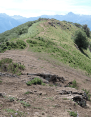
Reaching the top of Pico Jano is quite easy. There is a clear and well-waymarked path. This path starts from Dobarganes, a small village in the Vega de Liébana area. The walk is about 4 kilometers (about 2.5 miles) long.
You can also get to the summit by mountain bike. The trails are suitable for biking. From the top of Pico Jano, you can see amazing views. You can even see parts of the famous Picos de Europa mountain range.
See also
 Learn more in Spanish: Pico Jano (Liébana) para niños


