
Pierce City, Missouri facts for kids
Quick facts for kids
Pierce City, Missouri
|
|
|---|---|
_-_exterior.jpg)
St. Mary's Catholic Church (Pierce City, Missouri)
|
|

Location of Pierce City, Missouri
|
|
| Country | United States |
| State | Missouri |
| County | Lawrence, Barry |
| Area | |
| • Total | 1.29 sq mi (3.35 km2) |
| • Land | 1.29 sq mi (3.34 km2) |
| • Water | 0.01 sq mi (0.01 km2) |
| Elevation | 1,217 ft (371 m) |
| Population
(2010)
|
|
| • Total | 1,292 |
| • Estimate
(2019)
|
1,309 |
| • Density | 1,014.73/sq mi (391.82/km2) |
| Time zone | UTC-6 (Central (CST)) |
| • Summer (DST) | UTC-5 (CDT) |
| ZIP code |
65723
|
| Area code(s) | 417 |
| FIPS code | 29-57494 |
| GNIS feature ID | 0724319 |
Pierce City, once called Peirce City, is a small city in southwest Missouri, United States. It is located in parts of Lawrence and Barry counties. In 2010, about 1,292 people lived there. By 2019, the city estimated its population had grown slightly to 1,309 residents.
Contents
Geography of Pierce City
Pierce City is located at coordinates 36.946996°N and 94.002430°W.
The United States Census Bureau states that the city covers a total area of about 1.28 square miles (3.32 square kilometers). Most of this area, about 1.27 square miles (3.29 square kilometers), is land. A very small part, 0.01 square miles (0.03 square kilometers), is water.
Population and People
| Historical population | |||
|---|---|---|---|
| Census | Pop. | %± | |
| 1870 | 432 | — | |
| 1880 | 1,350 | 212.5% | |
| 1890 | 2,511 | 86.0% | |
| 1900 | 2,151 | −14.3% | |
| 1910 | 2,043 | −5.0% | |
| 1920 | 1,476 | −27.8% | |
| 1930 | 1,135 | −23.1% | |
| 1940 | 1,208 | 6.4% | |
| 1950 | 1,156 | −4.3% | |
| 1960 | 1,006 | −13.0% | |
| 1970 | 1,097 | 9.0% | |
| 1980 | 1,391 | 26.8% | |
| 1990 | 1,382 | −0.6% | |
| 2000 | 1,385 | 0.2% | |
| 2010 | 1,292 | −6.7% | |
| 2019 (est.) | 1,309 | 1.3% | |
| U.S. Decennial Census | |||
Facts from the 2010 Census
In 2010, the city had 1,292 people living in 538 households. There were 343 families. The city's population density was about 1,017 people per square mile (392 per square kilometer).
Most residents, about 95.9%, were White. Other groups included Native American (0.8%) and Asian (0.2%). About 4.6% of the population identified as Hispanic or Latino.
The average age of people in Pierce City was 37.4 years. About 26% of the residents were under 18 years old. About 16.2% were 65 years or older. The city had slightly more females (51.5%) than males (48.5%).
History of Pierce City
Two important buildings in Pierce City are listed on the National Register of Historic Places. These are the Lawrence County Bank Building and the Pierce City Fire Station, Courthouse and Jail.
How Pierce City Got Its Name
Pierce City was founded in 1870. It was created as a stop along the Atlantic and Pacific Railroad. The city was first spelled "Peirce City." It was named after Andrew Peirce, Jr., who was the president of the St. Louis–San Francisco Railway.
However, the United States Postal Service started using the spelling "Pierce" by mistake. This spelling became official in the 1930s. In 1982, there was an attempt to change the name back to "Peirce," but the United States Census Bureau did not approve it.
The May 2003 Tornado
In May 2003, a strong tornado hit Pierce City. This tornado was part of a larger series of storms. Many buildings in the historic downtown area and nearby homes were badly damaged or destroyed. About 90% of these structures had to be torn down.
A local National Guard Armory, which was also used as a storm shelter, was heavily damaged. Sadly, one person died there. However, many other buildings and homes outside the tornado's main path were not seriously harmed. The Pierce City tornado was rated an F-3 on the Fujita scale, which measures tornado strength.
Education in Pierce City
The Pierce City R-VI School District manages the local schools. It includes one elementary school, one middle school, and Pierce City High School.
The city also has a public library. It is a part of the Barry-Lawrence Regional Library system.
Images for kids
-
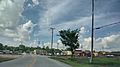
Downtown Pierce City in 2022

See also
 In Spanish: Pierce City (Misuri) para niños
