Pierre-Paul River facts for kids
Quick facts for kids Pierre-Paul River |
|
|---|---|

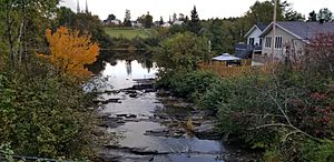
View of the mouth of river Pierre-Paul, from the bridge of route 352, on September 29, 2018. In the background: view of the village and the church of Saint-Adelphe.
|
|
| Country | Canada |
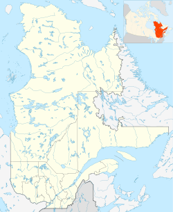
| Province | Quebec |
| Region | Mauricie |
| Regional County Municipalities | Mékinac Regional County Municipality |
| Municipalities | Saint-Tite, Sainte-Thècle and Lac-aux-Sables |
| Physical characteristics | |
| Main source | Lake Pierre-Paul (Mékinac) Saint-Tite 153 m 46°44′45″N 72°30′18″W / 46.74574°N 72.50512°W |
| River mouth | Rivière aux Castors Noirs (via Lac aux Biscuits) Batiscan River in Saint-Adelphe 100 m 46°43′54″N 72°26′15″W / 46.7318°N 72.4376°W |
| Basin features | |
| Tributaries |
|
The Pierre-Paul River is a cool river in Quebec, Canada. It flows through the Mékinac Regional County Municipality in the Mauricie area. You can find it winding through three towns: Saint-Tite, Sainte-Thècle, and Saint-Adelphe.
Contents
The River's Journey
This river is about 14 kilometres (8.7 mi) long. It starts at Pierre-Paul Lake in Saint-Tite. The land around it can be hilly. The river makes a big "Z" shape as it flows. It passes through farms and some reforested areas.
Starting Point
From Pierre-Paul Lake, the river flows north. It goes through parts of Saint-Tite. Then it enters Sainte-Thècle. Here, it crosses the Charest road for the first time. About 2.5 kilometres (1.6 mi) from its start, it takes a small detour. The Pierre-Paul River gets water from smaller streams. One important stream is Gagnon Creek.
Middle Section
The next part of the river's journey is quite straight. It flows for about 6.4 kilometres (4.0 mi). The river then turns sharply, almost 160 degrees, to flow south. It crosses the Charest road again. Then it enters Saint-Adelphe. At this point, it's only about 1.6 kilometres (0.99 mi) from where it started. The river also gets water from the 4th row Northeast Rivière des Envies area. It also gets water from a small part of northern Saint-Séverin.
Final Stretch
The last part of the river is about 3.4 kilometres (2.1 mi) long. It turns left, about 120 degrees, to flow north again. It goes through Saint-Adelphe. Near the end, the river makes a few turns. Finally, it flows into the Batiscan River. This happens near the village of Saint-Adelphe. In 1925, a new covered bridge was built over the Pierre-Paul River. This bridge is now part of Route 352.
River's Past
In the late 1800s and early 1900s, the Pierre-Paul River was important for moving timber. Loggers used the river to float logs downstream. This usually happened in spring when the water was high. In 1872, some loggers were even arrested for moving logs past a certain point!
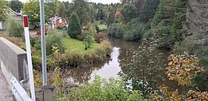
In winter, from December to March, people used the frozen river as an "ice road." This made it easier to transport wood. It was also a way to get to Saint-Tite before good roads were built. The bridge for Route 352 crosses the river near its mouth.
Arm of Pierre-Paul River
There's a stream called "Piché Creek." It drains a lot of farmland in Sainte-Thècle. It flows for about 5 kilometres (3.1 mi) from north to south. It crosses Route 352, which connects Saint-Adelphe and Sainte-Thècle. Piché Creek also collects water from other small streams.
From Creek to Arm
After crossing Route 352, Piché Creek changes its name. It becomes the "Arm of Pierre-Paul River" (bras de la rivière Pierre-Paul). This arm flows south for about 3 kilometres (1.9 mi). It then flows for another 2.3 kilometres (1.4 mi) in a winding path. Finally, it joins the main Pierre-Paul River. The mouth of the "Arm of Pierre-Paul River" is about 0.6 kilometres (0.37 mi) from where the main Pierre-Paul River flows into the Batiscan River.
Ancient Discoveries
Long before settlers arrived, Native Americans lived in the area. In the 1970s, a farmer named Emile Tessier found some ancient Native American tools. These tools were found in Sainte-Thècle. They were from a very old time, before history was written down. These tools were mostly stones that were cut and polished. They were used for hunting and other daily tasks.
These important tools are now kept at the University of Quebec at Trois-Rivières. Some were even shown in an exhibit in 1974. They were found near Piché Creek, not far from the Batiscan River.
What's in a Name?
The name "Pierre-Paul" has been used for this area since the 1870s. It first referred to the area near the river's mouth. This spot was the original center of Saint-Adelphe village. The Pierre-Paul River's mouth is between the Rivière des Envies and the Tawachiche River.
Theories About the Name
There are a couple of ideas about where the name "Pierre-Paul" comes from:
- One idea is that it's named after a Native American family. This family might have lived near Pierre-Paul Lake.
- Another idea is that "Pierre-Paul" is a simpler version of the names of early Christian apostles. This is similar to how nearby areas were named. For example, there are places called Saint-Pierre, Saint-Paul, and Saint-Thomas. Pierre-Paul Lake is in the Saint-Pierre area of Saint-Tite. The river itself also flows through a Saint-Pierre area in Saint-Adelphe.
In French Canada, Pierre-Paul is a common first name for boys. The name "Pierre-Paul" for both the lake and the river was officially recorded on December 5, 1968. The "Arm of Pierre-Paul River" was added to the official list on December 18, 1979.
 | Percy Lavon Julian |
 | Katherine Johnson |
 | George Washington Carver |
 | Annie Easley |


