Piney Run (Virginia) facts for kids
Quick facts for kids Piney Run |
|
|---|---|

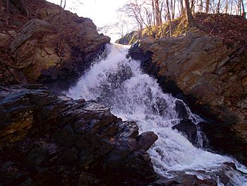
Falls of Piney Run
|
|
| Country | United States |
| State | Virginia |
| Region | Loudoun County |
| Physical characteristics | |
| Main source | Neersville 650 ft (200 m) 39°14′N 77°44′W / 39.24°N 77.74°W |
| River mouth | Potomac River Loudoun Heights 240 ft (73 m) 39°19′N 77°43′W / 39.32°N 77.71°W |
| Length | 9 mi (14 km) |
| Basin features | |
| Basin size | 15.2 sq mi (39 km2) |
| Tributaries |
|
Piney Run is a cool creek, or small river, in Loudoun County, Virginia. It's like a smaller helper river that flows into a bigger one. Piney Run is a tributary of the mighty Potomac River.
This creek is super important for draining water from the upper part of the Between the Hills valley. This valley is located in the northwestern part of Loudoun County.
Contents
Where Piney Run Starts and Flows
Piney Run begins its journey in a place called its "headwaters." Think of headwaters as the very beginning of a river or stream.
The Creek's Beginning
The headwaters of Piney Run are about 1.75 miles (2.82 km) south of Neersville, Virginia. You can find them just west of State Route 671, which is also known as Harpers Ferry Road.
Meeting Sweet Run
As Piney Run flows, it travels about 5 miles (8.0 km) from where it started. Along the way, it reaches a spot where a small dam or barrier, called an "impoundment," holds back some water. This area is part of the Blue Ridge Center for Environmental Stewardship. This center helps protect nature and teaches people about the environment.
Right before this impoundment, Piney Run meets its only named helper creek, called Sweet Run. Sweet Run joins Piney Run, adding more water to its flow.
Journey to the Potomac
After the impoundment, Piney Run continues for another 2 miles (3.2 km). It then crosses under State Route 671 again. From this point, the creek starts to cut a deep valley, known as a "gorge."
Over its last 2 miles (3.2 km), the creek drops about 150 feet (46 m)! This means it flows downhill quite steeply.
The Loudoun County Waterfall
Just before Piney Run joins the Potomac River, it passes under U.S. Route 340 through a culvert. A culvert is like a tunnel for water to flow through.
After this, the creek creates a beautiful waterfall! This waterfall drops about 20 feet (6.1 m). It's the only natural waterfall in all of Loudoun County, which makes it very special.
Piney Run finally meets the Potomac River below a spot called White Horse Rapids. This meeting point, or "confluence," is about 4,500 feet (1,400 m) downstream from where the Shenandoah River also joins the Potomac.
 | Frances Mary Albrier |
 | Whitney Young |
 | Muhammad Ali |

