Between the Hills facts for kids
Quick facts for kids Between the Hills |
|
|---|---|
| Floor elevation | 500 ft (150 m) |
| Length | 11 miles (18 km) North-South |
| Width | 2 miles (3.2 km) |
| Geography | |
| Location | Loudoun County, Virginia |
| Population centers | Neersville |
| Borders on | Short Hill Mountain (east) Blue Ridge Mountain (west) Potomac River (north) South Fork Catoctin Creek (south) |
| Topo map | USGS, Round Hill |
| Traversed by | Virginia Route 9 |
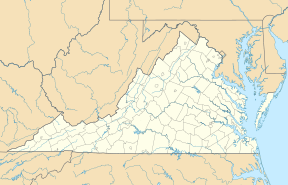
Between the Hills is a small valley located in the northwest part of Loudoun County, Virginia. It is a special area, separate but connected to the larger Loudoun Valley.
Contents
Exploring the Valley: Geography
This valley is found between two mountain ranges. To the west is the Blue Ridge Mountain, and to the east is Short Hill Mountain. Inside the valley, you'll find small communities like Neersville and Loudoun Heights.
Parts of the Valley
Between the Hills can be thought of in two main parts: the upper valley and the lower valley. The upper valley is north of a spot called the Hillsboro Gap in Short Hill. The lower valley is south of this gap.
The valley is about 11 miles (18 km) long. It changes width, from about 2.5 miles (4.0 km) at its widest point to about 1.4 miles (2.3 km) at its narrowest.
Valley Waterways
Two main streams flow through Between the Hills. The North Fork of Catoctin Creek drains the lower valley. It then flows through the Hillsboro Gap into the larger Catoctin Valley.
Piney Run drains the upper valley. This stream flows north directly into the Potomac River. If you look across the Potomac River, you'll see the valley continues into Maryland as Pleasant Valley.
Getting Around: Transportation
The main road in the upper valley is State Route 671, also known as Harpers Ferry Road. It runs north and south. It starts near Virginia State Route 9 and ends near the Potomac River, close to Harpers Ferry.
In the lower valley, State Route 719, or Stony Point-Woodgrove Road, also runs north and south. Another important road, the Charlestown Pike, cuts across the valley. It goes from the Hillsboro Gap to Keyes Gap in the Blue Ridge.
How the Valley Formed: Geology
The Between the Hills Valley was created by movements deep within the Earth. Long, long ago, during the early Paleozoic era, a crack in the Earth's crust, called the Short Hill fault, caused the land to separate. This separation involved rocks that were formed even earlier, during the late Proterozoic period.
Later, during another period of Earth movement called the Alleghenian Orogeny, the fault became active again. This caused more changes to the rocks and further shaped the valley we see today.
Stories from the Past: History
The Between the Hills valley has a rich history, especially during the American Civil War.
Local Figures and Battles
One notable resident was John Mobberly. He was a scout and fighter for the Confederate side. For about two years, he was very active in the area. He was killed near Neersville in April 1865.
In late 1864, Union cavalry forces carried out an event known as The Burning Raid. During this time, parts of the Between the Hills valley were burned. You can still see the ruins of Potts Mill, which was destroyed then, from Stony Point Road.
Another famous Confederate leader, John Mosby, and his group, the Rangers, faced a tough battle here. They had their first defeat in the valley during the Battle of Loudoun Heights, which happened on January 1, 1864.
 | Roy Wilkins |
 | John Lewis |
 | Linda Carol Brown |


