Pleasant Valley (Maryland) facts for kids
Quick facts for kids Pleasant Valley |
|
|---|---|

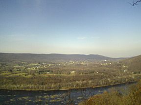
Pleasant Valley as seen from Short Hill Mountain with the Potomac River in the foreground
|
|
| Floor elevation | 600 ft (180 m) |
| Length | 10 miles (16 km) North-South |
| Width | 2 miles (3.2 km) |
| Geography | |
| Location | Washington County, Maryland |
| Population centers | Rohrersville |
| Borders on | South Mountain (east) Elk Ridge (west) Potomac River (south) Israel Creek (north) |
| Traversed by | U.S. Route 340 Maryland Route 67 |
Pleasant Valley is a small valley located in Washington County, Maryland, United States. It's a beautiful area known for its natural features and important history.
Contents
Exploring Pleasant Valley's Geography
Pleasant Valley is surrounded by natural features. To the east, you'll find South Mountain. On the west side is Elk Ridge. The Potomac River forms its southern edge.
Northern Connections and Waterways
In the north, the valley opens up and connects with the Hagerstown Valley near Boonsboro. The northern part of Pleasant Valley has a special boundary. This boundary is where water flows in different directions. It separates the area where water drains into Israel Creek from where it drains into Little Antietam Creek. Both of these creeks eventually flow into the Potomac River.
This northern boundary is located north of the small town of Gapland. It is also south of Rohrersville. Geographically, Pleasant Valley is like an extension of the Between the Hills valley, which is south of the Potomac River in Virginia.
Understanding the Short Hill Fault
A geological feature called the Short Hill fault runs along the eastern edge of Pleasant Valley. This fault separates Elk Ridge from South Mountain. It's an interesting part of the valley's natural structure.
A Look at Pleasant Valley's History
Pleasant Valley has a rich history, with events dating back centuries.
Early Settlements and Land Claims
The eastern side of Pleasant Valley, on the slope of South Mountain, was home to William Park's "Park Hall." This land was officially surveyed in 1731. It was the first piece of land legally claimed by a European-American in what would later become Washington County.
John Brown's Connection to the Valley
Pleasant Valley is on the east side of Elk Ridge mountain. On the opposite, west side of Elk Ridge, is the historic Kennedy Farm. This farm was where John Brown and his followers stayed before their famous raid. Their target was nearby Harpers Ferry, West Virginia.
After the raid was stopped by Federal soldiers, some of John Brown's men managed to escape. Their escape route led them north towards Pennsylvania. They followed Elk Ridge and South Mountain. These escaping raiders crossed from Elk Ridge mountain to South Mountain in the area around Rohrersville. This area is just north of Pleasant Valley.
The Community of Yarrowsburg
Nestled at the foot of Elk Ridge, on the west side of the lower valley, is the community of Yarrowsburg. This community was named after Aquilla and Polly Yarrow. They were early free African-American residents who lived there in the 1830s.
Pleasant Valley During the Civil War
During the Antietam Campaign of the American Civil War, Pleasant Valley played a role. The Confederate soldiers set up a picket line here. A picket line is like a guard post. Their goal was to stop General George B. McClellan's Union Army from helping the Union soldiers in Harpers Ferry.
Later, after the Battle of Antietam, the farmlands of Pleasant Valley were filled with tents. These were the tents of Union Army soldiers. Pleasant Valley was used as a bivouac, which is a temporary camp. Soldiers rested and recovered here after the intense battle.
 | Charles R. Drew |
 | Benjamin Banneker |
 | Jane C. Wright |
 | Roger Arliner Young |

