Catoctin Valley facts for kids
Quick facts for kids Catoctin Valley |
|
|---|---|
| Floor elevation | 500 |
| Length | 11 miles (18 km) North-South |
| Width | 7 miles (11 km) |
| Area | 77 square miles (20,000 ha) |
| Geography | |
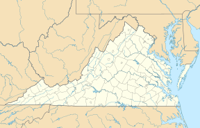
| Location | Loudoun County, Virginia |
| Population centers | Lovettsville Waterford |
| Borders on | Catoctin Mountain (east) Short Hill Mountain(west) Potomac River (north) |
| Traversed by | Virginia Route 287 |
The Catoctin Valley is a beautiful, smaller valley located in Loudoun County, Virginia. It's closely connected to the bigger Loudoun Valley nearby. Imagine a long, narrow dip in the land, surrounded by mountains – that's a valley!
Contents
Geography of Catoctin Valley
The Catoctin Valley is found in the northern part of the Loudoun Valley. It sits between two mountains: Short Hill Mountain to the west and Catoctin Mountain to the east. To the north, the valley meets the Potomac River.
Valley Borders and Size
The southern edge of the valley is not a clear line. It runs from the end of Short Hill Mountain to the base of Catoctin Mountain. This spot is about two miles north of Virginia State Route 7. On the other side of the Potomac River, in Maryland, the valley continues as the Middletown Valley.
The Catoctin Valley is about 7 miles (11 km) wide from east to west. It stretches for about 11 miles (18 km) from north to south.
Towns and Waterways
Several small communities are located within this valley. These include Waterford, Lovettsville, Wheatland, Morrisonville, and Taylorstown. The valley is watered by the Catoctin Creek and its smaller streams.
Travel in Catoctin Valley
The main road that goes through the Catoctin Valley is Virginia State Route 287. It's also known as the Berlin Turnpike. This road runs north and south, connecting the Potomac River to Virginia State Route 7. Another road, Virginia State Route 9, crosses the very southern part of the valley from east to west.
History of Catoctin Valley
People started settling in the Catoctin Valley in the 1730s. These early settlers were German immigrants and members of the Quaker faith. They traveled south from southern Pennsylvania to find new homes.
Early Settlers and Farms
These settlers created small, self-sufficient farms. Their lives often centered around small villages with mills. Unlike some other areas, they used very few, if any, enslaved people on their farms. This was quite different from the southern Loudoun Valley. In that area, English settlers from Tidewater Virginia set up large plantation-style farms.
The Civil War Era
During the American Civil War, the people in this part of Loudoun County had strong ties to Maryland. They also did not rely much on enslaved labor. Because of this, many people in the Catoctin Valley supported the Union side. This was different from other parts of the county that supported the Confederacy.
This difference in beliefs led to local disagreements. For example, there was a notable event called The Fight at Waterford. This was a conflict between local Union soldiers, known as the Loudoun Rangers, and pro-Confederate soldiers from the county.
 | Aaron Henry |
 | T. R. M. Howard |
 | Jesse Jackson |


