Loudoun Valley facts for kids
Quick facts for kids Loudoun Valley |
|
|---|---|

The Loudoun Valley as seen from the foot of Blue Ridge Mountain
|
|
| Floor elevation | 500 ft (150 m) |
| Length | 34 miles (55 km) North to South |
| Width | 10 miles (16 km) |
| Geography | |
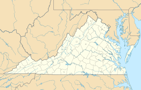
| Location | Loudoun County, Virginia |
| Population centers | Purcellville Middleburg |
| Borders on | Catoctin & Bull Run Mountains (east) Blue Ridge Mountain (west) Potomac River (north) Broken Hills (south) |
| Traversed by | State Route 7, U.S. Route 50 |
The Loudoun Valley is a beautiful and important valley in Loudoun County, Virginia, in the United States. It's a special place with a rich history, nestled among the Blue Ridge Mountains. This valley is known for its green lands and its role in American history.
Contents
Exploring the Loudoun Valley
Where is the Loudoun Valley?
The Loudoun Valley is a fertile area located in Northern Virginia. It sits between two mountain ranges. To the east are Catoctin Mountain and the Bull Run Mountains. To the west are the Blue Ridge Mountains.
The Potomac River forms its northern border. To the south, you'll find the Broken Hills in Fauquier County. A small part of the valley in Fauquier County is called Upper Fauquier.
Size and Shape of the Valley
The valley is about 34 miles (55 km) long. Its width changes, usually between 8 miles (13 km) and 12 miles (19 km). In the northern part, Short Hill Mountain cuts through the valley. The area west of Short Hill is called Between the Hills. The area to the east is sometimes known as the Catoctin Valley.
Rivers and Roads
Important waterways in the valley include Goose Creek, Catoctin Creek, Panther Skin Run, and the Little River.
Three main highways cross the valley. U.S. Route 50 goes from Aldie to Ashby Gap. Route 7 runs from Clarke's Gap near Leesburg to Snickers Gap near Bluemont. Route 9 starts at Clarke's Gap and goes west to Keyes Gap on the West Virginia border.
Valley Landscape and Soil
The land in the valley is gently rolling, with many small hills. The elevation ranges from about 350 feet (110 m) to 730 feet (220 m) above sea level. The soil here is very fertile. It's made from different types of rock and minerals. This rich soil helps plants grow well.
A Look Back in Time: Loudoun Valley's History
Early Settlers in the Valley
After a peace agreement in 1722, people slowly began to move into the Loudoun Valley. Many early settlers came from southern Pennsylvania. These included Quakers, Scotch-Irish people, and Germans. They wanted to start small farms.
The Quakers had a big impact in the central valley. They settled in places like Waterford and Lincoln. Their stone buildings are still a key part of the landscape. German settlers lived in the northern valley, especially around Lovettsville. They built many log structures. Unlike some other settlers, these groups did not use enslaved people to work their farms.
In the southern part of the valley, around Middleburg, English settlers moved in. They came from the Tidewater region and used enslaved people to run large farms. Before the Civil War, the valley became a major farming area. They grew crops like wheat, oats, rye, and corn.
The Civil War Years
The Loudoun Valley saw a lot of fighting during the Civil War. Neighbors sometimes fought against each other because of divided loyalties. People who supported the Union formed the Loudoun Rangers. Those who supported the Confederacy joined groups like Mosby's Rangers. These groups often fought in the valley. One example is the Fight at Waterford in 1862.
Major battles also happened here. In 1862, after the Battle of Antietam, Union General George McClellan marched his army through the valley. Confederate cavalry, led by Maj. Gen. J.E.B. Stuart, slowed them down in the Battle of Unison.
During the Gettysburg Campaign, there were several cavalry fights in the valley. These happened at Aldie, Middleburg, and Upperville. General Stuart kept Union forces from finding Robert E. Lee's main army. In 1864, Union forces attacked Confederate supply wagons near Purcellville. Later that year, General Phillip Sheridan ordered the valley to be burned. This was because Confederate partisans, like John Mosby, used the valley as their base. This event is known as The Burning Raid.
Loudoun Valley Today
After the Civil War, it took time for the Loudoun Valley to recover from the damage. But soon, it became a major farming area again, especially known for its dairy farms. Farming was the main job for many years.
In the early 1990s, cities began to grow closer to the valley. While farming is not as dominant as it once was, it's still very important. Loudoun County is a top producer of agricultural products in Virginia. Corn, wheat, and beans are still common crops. Berry production has grown a lot, and the county is now number one in the state for berries.
Christmas tree farming and raising livestock (like sheep and cattle) are also big parts of the valley's agriculture. In recent years, many vineyards and wineries have opened. This has made the Loudoun Valley a leading producer of wine in Virginia.
 | John T. Biggers |
 | Thomas Blackshear |
 | Mark Bradford |
 | Beverly Buchanan |


