Purcellville, Virginia facts for kids
Quick facts for kids
Purcellville, Virginia
|
|
|---|---|
| Town of Purcellville | |

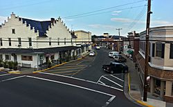
Downtown Purcellville in November 2014
|
|
| Country | |
| State | |
| County | |
| Incorporated | March 14, 1908 |
| Area | |
| • Total | 3.40 sq mi (8.81 km2) |
| • Land | 3.38 sq mi (8.77 km2) |
| • Water | 0.01 sq mi (0.04 km2) |
| Elevation | 574 ft (175 m) |
| Population
(2020)
|
|
| • Total | 8,929 |
| • Density | 2,626.2/sq mi (1,161.02/km2) |
| Time zone | UTC−5 (Eastern (EST)) |
| • Summer (DST) | UTC−4 (EDT) |
| ZIP codes |
20132, 20134, 20160
|
| Area code(s) | 540 |
| FIPS code | 51-65008 |
| GNIS feature ID | 1472871 |
Purcellville is a town located in Loudoun County, Virginia. In 2020, about 8,929 people lived there. It's a main town in the western part of Loudoun County and the Loudoun Valley. Many old buildings in Purcellville show off the Victorian style, which was popular in the early 1900s.
Contents
History of Purcellville
The first land grant in this area was given in 1740. However, the first known settler, James Dillon, arrived in 1764. An old path, later called the "Great Road," became the center of the town. Farms were already in the area, and a church called Ketoctin Baptist Church was founded nearby by 1752.
The first business was an "ordinary" (a store and inn combined) opened by Abraham Vickers in 1799. Another inn followed in 1804. Later, "Purcel's Store" and Post Office opened, started by Valentine Vernon Purcell. The town's name comes from him. A blacksmith's shop also opened around 1848. On July 9, 1853, the village officially became Purcellville.
Growth and Transportation
The Great Road became a special road called a "turnpike" in 1785. This turnpike helped people travel more easily from Alexandria to areas west. When the turnpike was built in 1832, more people started traveling through Purcellville. The first stagecoach arrived in 1841.
Before the American Civil War, a railroad line connected Purcellville to Leesburg and places to the east. People could then travel further west by stagecoach from Purcellville.
Purcellville During the Civil War
Both Union and Confederate armies passed through Purcellville during the Civil War. However, there wasn't much fighting directly in the town. The most notable event was a small battle called the skirmish of Heaton's Crossroads.
The town was part of an area known as Mosby's Confederacy. This was where Confederate partisan John S. Mosby often operated. In 1864, the town was damaged as part of The Burning Raid. This was done in response to the area's support for Mosby's group.
Railroad Era and Modern Times
When the railroad reached Purcellville in 1874, the town became the main starting point for stagecoach routes. This lasted until the railroad was extended to Round Hill in 1875. The Southern Railway built the Purcellville Train Station in 1891, which is still there today. The railroad stopped running in 1968. Now, the old railroad path is the Washington & Old Dominion Railroad Regional Park. Its western end is at the old station.
The first public school in Purcellville was built in 1883. On March 14, 1908, Purcellville officially became a town by a law from Virginia's government.
In the 1900s, several big fires, especially in 1900 and 1914, destroyed most of the business area. This meant many of the town's oldest buildings were lost. However, Purcellville's good location and the railroad helped it rebuild. It became a major farming center in Western Loudoun. Over time, as more people got jobs outside the town, Purcellville became less dependent on farming.
Several important places in Purcellville are listed on the National Register of Historic Places. These include Locust Grove, the Purcellville Historic District, Rich Bottom Farm, and The Tabernacle-Fireman's Field.
Geography of Purcellville
Purcellville is located at 39°8′4″N 77°42′40″W / 39.13444°N 77.71111°W.
The town covers about 3.1 square miles (8.0 km2) of land.
Purcellville is in western Loudoun County, Virginia, right in the middle of the Loudoun Valley. It's about 9 miles (14 km) west of Leesburg, the county seat. To the west, you can see the Blue Ridge Mountains from many parts of town. The town of Round Hill is about 4 miles (6.4 km) away. Other nearby towns include Philomont (5 miles south), Middleburg (12 miles southeast), and Lovettsville (11 miles north).
Purcellville Population Facts
| Historical population | |||
|---|---|---|---|
| Census | Pop. | %± | |
| 1880 | 98 | — | |
| 1910 | 388 | — | |
| 1920 | 549 | 41.5% | |
| 1930 | 747 | 36.1% | |
| 1940 | 787 | 5.4% | |
| 1950 | 945 | 20.1% | |
| 1960 | 1,419 | 50.2% | |
| 1970 | 1,775 | 25.1% | |
| 1980 | 1,567 | −11.7% | |
| 1990 | 1,744 | 11.3% | |
| 2000 | 3,584 | 105.5% | |
| 2010 | 7,727 | 115.6% | |
| 2020 | 8,929 | 15.6% | |
| U.S. Decennial Census | |||
In 2020, there were 8,929 people living in Purcellville. There were 2,986 households. The town had about 2,626 people per square mile (1,014 per square kilometer).
Most of the people in town, about 83.2%, were White. About 6.8% were African American, and 4.7% were Asian. People of Hispanic or Latino background made up 12.2% of the population.
The average household income in Purcellville was $139,073. The average income per person was $46,399. About 3.0% of the population lived below the poverty line.
Education in Purcellville
Purcellville has both public and private schools. The public schools are run by Loudoun County Public Schools.
Public Schools
Public schools in Purcellville cover all grades from kindergarten to twelfth grade. These include:
- Loudoun Valley High School
- Woodgrove High School
- Blue Ridge Middle School
- Harmony Middle School
- Emerick Elementary School
- Kenneth W. Culbert Elementary School
- Mountain View Elementary School
Private College
Patrick Henry College, a private Christian liberal arts college, is located just inside the eastern edge of Purcellville.
Transportation in Purcellville
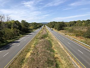
The main highway that serves Purcellville is Virginia State Route 7.
Major Highways
- Virginia State Route 7 (SR 7): This road goes east to Leesburg and then all the way to Alexandria. It connects with major interstates like I-495, I-66, and I-395. To the west, SR 7 passes Berryville and ends in Winchester, where it connects with I-81. The current SR 7 goes around the center of Purcellville. The old road through town is now called SR 7 Business.
- Virginia State Route 287 (SR 287): This road starts at SR 7 Business and heads north. It goes through Lovettsville and ends at the Potomac River. A bridge there connects SR 287 to Brunswick, Maryland.
Purcellville Public Library
The Purcellville Public Library is a public library owned by the county. It was started in 1938 by Clarence Robey and Gertrude Robey. The building was designed by Delos H. Smith and built in 1937. The Purcellville Library and its bookmobile service were some of the first branches when the Loudoun County Public Library system was created in 1973.
Notable People from Purcellville
Many interesting people have connections to Purcellville, including:
- Madeleine Albright, a diplomat
- Shaun Alexander, an NFL player
- Henry Cole, an illustrator
- Michael Farris, a lawyer and activist
- Drew Hunter, a runner
- Blair Brown Lipsitz, a volleyball player
- Billy Pierce, a choreographer
- Betsy Woodruff Swan, a journalist
Climate in Purcellville
The weather in Purcellville has hot, humid summers and generally mild to cool winters. According to the Köppen Climate Classification system, Purcellville has a humid subtropical climate. This means it has warm temperatures and plenty of rain throughout the year.
| Climate data for Purcellville, Virginia (1991–2020 normals, extremes 1900–present) | |||||||||||||
|---|---|---|---|---|---|---|---|---|---|---|---|---|---|
| Month | Jan | Feb | Mar | Apr | May | Jun | Jul | Aug | Sep | Oct | Nov | Dec | Year |
| Record high °F (°C) | 78 (26) |
81 (27) |
92 (33) |
100 (38) |
102 (39) |
107 (42) |
109 (43) |
108 (42) |
108 (42) |
98 (37) |
86 (30) |
79 (26) |
109 (43) |
| Mean daily maximum °F (°C) | 41.0 (5.0) |
44.0 (6.7) |
52.6 (11.4) |
64.5 (18.1) |
72.9 (22.7) |
81.4 (27.4) |
86.4 (30.2) |
84.7 (29.3) |
77.8 (25.4) |
66.3 (19.1) |
54.9 (12.7) |
44.7 (7.1) |
64.3 (17.9) |
| Daily mean °F (°C) | 32.8 (0.4) |
35.0 (1.7) |
42.5 (5.8) |
53.4 (11.9) |
62.2 (16.8) |
71.2 (21.8) |
76.0 (24.4) |
74.3 (23.5) |
66.9 (19.4) |
55.3 (12.9) |
44.7 (7.1) |
36.5 (2.5) |
54.2 (12.3) |
| Mean daily minimum °F (°C) | 24.5 (−4.2) |
25.9 (−3.4) |
32.3 (0.2) |
42.2 (5.7) |
51.6 (10.9) |
61.1 (16.2) |
65.5 (18.6) |
63.9 (17.7) |
56.1 (13.4) |
44.3 (6.8) |
34.5 (1.4) |
28.4 (−2.0) |
44.2 (6.8) |
| Record low °F (°C) | −15 (−26) |
−13 (−25) |
−2 (−19) |
10 (−12) |
27 (−3) |
39 (4) |
46 (8) |
40 (4) |
30 (−1) |
19 (−7) |
5 (−15) |
−11 (−24) |
−15 (−26) |
| Average precipitation inches (mm) | 3.05 (77) |
2.56 (65) |
3.61 (92) |
3.54 (90) |
4.35 (110) |
4.25 (108) |
4.08 (104) |
3.57 (91) |
4.77 (121) |
3.52 (89) |
3.13 (80) |
3.35 (85) |
43.78 (1,112) |
| Source: NOAA | |||||||||||||
See also
 In Spanish: Purcellville (Virginia) para niños
 | Georgia Louise Harris Brown |
 | Julian Abele |
 | Norma Merrick Sklarek |
 | William Sidney Pittman |


