Ashby Gap facts for kids
Quick facts for kids Ashby's Gap |
|
|---|---|

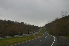
The view west into Ashby's Gap (2007)
|
|
| Elevation | 1,027 ft (313 m) |
| Traversed by | |
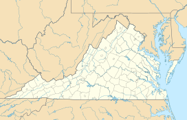
| Location | Virginia, United States |
| Range | Blue Ridge Mountains |
| Coordinates | 39°00′49″N 77°57′43″W / 39.01361°N 77.96194°W |
Ashby Gap, often called Ashby's Gap, is a natural low point in the Blue Ridge Mountains. It's known as a "wind gap" because it was likely formed by wind and water over a very long time. This gap is located where Clarke County, Loudoun County, and Fauquier County meet in Virginia.
A major road, U.S. Route 50, goes through Ashby's Gap. The famous Appalachian Trail also crosses this historic spot.
Contents
Geography of Ashby's Gap
Ashby's Gap sits at about 1,027 feet (313 m) above sea level. It is about 500 feet (150 m) lower than the mountain ridges next to it. The gap is also about 700 feet (210 m) higher than the Shenandoah River, which flows nearby.
To the west of the gap, you'll find Virginia's beautiful Shenandoah Valley. This valley is part of the larger Great Appalachian Valley. To the east is Virginia's Piedmont region, which is flatter land. Just south of Ashby's Gap is Sky Meadows State Park, a great place to visit.
The gap also marks part of the border between Fauquier and Loudoun counties. Long ago, a special tree marked this spot. Today, U.S. Route 50 has been moved slightly. This means Loudoun County is not entered when you drive through the gap.
History of Ashby's Gap
Ashby's Gap has been used for a very long time. The first people to use it were Native Americans. They used it as part of their trails through the mountains.
When Europeans arrived, they first called it the "Upper Thoroughfare of the Blue Ridge." Later, it was named "Ashby's Bent." This was after Thomas Ashby settled nearby in Paris, Virginia. Eventually, it became known as Ashby's Gap.
In the early 1800s, the Ashby's Gap Turnpike was built. This road connected Aldie to the top of the gap. These old roads later became part of the modern U.S. Route 50 in 1922.
Ashby's Gap During the American Civil War
Ashby's Gap was very important during the American Civil War. Both the Confederate Army and the Union Army used it often. This was especially true during the battles in the Shenandoah Valley. Confederate soldiers also used the nearby ridgetop for their signal corps. They would send messages using flags.
Jackson's March to Manassas
In July 1861, Confederate Brigadier General Stonewall Jackson led his soldiers through Ashby's Gap. They were going from Winchester to Piedmont Station (now Delaplane). From there, they took trains to Manassas Junction. This was during the First Battle of Manassas. This event was special because it was one of the first times trains were used to move a large number of soldiers in a war.
Stuart's Cavalry and Gettysburg
In June 1863, Confederate Major General J.E.B. Stuart's cavalry protected Ashby's Gap. They wanted to stop Union soldiers from bothering General Robert E. Lee's army. Lee's army was marching north towards Pennsylvania for the Gettysburg Campaign.
Battle of Ashby's Gap (1864)
On July 19, 1864, a small cavalry battle happened at the gap. It's sometimes called the Battle of Ashby's Gap. Union cavalry tried to cross the gap and the Shenandoah River. They hoped to attack the rear of Confederate Lieutenant General Jubal Early's army. Early's army was moving near Berryville as part of the Valley Campaigns of 1864.
 | Isaac Myers |
 | D. Hamilton Jackson |
 | A. Philip Randolph |


