Snickers Gap facts for kids
Quick facts for kids Snickers Gap |
|
|---|---|
| Williams Gap | |

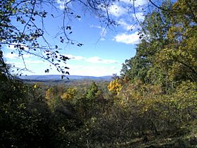
Snickers Gap as seen from across the Loudoun Valley on Mount Gilead
|
|
| Elevation | 1,056 feet (322 m) |
| Traversed by | |
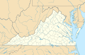
| Location | Clarke County / Loudoun County, Virginia, United States |
| Range | Blue Ridge Mountains Appalachian Mountains |
| Coordinates | 39°6′56″N 77°50′43″W / 39.11556°N 77.84528°W |
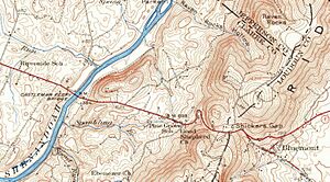
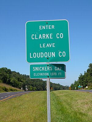
Snickers Gap, once known as William's Gap, is a special kind of low spot in the Blue Ridge Mountains. It sits right on the edge between Loudoun County and Clarke County in Virginia. This gap is a natural pathway through the mountains.
You can travel through Snickers Gap using Virginia State Route 7. The famous Appalachian Trail, a long hiking path, also crosses this gap. Nearby, you'll find cool spots like Bear's Den and Raven Rocks.
During the fall, many raptors fly south for the winter. Birdwatchers love Snickers Gap because it's a great place to see these birds as they follow the mountain ridge.
Exploring Snickers Gap's Geography
Snickers Gap is about 1,056 feet (322 m) high. It's like a dip in the mountain range, sitting about 300 to 600 feet (91 to 183 m) lower than the peaks around it. Yet, it's still 400 to 600 feet (120 to 180 m) higher than the flat land nearby.
The Blue Ridge Mountains get lower as they get closer to the Potomac River. This makes Snickers Gap one of the lowest natural passes in Virginia. Only Manassas Gap and Keyes Gap are lower.
This gap connects two important areas: the northern Virginia Piedmont (a hilly area at the foot of the mountains) and the lower Shenandoah Valley. It has always been a main route between these two regions.
The History of Snickers Gap
Snickers Gap has been an important travel route for a very long time. Even before Europeans settled in the area, Native Americans used a trail through the gap. White settlers later continued to use this same path.
The gap was called William's Gap until the early 1780s. That's when it started to be known as Snickers Gap. The new name came from Edward Snickers. He owned the land around the gap and ran a ferry across the Shenandoah River on the western side.
By the late 1700s, two important roads were built: the Snickersville Turnpike and the Snickers Gap Turnpike. These roads made Snickers Gap the main way to travel between Loudoun County and the Shenandoah Valley. Before this, Keyes Gap was the preferred route.
The two turnpikes met at Snickersville, which is now called Bluemont. From there, they continued over the gap to Winchester. People had to pay a toll to use the road through the gap, even into the 1900s. Eventually, the Snickers Gap turnpike became Virginia State Route 7, and the toll was removed.
Snickers Gap was also a site of small battles during the American Civil War. Part of the Battle of Cool Spring (sometimes called the "Battle of Snicker's Gap") happened here.

 | Madam C. J. Walker |
 | Janet Emerson Bashen |
 | Annie Turnbo Malone |
 | Maggie L. Walker |


