Piss Pot Island facts for kids

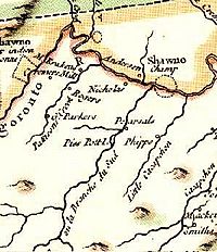
Piss Pot Island on the 1755 Carte de la Virginie et du Maryland
|
|
| Geography | |
|---|---|
| Location | South Branch Potomac River, West Virginia |
| Coordinates | 39°20′06″N 78°46′52″W / 39.334936°N 78.781114°W |
| Administration | |
|
United States
|
|
Piss Pot Island is a small island located in the South Branch Potomac River. You can find it west of Romney in Hampshire County, West Virginia. The island has a very unique name, which it received before the year 1755. That year, it was even shown on an old map called Carte de la Virginie et du Maryland.
What's cool about Piss Pot Island is that it has stayed almost the same size for hundreds of years. This is unusual for islands like it.
About Piss Pot Island
Piss Pot Island is covered mostly with trees. You'll find many American sycamore and silver maple trees growing there.
The island is a popular spot for people who enjoy the outdoors. Many fishermen visit to catch fish. Canoers also love to paddle around the island on the South Branch Potomac River.
Two smaller streams flow into the river near the island. Mill Creek joins the South Branch on the island's west side. Wergman Run enters the river to the northeast.
Who Owns the Island?
Today, the Williams family owns Piss Pot Island. Their historic home, Sycamore Dale, is a large brick plantation house located to the east of the island.
You can easily see Piss Pot Island from a few different places. It's visible from the Northwestern Turnpike (U.S. Route 50) in Vanderlip. You can also get a good view from the Romney Bridge.
 | Bayard Rustin |
 | Jeannette Carter |
 | Jeremiah A. Brown |

