
Pithlachascotee River facts for kids
Quick facts for kids Pithlachascotee River |
|
|---|---|

The US 19 bridge over the Pithlachascotee River between Port Richey(left) and New Port Richey.
|
|
| Other name(s) | "Cotee River" |
| Country | United States |
| State | Florida |
| County | Pasco |
| District | SWFWMD |
| Physical characteristics | |
| Main source | Starkey park Shady Hills, Florida 28°22′08″N 82°31′58″W / 28.36889°N 82.53278°W |
| River mouth | Gulf of Mexico Port Richey, Florida 28°16′40″N 82°44′37″W / 28.27778°N 82.74361°W |
| Length | 23 mi (37 km) |
| Basin features | |
| Tributaries |
|

The Pithlachascotee River, often called the Cotee or "Cootie" River, is a special kind of waterway in Pasco County, Florida. It's known as a blackwater river, which means its water looks dark, like tea. This color comes from plants and trees decaying in the water, releasing a natural stain called tannin.
This river starts near Crews Lake and flows for more than 23 miles (37 km). It travels south and west, passing through the Starkey Wilderness Park. Then, it turns northwest and goes right through downtown New Port Richey. Finally, it empties into the Gulf of Mexico at Miller's Bayou. If you love to paddle, there's even a special Canoe Trail along the river!
Contents
What Does the River's Name Mean?
The name "Pithlachascotee" is very old and has a cool meaning. Back in 1851, a map of Florida's west coast translated the name as "Boat Building River."
How the Name Came to Be
The name comes from the Creek language, which was spoken by the Seminole people. The word pithlo means "canoe," and chaskita means "to chop out." So, the full name describes a place where canoes were made by chopping or digging them out of tree trunks. The Seminole people often used large cypress trees for their canoes.
Exploring the River's Journey
The Pithlachascotee River flows through many different areas, from quiet wilderness to busy towns. Along its path, it passes under several roads and bridges that connect communities in Pasco County.
Bridges and Crossings
As the river winds its way to the Gulf of Mexico, it goes under many bridges. These bridges help people travel across the river. Some of the important roads that cross the river include:
- SR 52
- The Suncoast Parkway
- Starkey Boulevard
- Little Road
- Rowan Road
- Madison Street
- Grand Boulevard
- Main Street
- And finally, US 19 near its mouth at the Gulf.
Images for kids
-
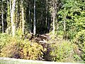
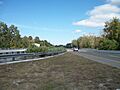
The Pithlachascotee River north of Florida State Road 52.
-
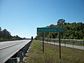
The Suncoast Parkway bridge over the Pithlachascotee River.
-
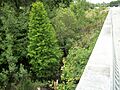
The Starkey Boulevard bridge over the Pithlachascotee River.
-
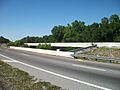
The Little Road bridges over the Pithlachascotee River.
-
The Rowan Road bridge over the Pithlachascotee River.
-
The Madison Street bridge over the Pithlachascotee River.
-
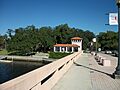
The Grand Boulevard bridge over the Pithlachascotee River.
-
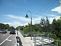
The Main Street bridge in New Port Richey.
-

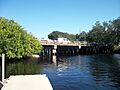
The US 19 bridge over the Pithlachascotee River.


.JPG)


