Plainfield, Ohio facts for kids
Quick facts for kids
Plainfield, Ohio
|
|
|---|---|
|
Village
|
|

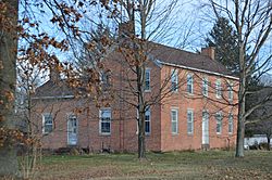
The Thomas Johnson House on Main Street
|
|

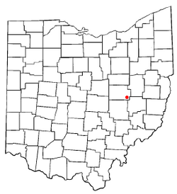
Location of Plainfield, Ohio
|
|

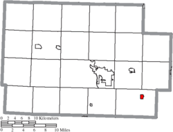
Location of Plainfield in Coshocton County
|
|
| Country | United States |
| State | Ohio |
| County | Coshocton |
| Township | Linton |
| Area | |
| • Total | 0.39 sq mi (1.02 km2) |
| • Land | 0.39 sq mi (1.02 km2) |
| • Water | 0.00 sq mi (0.00 km2) |
| Elevation | 791 ft (241 m) |
| Population
(2020)
|
|
| • Total | 141 |
| • Density | 359.69/sq mi (138.83/km2) |
| Time zone | UTC-5 (Eastern (EST)) |
| • Summer (DST) | UTC-4 (EDT) |
| ZIP code |
43836
|
| Area code(s) | 740 |
| FIPS code | 39-63044 |
| GNIS feature ID | 2399683 |
Plainfield is a small village located in Coshocton County, Ohio, United States. It sits right next to Wills Creek. In 2020, about 141 people lived in Plainfield.
Contents
History of Plainfield
Plainfield was first planned out in the year 1816. It got its name because it was built on flat "plains" of land.
By 1833, Plainfield was a small but growing place. It had at least one store where people could buy goods. There was also a tavern, which was a place for travelers to rest and eat. Plainfield officially became a village in 1878. This meant it had its own local government.
Geography of Plainfield
Plainfield is a very small village in terms of its size. According to the United States Census Bureau, the village covers a total area of about 0.41 square miles (1.06 km2). All of this area is land, meaning there are no large lakes or rivers within the village limits.
Plainfield's Population Facts
The number of people living in Plainfield has changed over the years. This information comes from the U.S. Census, which counts everyone in the country every ten years.
| Historical population | |||
|---|---|---|---|
| Census | Pop. | %± | |
| 1860 | 30 | — | |
| 1880 | 300 | — | |
| 1890 | 234 | −22.0% | |
| 1900 | 255 | 9.0% | |
| 1910 | 215 | −15.7% | |
| 1920 | 172 | −20.0% | |
| 1930 | 183 | 6.4% | |
| 1940 | 130 | −29.0% | |
| 1950 | 136 | 4.6% | |
| 1960 | 178 | 30.9% | |
| 1970 | 183 | 2.8% | |
| 1980 | 221 | 20.8% | |
| 1990 | 178 | −19.5% | |
| 2000 | 158 | −11.2% | |
| 2010 | 157 | −0.6% | |
| 2020 | 141 | −10.2% | |
| U.S. Decennial Census | |||
What the 2010 Census Showed
In 2010, the census counted 157 people living in Plainfield. These people lived in 69 different homes, and 46 of those were families.
The village had about 382.9 inhabitants per square mile (147.8/km2) people per square mile. There were 76 housing units, which are homes or apartments. On average, there were 185.4 per square mile (71.6/km2) housing units per square mile.
Most people in Plainfield were White (96.8%). A small number were African American (0.6%), and 2.5% were from two or more racial backgrounds.
Out of the 69 homes:
- About 20% had children under 18 living there.
- Most homes (58%) were married couples living together.
- A few homes (5.8%) had a female head of household with no husband.
- A very small number (2.9%) had a male head of household with no wife.
- About 33% of homes were not families, meaning individuals or unrelated roommates lived there.
Around 29% of all homes had just one person living in them. Of those, 14.5% were people aged 65 or older living alone. The average home had 2.28 people, and the average family had 2.74 people.
The average age of people in Plainfield in 2010 was 50.5 years old.
- 19.1% of residents were under 18.
- 6.4% were between 18 and 24.
- 18.4% were between 25 and 44.
- 37.6% were between 45 and 64.
- 18.5% were 65 years old or older.
The village had a nearly even number of males and females: 49.0% male and 51.0% female.
See also
 In Spanish: Plainfield (Ohio) para niños
 | William L. Dawson |
 | W. E. B. Du Bois |
 | Harry Belafonte |

