Playa Sardinas II facts for kids
Quick facts for kids
Playa Sardinas II
|
|
|---|---|
|
Barrio
|
|

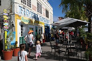
Hotel Kokomo in Playa Sardines II
|
|

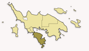
Map of Culebra highlighting Playa Sardina II
|
|
| Commonwealth | |
| Municipality | |
| Area | |
| • Total | 24.3 sq mi (63 km2) |
| • Land | 1.0 sq mi (3 km2) |
| • Water | 23.3 sq mi (60 km2) |
| Elevation | 0 ft (0 m) |
| Population
(2010)
|
|
| • Total | 64 |
| • Density | 64/sq mi (25/km2) |
| Source: 2010 Census | |
| Time zone | UTC−4 (AST) |
| ZIP Code |
00775
|
Playa Sardinas II is a small area or neighborhood, known as a barrio, located in the beautiful island municipality of Culebra, Puerto Rico. In 2010, about 64 people lived here. It's a quiet place, part of the larger Culebra island.
Contents
What is Playa Sardinas II?
Playa Sardinas II is one of the areas that make up the island of Culebra. Think of it like a district or a part of a town. It's known for its natural beauty and peaceful environment.
Population Over Time
The number of people living in Playa Sardinas II has changed over the years. For example, in 1950, there were 23 residents. By 1980, the population grew to 93, and in 2000, it reached 122 people. However, by 2010, the population was 64.
Natural Features
One of the special places in Playa Sardinas II is a body of water called Laguna Lobina. This lagoon adds to the natural charm of the area. It's a great spot to see local wildlife and enjoy the peaceful scenery.
Local Areas: Sectors
Within barrios like Playa Sardinas II, there are even smaller local areas called sectores. These are like tiny neighborhoods or sections within the larger barrio. They help organize different parts of the community.
Some of the sectors you can find in Playa Sardinas II are:
- Sector Ensenada Honda
- Sector Punta Aloe
Gallery
See also
 In Spanish: Playa Sardinas II para niños
- List of communities in Puerto Rico
- List of barrios and sectors of Culebra, Puerto Rico
 | Audre Lorde |
 | John Berry Meachum |
 | Ferdinand Lee Barnett |


