Plover, Iowa facts for kids
Quick facts for kids
Plover, Iowa
|
|
|---|---|

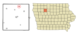
Location of Plover, Iowa
|
|
| Country | |
| State | |
| County | Pocahontas |
| Area | |
| • Total | 0.56 sq mi (1.45 km2) |
| • Land | 0.56 sq mi (1.45 km2) |
| • Water | 0.00 sq mi (0.00 km2) |
| Elevation | 1,211 ft (369 m) |
| Population
(2020)
|
|
| • Total | 50 |
| • Density | 89.29/sq mi (34.47/km2) |
| Time zone | UTC-6 (Central (CST)) |
| • Summer (DST) | UTC-5 (CDT) |
| ZIP code |
50573
|
| Area code(s) | 712 |
| FIPS code | 19-63840 |
| GNIS feature ID | 0460323 |
Plover is a small city located in Pocahontas County, Iowa, in the United States. According to the 2020 census, only 50 people live there, making it a very small community.
Contents
The Story of Plover
Plover was officially started in 1883. This happened shortly after the Des Moines and Fort Dodge Railroad built its tracks through the area. The person in charge of the railroad decided to name the new town after the "plover" bird.
Where is Plover Located?
Plover is found at specific geographic coordinates: 42.878058 degrees North and -94.622648 degrees West. You can also see this as 42°52′41″N 94°37′22″W / 42.87806°N 94.62278°W.
The United States Census Bureau says that the city covers a total area of about 0.54 square miles (1.4 square kilometers). All of this area is land, with no water.
How Many People Live in Plover?
Plover's population has changed a lot over the years. Here's a quick look at how many people have lived there during different census years:
| Historical populations | ||
|---|---|---|
| Year | Pop. | ±% |
| 1920 | 246 | — |
| 1930 | 266 | +8.1% |
| 1940 | 280 | +5.3% |
| 1950 | 243 | −13.2% |
| 1960 | 182 | −25.1% |
| 1970 | 129 | −29.1% |
| 1980 | 135 | +4.7% |
| 1990 | 101 | −25.2% |
| 2000 | 95 | −5.9% |
| 2010 | 77 | −18.9% |
| 2020 | 50 | −35.1% |
| Source: and Iowa Data Center Source: |
||
Plover's Population in 2020
In 2020, the census showed that 50 people lived in Plover. There were 29 households, which are like homes or families living together. Out of these, 18 were families.
The city had about 89 people per square mile (34.5 people per square kilometer). There were 36 housing units, which are places where people can live.
Most of the people in Plover (90%) were White. A small number (4%) were Asian, and another 4% were from other races. Only 2% were from two or more races. No one identified as Hispanic or Latino in 2020.
About 34.5% of the households had children under 18 living there. About 31% were married couples. Some households (24.1%) had a female head without a spouse, and 37.9% had a male head without a spouse.
The average age of people in Plover was 50 years old.
- 28% of residents were under 20 years old.
- 8% were between 20 and 24 years old.
- 12% were between 25 and 44 years old.
- 28% were between 45 and 64 years old.
- 24% were 65 years old or older.
The population was split evenly, with 50% male and 50% female residents.
Plover's Population in 2010
The 2010 census counted 77 people living in Plover. There were 34 households and 20 families. The population density was about 142.6 people per square mile (55.1 people per square kilometer). There were 44 housing units.
Most residents (98.7%) were White, and 1.3% were from two or more races.
About 26.5% of households had children under 18. More than half (55.9%) were married couples living together. About 38.2% of all households were made up of individuals living alone.
The average age in 2010 was 46.3 years.
- 24.7% of residents were under 18.
- 6.5% were between 18 and 24.
- 18.2% were between 25 and 44.
- 32.5% were between 45 and 64.
- 18.2% were 65 or older.
The gender split was close, with 50.6% male and 49.4% female.
Schools in Plover
Public schools in Plover are part of the Pocahontas Area Community School District. Before 1989, Plover was in the Havelock-Plover Community School District. This district then joined with the Pocahontas School District to form the current Pocahontas Area School District.
See also
 In Spanish: Plover (Iowa) para niños
 | Ernest Everett Just |
 | Mary Jackson |
 | Emmett Chappelle |
 | Marie Maynard Daly |

