Point Judith Pond facts for kids
Quick facts for kids Point Judith Pond |
|
|---|---|
| Location | Washington County, Rhode Island, United States |
| Coordinates | 41°23′59″N 71°30′23″W / 41.3998243°N 71.5064463°W |
| Basin countries | United States |
| Max. length | 4 mi (6.4 km) |
| Max. width | 1 mi (1.6 km) |
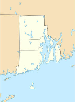
Point Judith Pond is a long, shallow saltwater area in Rhode Island. It's about 4 miles (6 km) long. This pond sits behind the sandy beaches and dunes of Point Judith Harbor. It's located near Narragansett, at the very end of Narragansett Bay.
The pond helps form a border between the towns of Narragansett and South Kingstown. A small waterway connects the pond to Point Judith Harbor. This waterway is very busy! Fishing boats use it, along with many recreational boats. During the summer, lots of people travel through the harbor. You can even catch a ferry from Point Judith to Block Island all year round.
Contents
Building Point Judith Harbor
Work on Point Judith Harbor started a long time ago, back in 1905. The main parts of the project were finished by 1950. These projects helped make the harbor safer and easier to use for boats.
Protecting the Harbor with Breakwaters
One important part of the project was building large stone walls called breakwaters. These walls protect the harbor from big waves.
- A main breakwater in Point Judith Harbor is about 6,970 feet (2,124 meters) long. It's shaped like a "V" and sits about half a mile (0.8 km) from the shore. This was built in 1914.
- Another stone breakwater, 2,240 feet (683 meters) long, extends from Point Judith. There's a gap of about 1,200 feet (366 meters) between this and the main breakwater. This gap lets boats enter the harbor safely.
- A third stone breakwater, 3,640 feet (1,109 meters) long, extends from the entrance of Point Judith Pond. There's another gap of about 1,500 feet (457 meters) between this and the main breakwater.
Creating Channels for Boats
To help boats move around, several deep channels were dug. These are like underwater roads for ships.
- A channel 15 feet (4.6 meters) deep and 150 feet (46 meters) wide runs along the west side of the harbor. It goes past the entrance to Point Judith Pond and the jetties at the Port of Galilee. This channel ends near the State Pier in Jerusalem.
- Another channel, also 15 feet (4.6 meters) deep but 200 feet (61 meters) wide, branches off. It goes up the east side of Point Judith Pond. This channel was made longer in 1977, adding about 1,400 feet (427 meters). It also became wider, ranging from 150 to 640 feet (46 to 195 meters).
- A longer channel, 4.5 miles (7.2 km) long, is 6 feet (1.8 meters) deep and 100 feet (30 meters) wide. It starts near the State Pier in Jerusalem and runs along the west side of the pond. This channel ends in the Wakefield village of South Kingstown.
Safe Spots for Boats: Anchorages
Special areas called anchorages were also created. These are safe places where boats can drop anchor and stay put.
- One anchorage is 10 feet (3 meters) deep and covers 5 acres (2 hectares). It's located on the west side of the pond, right inside the entrance.
- Another anchorage, 6 feet (1.8 meters) deep and 5 acres (2 hectares) in size, is found at the end of the long channel in Wakefield.
Keeping the Water Clear
To make sure boats could always pass easily, some underwater sandbanks, called shoals, were removed.
- Two shoals were cleared to a depth of 18 feet (5.5 meters). One was in the 10-foot-deep anchorage area. The other was on the east side of the Point Judith Pond entrance. This work was finished in 1921.
- Other projects were done to help trap and hold sand at the pond's entrance. This prevents sand from blocking the way for boats.
 | Precious Adams |
 | Lauren Anderson |
 | Janet Collins |


