Narragansett, Rhode Island facts for kids
Quick facts for kids
Narragansett, Rhode Island
|
||
|---|---|---|
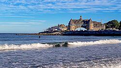
The Towers in Narragansett
|
||
|
||
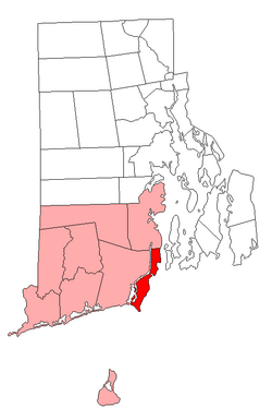
Location of Narragansett in Washington County, Rhode Island
|
||
| Country | United States | |
| State | Rhode Island | |
| County | Washington | |
| Area | ||
| • Total | 37.8 sq mi (97.8 km2) | |
| • Land | 14.1 sq mi (36.6 km2) | |
| • Water | 23.6 sq mi (61.2 km2) | |
| Elevation | 20 ft (6 m) | |
| Population
(2020)
|
||
| • Total | 14,532 | |
| • Density | 1,028/sq mi (397.0/km2) | |
| Time zone | UTC-5 (Eastern (EST)) | |
| • Summer (DST) | UTC-4 (EDT) | |
| ZIP Codes |
02874 (Saunderstown), 02882 (Narragansett)
|
|
| Area code(s) | 401 | |
| FIPS code | 44-48340 | |
| Website | www.narragansettri.gov | |
Narragansett is a town in Rhode Island, located in Washington County. In 2020, about 14,532 people lived there. However, during the summer, the number of people in Narragansett more than doubles to around 34,000.
The town is on a narrow strip of land. It runs along the eastern side of the Pettaquamscutt River, also known as Narrow River. This strip extends to the shore of Narragansett Bay and the Atlantic Ocean. Narragansett became a separate town in 1901.
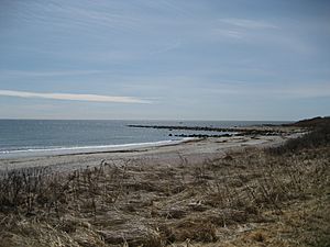
With its many ocean beaches, Narragansett is a popular summer vacation spot. It's also a famous place for surfing on the East Coast. This is because of the frequent waves from the Atlantic Ocean.
For more details about the village of Narragansett Pier, which is part of Narragansett, you can check out the article on Narragansett Pier.
Contents
- Exploring Narragansett's Geography
- Narragansett's Population Over Time
- Fun and Recreation in Narragansett
- Education in Narragansett
- Housing Rules in Narragansett
- Narragansett's Water Supply
- Economy and Top Employers
- Places of Worship in Narragansett
- Historic Places in Narragansett
- Famous People from Narragansett
- See also
Exploring Narragansett's Geography
Narragansett covers a total area of about 37.8 square miles (97.8 km2). Most of this area, about 23.6 square miles (61.2 km2), is water. The land area is about 14.1 square miles (36.6 km2).
Villages and Neighborhoods in Narragansett
Several smaller communities are found within Narragansett. Some of these are shared with nearby towns.
These include:
- Saunderstown (shared with North Kingstown)
- South Ferry
- Bonnet Shores
- Narragansett Pier
- Point Judith
- Galilee
- Great Island
- Salt Pond
- Mettatuxet
- Jerusalem (shared with South Kingstown)
Understanding Narragansett's Climate
Narragansett has a mild temperate climate. This means it usually has warm summers and cool winters. From May to mid-November, the weather is often warm or mild. It can get hot in June, July, and August. There are many sunny days and not too much rain.
The colder season is from December to March. During this time, high temperatures are usually between 40°F (4.4°C) and 49°F (9.4°C). Snowfall is usually light and melts quickly. This is because the town is close to the ocean. Narragansett gets about 200 days a year without frost. It also enjoys about 2300 hours of sunshine each year.
| Climate data for Narragansett, Rhode Island | |||||||||||||
|---|---|---|---|---|---|---|---|---|---|---|---|---|---|
| Month | Jan | Feb | Mar | Apr | May | Jun | Jul | Aug | Sep | Oct | Nov | Dec | Year |
| Record high °F (°C) | 66 (19) |
65 (18) |
79 (26) |
89 (32) |
91 (33) |
94 (34) |
98 (37) |
96 (36) |
93 (34) |
83 (28) |
74 (23) |
70 (21) |
98 (37) |
| Mean daily maximum °F (°C) | 40 (4) |
42 (6) |
49 (9) |
59 (15) |
69 (21) |
78 (26) |
83 (28) |
82 (28) |
75 (24) |
65 (18) |
54 (12) |
45 (7) |
62 (17) |
| Mean daily minimum °F (°C) | 22 (−6) |
23 (−5) |
29 (−2) |
38 (3) |
48 (9) |
58 (14) |
64 (18) |
63 (17) |
56 (13) |
45 (7) |
36 (2) |
27 (−3) |
42 (6) |
| Record low °F (°C) | −6 (−21) |
−6 (−21) |
3 (−16) |
19 (−7) |
31 (−1) |
41 (5) |
50 (10) |
49 (9) |
35 (2) |
27 (−3) |
15 (−9) |
4 (−16) |
−6 (−21) |
| Average precipitation inches (mm) | 3.66 (93) |
3.23 (82) |
4.52 (115) |
3.90 (99) |
3.54 (90) |
3.90 (99) |
3.66 (93) |
4.03 (102) |
3.90 (99) |
4.64 (118) |
3.78 (96) |
4.52 (115) |
47.28 (1,201) |
| Average snowfall inches (cm) | 7 (18) |
7 (18) |
3 (7.6) |
0 (0) |
0 (0) |
0 (0) |
0 (0) |
0 (0) |
0 (0) |
0.1 (0.25) |
1 (2.5) |
3 (7.6) |
21.1 (53.95) |
Narragansett's Population Over Time
| Historical population | |||
|---|---|---|---|
| Census | Pop. | %± | |
| 1890 | 1,408 | — | |
| 1900 | 1,523 | 8.2% | |
| 1910 | 1,250 | −17.9% | |
| 1920 | 993 | −20.6% | |
| 1930 | 1,258 | 26.7% | |
| 1940 | 1,560 | 24.0% | |
| 1950 | 2,288 | 46.7% | |
| 1960 | 3,444 | 50.5% | |
| 1970 | 7,138 | 107.3% | |
| 1980 | 12,088 | 69.3% | |
| 1990 | 14,985 | 24.0% | |
| 2000 | 16,361 | 9.2% | |
| 2010 | 15,868 | −3.0% | |
| 2020 | 14,532 | −8.4% | |
| U.S. Decennial Census | |||
Population Details from the 2020 Census
The 2020 United States census counted 3,308 people living in Narragansett Pier. There were 1,596 households and 954 families. The population density was about 927 people per square mile.
About 9.9% of the people were under 18 years old. About 33.2% were 65 years or older. The average age was 56.6 years.
Fun and Recreation in Narragansett
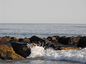
Narragansett is well-known for its summer activities and beautiful beaches. Fishermen's Memorial State Park, near Galilee, has an old military fort called Fort Greene and a campground.
Here are three of Narragansett's most famous beaches:
- Narragansett Town Beach: This beach is in the middle of Narragansett. It charges a fee to enter the beach and for parking. This helps the beach pay for itself without using taxpayer money.
- Scarborough State Beach: This large beach has two parts, North and South. Both have pavilions, showers, picnic tables, and boardwalks. There is a small fee for parking.
- Roger Wheeler State Beach and Salty Brine State Beach: Both of these beaches are in Point Judith. This is the southernmost tip of Narragansett. A breakwater protects both beaches. A new building opened at Salty Brine State Beach in 2010. It had food stands and a wind turbine, but the wind turbine was damaged in a storm in 2017.
Education in Narragansett
Narragansett has its own school system for students from Pre-K through 12th grade. There are three schools:
- Narragansett Elementary School
- Narragansett Pier Middle School
- Narragansett High School
The South County Museum is also located in Narragansett. The Narragansett Bay Campus of the University of Rhode Island is here too.
Housing Rules in Narragansett
To manage housing, Narragansett has a rule. No more than three college students can live together in one housing unit.
Narragansett's Water Supply
The town gets its drinking water from two main organizations. These organizations divide the water into four systems.
- The Town of Narragansett Water Division: This division buys its water from other sources.
- North End Suez: Buys water from Suez Water, a private company in South Kingstown.
- North End North Kingston: Buys water from the Town of North Kingstown.
- Point Judith: Buys water from Suez Water.
- Suez Water: This company also sells water directly to customers in Narragansett.
Economy and Top Employers
Narragansett has several important employers. These businesses and organizations provide many jobs for the community.
Here are the top employers in Narragansett:
| # | Employer | Number of Employees |
|---|---|---|
| 1 | Town of Narragansett | 448 |
| 2 | University of Rhode Island Narragansett Bay Campus | 245 |
| 3 | Stop & Shop | 225 |
| 4 | The Dunes Club | 180 |
| 5 | VNS Home Health Service | 150 |
| 6 | Environmental Protection Agency | 160 |
| 7 | DeWal Industries | 120 |
| 8 | George's of Galilee | 100 |
| 9 | National Marine Fisheries Service | 70 |
Places of Worship in Narragansett
Narragansett is home to several different places of worship for various faiths:
- St. Thomas More Church (Roman Catholic)
- St. Veronica Chapel (Roman Catholic)
- St. Mary Star of the Sea Church (Roman Catholic)
- St. Peter By-the-Sea Church (Episcopal)
- Calvary Bible Church (Nondenominational)
- First Baptist Church of Narragansett
- South Ferry Church (Baptist, no regular services)
- Church of Jesus Christ of Latter-day Saints, Narragansett Ward
- Generation Church (nondenominational)
- Congregation Beth David (Jewish conservative)
Historic Places in Narragansett
Many buildings and areas in Narragansett are listed on the National Register of Historic Places. This means they are important historical sites.
Here are some of them:
- Central Street Historic District
- The Dunes Club (built in 1928)
- Druidsdream (built in 1884)
- Dunmere (built in 1883)
- Earlscourt Historic District
- Gardencourt (built in 1888)
- Gladstone Springhouse and Bottling Plant (built in 1899)
- Greene Inn (built in 1887)
- Narragansett Baptist Church (built in 1850)
- Narragansett Pier Life Saving Station (built in 1888)
- Ocean Road Historic District
- Point Judith Lighthouse (built in 1857)
- Towers Historic District
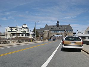
- The Towers (built in 1883)
Famous People from Narragansett
Many notable people have connections to Narragansett. Some were born there, and others lived or died there.
Here are a few:
- Karen Adams, a television news anchor
- Andy Boss, Geoff Boss, and Peter Boss, auto racing drivers
- John Joseph Boylan, a Roman Catholic bishop
- Ruth Clifford, a silent film actress
- David Caprio, an attorney and former state representative
- Frank Caprio, a judge and TV personality
- Frank T. Caprio, a former state treasurer
- Alana DiMario, a member of the Rhode Island Senate
- Patrick Doyle, former CEO of Domino’s Pizza
- Roberta Dunbar, a clubwoman
- Joe Faragalli, a football player and coach
- Steven Fulop, the current mayor of Jersey City, New Jersey
- John Gardner, a farmer and delegate to the Continental Congress
- Harriet Lane, acting first lady for her uncle James Buchanan
- Donald Lally, a former state representative
- Ted Leo, an indie rock musician
- J. Howard McGrath, a former United States attorney general and governor of Rhode Island
- Christopher Murney, an actor
- Peter Pezzelli, a novelist
- William Russell Sweet, a painter and sculptor
- Tage Thompson, an NHL Hockey player
- Jack Zilly, a football player
- John Cafferty and the Beaver Brown Band, a rock music group
See also
 In Spanish: Narragansett (Rhode Island) para niños
 | Precious Adams |
 | Lauren Anderson |
 | Janet Collins |


