
Point Lay, Alaska facts for kids
Quick facts for kids
Point Lay, Alaska
Kali
|
|
|---|---|

1940s
|
|

Location of Point Lay, Alaska
|
|

Point Lay, Alaska
Location in Alaska

Point Lay, Alaska
Location in North America
|
|
| Country | United States |
| State | Alaska |
| Borough | North Slope |
| Area | |
| • Total | 32.29 sq mi (83.63 km2) |
| • Land | 28.51 sq mi (73.85 km2) |
| • Water | 3.78 sq mi (9.78 km2) |
| Elevation | 30 ft (9 m) |
| Population
(2020)
|
|
| • Total | 330 |
| • Density | 11.57/sq mi (4.47/km2) |
| Time zone | UTC-9 (Alaska (AKST)) |
| • Summer (DST) | UTC-8 (AKDT) |
| ZIP code |
99759
|
| Area code(s) | 907 |
| FIPS code | 2419178 |
Point Lay is a small community in Alaska, United States. Its name in the Inupiaq language is Kali, which means "Mound." In 2020, about 330 people lived there. It is located in the North Slope Borough, Alaska.
Contents
Where is Point Lay Located?
Point Lay is found on the coast of the Chukchi Sea in Alaska. The area covers about 32 square miles (83 square kilometers). Most of this area is land, but some is water.
Point Lay was once on a narrow strip of land in the Kasegaluk Lagoon. But in the 1970s, the village moved to the mainland. This new location is close to the mouth of the Kokolik River.
Point Lay's Climate
Point Lay has a tundra climate. This means it has very long and cold winters. The summers are short and cool.
| Climate data for Point Lay (1949-1958) | |||||||||||||
|---|---|---|---|---|---|---|---|---|---|---|---|---|---|
| Month | Jan | Feb | Mar | Apr | May | Jun | Jul | Aug | Sep | Oct | Nov | Dec | Year |
| Mean daily maximum °F (°C) | −3.7 (−19.8) |
−15.3 (−26.3) |
−7.4 (−21.9) |
11.7 (−11.3) |
29.6 (−1.3) |
44.3 (6.8) |
51.6 (10.9) |
50.8 (10.4) |
39.9 (4.4) |
25.4 (−3.7) |
10.0 (−12.2) |
−6.0 (−21.1) |
19.2 (−7.1) |
| Mean daily minimum °F (°C) | −20.2 (−29.0) |
−30.5 (−34.7) |
−22.4 (−30.2) |
−4.5 (−20.3) |
17.7 (−7.9) |
32.7 (0.4) |
38.5 (3.6) |
38.9 (3.8) |
31.3 (−0.4) |
15.2 (−9.3) |
−2.3 (−19.1) |
−19.6 (−28.7) |
6.2 (−14.3) |
| Average precipitation inches (mm) | 0.17 (4.3) |
0.03 (0.76) |
0.10 (2.5) |
0.17 (4.3) |
0.05 (1.3) |
0.31 (7.9) |
1.67 (42) |
1.78 (45) |
0.72 (18) |
0.42 (11) |
0.15 (3.8) |
0.12 (3.0) |
5.69 (143.86) |
| Source: http://www.wrcc.dri.edu/cgi-bin/cliMAIN.pl?ak7442 | |||||||||||||
Who Lives in Point Lay?
| Historical population | |||
|---|---|---|---|
| Census | Pop. | %± | |
| 1880 | 30 | — | |
| 1890 | 77 | 156.7% | |
| 1940 | 117 | — | |
| 1950 | 75 | −35.9% | |
| 1980 | 68 | — | |
| 1990 | 139 | 104.4% | |
| 2000 | 247 | 77.7% | |
| 2010 | 189 | −23.5% | |
| 2020 | 330 | 74.6% | |
| U.S. Decennial Census | |||
Point Lay first appeared in the U.S. Census in 1880. At that time, 30 Inuit people lived there. By 1890, the population grew to 77, all of whom were native people.
The village moved to its current mainland location in the 1970s. Since 1980, Point Lay has been listed as a "census-designated place" (CDP). This means it is a community that the government counts for population statistics.
Population Details
In 2010, there were 189 people living in Point Lay. Most of the people (88.4%) were Native American. About 10.1% were White. A small number were Pacific Islander or from two or more races. Less than 1% were Hispanic or Latino.
In 2000, the average household had about 3.9 people. The average family had about 4.5 people. Many households (50.8%) had children under 18 living with them.
The median age of people in Point Lay in 2000 was 21 years old. This means half the population was younger than 21, and half was older. Many young people live in Point Lay, with 46.2% of the population being under 18.
Life in Point Lay

The people of Point Lay have a special annual hunt for beluga whales in the Kasegaluk Lagoon. This hunt is an important part of their culture and way of life.
On the Fourth of July, the village has a parade. Fire engines and ambulances from the local fire department lead the parade.
The Inupiaq name for the village is Kali. This name is used for the local school and fire department. The Kali school is part of the North Slope Borough School District.
Old Radar Station

Near Point Lay, there used to be a group of radar dishes. These dishes were part of the Distant Early Warning Line, also known as the DEW Line. This system was built during the Cold War to detect incoming attacks. The station was closed in the 1990s. The radar dishes were taken down between 2004 and 2006.
Images for kids
-
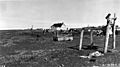
A view of Point Lay in the 1940s.
-
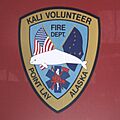
Point Lay fire truck insignia with Beluga Whale.


See also
 In Spanish: Point Lay (Alaska) para niños
