Ponshewaing, Michigan facts for kids
Quick facts for kids
Ponshewaing, Michigan
|
|
|---|---|

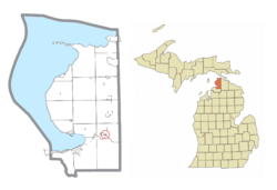
Location within Emmet County
|
|
| Country | United States |
| State | Michigan |
| County | Emmet |
| Township | Littlefield |
| Area | |
| • Total | 0.09 sq mi (0.23 km2) |
| • Land | 0.09 sq mi (0.23 km2) |
| • Water | 0.00 sq mi (0.00 km2) |
| Elevation | 614 ft (187 m) |
| Population
(2020)
|
|
| • Total | 126 |
| • Density | 1,431.82/sq mi (552.98/km2) |
| Time zone | UTC-5 (Eastern (EST)) |
| • Summer (DST) | UTC-4 (EDT) |
| ZIP code(s) |
49706 (Alanson)
|
| Area code(s) | 231 |
| FIPS code | 26-65420 |
| GNIS feature ID | 635223 |
Ponshewaing (pronounced PON-shə-WANG) is a small community in Michigan, a state in the United States. It's known as an "unincorporated community," which means it doesn't have its own local government like a city or town. It's also a "census-designated place" (CDP). This means the U.S. government counts its population and defines its borders for official records.
Ponshewaing is located in Emmet County, specifically within Littlefield Township. According to the 2020 census, about 126 people live in Ponshewaing.
Contents
Where is Ponshewaing Located?
Ponshewaing is found in the southeastern part of Emmet County. It sits right on the northern shore of Crooked Lake, which is a beautiful spot. To its west, you'll find the community of Oden.
A main road, U.S. Route 31, goes through Ponshewaing. This road can take you about 9 miles (14 km) southwest to Petoskey, which is the main city in Emmet County. If you head northeast on the same road for about 2 miles (3 km), you'll reach the town of Alanson.
Size of the Community
Ponshewaing was first recognized as an official census-designated place (CDP) for the 2010 census. This was the first time it had official borders and population numbers.
The U.S. Census Bureau says that Ponshewaing CDP covers a total area of about 0.09 square miles (0.23 square kilometers). All of this area is land. Ponshewaing is actually the smallest census-designated place in Michigan when it comes to land area.
Schools in Ponshewaing
Students living in Ponshewaing attend schools that are part of the Alanson Public Schools district.
How Many People Live Here?
The number of people living in Ponshewaing has changed over time. Here's a quick look at the population counts from recent U.S. censuses:
| Historical population | |||
|---|---|---|---|
| Census | Pop. | %± | |
| 2020 | 126 | — | |
| U.S. Decennial Census | |||
See also
 In Spanish: Ponshewaing para niños
 | Janet Taylor Pickett |
 | Synthia Saint James |
 | Howardena Pindell |
 | Faith Ringgold |


