Emmet County, Michigan facts for kids
Quick facts for kids
Emmet County
|
||
|---|---|---|
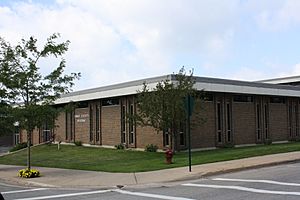
Emmet County Building
|
||
|
||
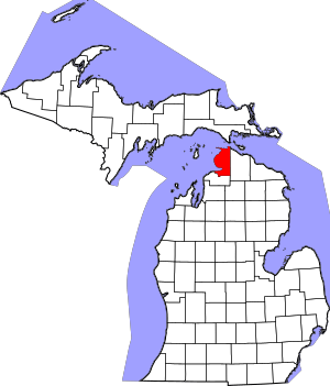
Location within the U.S. state of Michigan
|
||
 Michigan's location within the U.S. |
||
| Country | ||
| State | ||
| Founded | April 1, 1840 | |
| Named for | Robert Emmet | |
| Seat | Petoskey | |
| Largest city | Petoskey | |
| Area | ||
| • Total | 882 sq mi (2,280 km2) | |
| • Land | 467 sq mi (1,210 km2) | |
| • Water | 415 sq mi (1,070 km2) 47%% | |
| Population
(2020)
|
||
| • Total | 34,112 | |
| • Density | 70/sq mi (30/km2) | |
| Time zone | UTC−5 (Eastern) | |
| • Summer (DST) | UTC−4 (EDT) | |
| Congressional district | 1st | |
Emmet County is a cool place in the state of Michigan, USA. In 2020, about 34,112 people lived here. It's the second-biggest county by population in Northern Michigan. The main city, where the county government is, is Petoskey. It's also the biggest city in the county.
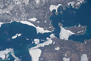
Emmet County sits at the very top of Michigan's Lower Peninsula. It has Lake Michigan to its west and the Straits of Mackinac to its north. Its wild areas are home to some amazing and rare animals. For a long time, the Odawa people lived here. Today, the Little Traverse Bay Bands of Odawa Indians still call this county home.
Contents
History of Emmet County
Native Americans and Early European Settlers
Long ago, the Odawa people lived in Emmet County. They were known for farming and trading. They grew crops like corn, squash, and strawberries. The Odawa traded with the French at Mackinac Island. They exchanged food and canoes for things like clothing and beads. This trading was very important in the Great Lakes area.
The French were the first Europeans to arrive. They built Fort Michilimackinac around 1715. This fort was a busy trading spot where many different Native American tribes came to trade. A Jesuit priest named Pierre du Jaunay worked as a missionary here for nearly 30 years.
British Control and US Settlement
During the Seven Years' War (1754–1763), the British took control of Fort Michilimackinac in 1761. In 1763, Ojibwe warriors took the fort during Pontiac's Rebellion. The British got it back a year later. They later moved to Mackinac Island and built Fort Mackinac.
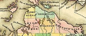
After the War of 1812, this area became part of the United States. In the 1840s, Odawa villages were all along the Lake Michigan shore. In 1840, the area was first called Tonedagana County. This name came from an Odawa war chief.
In 1843, the Michigan Legislature changed the name to Emmet County. It was named after Robert Emmet. Later, a group of Mormons settled on Beaver Island. Their leader, James Jesse Strang, became very powerful. He even got elected to the Michigan State House of Representatives.
Strang helped pass a law in 1853 that made Emmet County bigger. This law added nearby islands to the county. Because of Strang, Mormons had a lot of control in the county government. This caused many non-Mormon settlers to leave. In 1855, the Michigan Legislature changed things again. The islands, including Beaver Island, were moved to a new county called Manitou County. This helped balance the power in Emmet County.
Geography of Emmet County
Emmet County covers about 882 square miles. About 467 square miles are land, and 415 square miles (47%) are water. The southern part of the county has Little Traverse Bay. Emmet County is part of Northern Michigan.
Neighboring Counties
By Land
- Cheboygan County (east)
- Charlevoix County (south)
By Water
- Charlevoix County (west)
- Mackinac County (north; connected by the Mackinac Bridge)
Communities in Emmet County
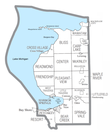
Emmet County has several cities, villages, and townships.
Cities
- Harbor Springs
- Petoskey (the county seat)
Villages
- Alanson
- Mackinaw City (partly in another county)
- Pellston
Townships
- Bear Creek Township
- Bliss Township
- Carp Lake Township
- Center Township
- Cross Village Township
- Friendship Township
- Little Traverse Township
- Littlefield Township
- Maple River Township
- McKinley Township
- Pleasantview Township
- Readmond Township
- Resort Township
- Springvale Township
- Wawatam Township
- West Traverse Township
Other Places to Know
- Bay Shore
- Bay View
- Brutus
- Carp Lake
- Conway
- Cross Village
- Levering
- Oden
- Ponshewaing
Native American Reservations
- Burt Lake Band of Ottawa and Chippewa Indians
- Little Traverse Bay Bands of Odawa Indians has several areas within Emmet County.
- Mackinac Bands of Chippewa and Ottawa Indians
Population and People
| Historical population | |||
|---|---|---|---|
| Census | Pop. | %± | |
| 1860 | 1,149 | — | |
| 1870 | 1,211 | 5.4% | |
| 1880 | 6,639 | 448.2% | |
| 1890 | 8,756 | 31.9% | |
| 1900 | 15,931 | 81.9% | |
| 1910 | 18,561 | 16.5% | |
| 1920 | 15,639 | −15.7% | |
| 1930 | 15,109 | −3.4% | |
| 1940 | 15,791 | 4.5% | |
| 1950 | 16,534 | 4.7% | |
| 1960 | 15,904 | −3.8% | |
| 1970 | 18,331 | 15.3% | |
| 1980 | 22,992 | 25.4% | |
| 1990 | 25,040 | 8.9% | |
| 2000 | 31,437 | 25.5% | |
| 2010 | 32,694 | 4.0% | |
| 2020 | 34,112 | 4.3% | |
| 2023 (est.) | 34,123 | 4.4% | |
| US Decennial Census 1790-1960 1900-1990 1990-2000 2010-2018 |
|||
In 2000, about 31,437 people lived in Emmet County. There were 12,577 households. By 2020, the population grew to 34,112 people.
Most people in 2000 were White (94.33%). About 3.11% were Native American. Many people had German, English, Irish, or Polish backgrounds. Most people (96.9%) spoke English at home.
The average age in the county was 39 years old. About 25.3% of the population was under 18.
Fun Things to Do
Parks and Recreation
- Wilderness State Park is a huge park (10,512 acres) on the shores of Lake Michigan. It has a special area called Waugoshance Point. This point and nearby islands are nesting spots for the endangered piping plover, a small bird.
- The Headlands is a 550-acre park west of Mackinaw City, Michigan. It has forests and over two miles of natural shoreline. You can find many rare plants here. There are trails for hiking, bicycling, and cross-country skiing. In 2011, The Headlands became an International Dark Sky Park. This means it's a great place to see stars at night!
Economy and Jobs
Emmet County's economy gets a big boost from local businesses and factories. Companies in areas like aerospace, gaming, and candy making help the county's economy grow.
Local Businesses and Industries
- The Odawa Casino Resort in Resort Township is a popular spot. It's one of the main casinos in Northern Michigan. The LTBB Gaming Administration in Petoskey also employs 250 people.
- The Kilwins chocolate company started in Petoskey in 1947. They make delicious ice cream, candy, chocolate, and fudge. You can find their stores in many tourist places across 21 states.
- McLaren Northern Michigan Hospital in Petoskey is one of the biggest employers. It has 950 employees.
- Moeller Aerospace Technology in Harbor Springs makes different products for airplanes and space.
- The Petoskey News-Review is a local newspaper that has been around since 1878.
Getting Around
Main Roads
 I-75 is a big highway that goes through the very northeast corner of Emmet County in Mackinaw City. North of Emmet County, I-75 crosses the Straits of Mackinac on the Mackinac Bridge.
 US 31 is the main north-south road in Emmet County. It connects cities like Petoskey, Alanson, and Mackinaw City.
 US 131 starts in Petoskey and goes south.
- M-119 is a highway completely within Emmet County. It follows the shore of Little Traverse Bay and Lake Michigan. The famous "Tunnel of Trees" is along M-119.
Bus and Air Travel
- Indian Trails offers bus service to Emmet County. You can catch a bus in Petoskey and Pellston.
- Emmet County has its own airport, Pellston Regional Airport. You can fly from here to Detroit and other places in Northern Michigan.
See also
 In Spanish: Condado de Emmet (Míchigan) para niños
 | Frances Mary Albrier |
 | Whitney Young |
 | Muhammad Ali |


