
Mackinac Island facts for kids
|
Native name:
Michilimackinac
Mishimikinaak ᒥᔑᒥᑭᓈᒃ |
|
|---|---|

Topographic map of Mackinac island
|
|

Mackinac
Location in Michigan
|
|
| Geography | |
| Location | Lake Huron |
| Coordinates | 45°51′40″N 84°37′50″W / 45.86111°N 84.63056°W |
| Area | 4.35 sq mi (11.3 km2) |
| Coastline | 8 mi (13 km) |
| Highest elevation | 890 ft (271 m) |
| Highest point | Fort Holmes |
| Administration | |
|
United States
|
|
| State | Michigan |
| Largest settlement | Mackinac Island (pop. 583) |
| County | Mackinac County |
| Demographics | |
| Population | 583 (2020) |
| Pop. density | 134.02 /sq mi (51.745 /km2) |
| Ethnic groups | see demographics |
|
Mackinac Island
|
|

Cyclists on M-185 (Main Street) at mile marker 0 in downtown Mackinac Island
|
|
| Location | Mackinac Island, Michigan |
| NRHP reference No. | 66000397 |
| Significant dates | |
| Added to NRHP | October 15, 1966 |
| Designated NHLD | October 9, 1960 |
| Additional information | |
| ZIP code(s) | 49737 |
| Area code(s) | 906 |
Mackinac Island (mak-Ə-naw mak-Ə-nə) is a beautiful island and popular vacation spot in Michigan, USA. It covers about 4.35 square miles (11.3 km²). The island's name comes from Native American languages, meaning "Great Turtle."
It is located in Lake Huron, right where the Straits of Mackinac connect the two parts of Michigan. For a long time, Native American tribes like the Odawa lived here. Later, in the 1600s, Europeans arrived. The island became a key place for the fur trade in the Great Lakes region.
During the American Revolutionary War, the British built Fort Mackinac on the island. It was also important during the War of 1812, with two battles fought here. After the war, the island became part of the United States.
In the late 1800s, Mackinac Island became a famous place for tourists and summer visitors. Many old buildings have been carefully saved and fixed up. The whole island is a National Historic Landmark because of its history. It's known for its many events, Victorian architecture, and the famous Grand Hotel.
One special thing about Mackinac Island is that almost no cars are allowed! Only emergency vehicles, city service vehicles, and snowmobiles in winter can use motors. More than 80% of the island is protected as Mackinac Island State Park.
Contents
- What Does Mackinac Mean?
- A Look Back: Mackinac Island's History
- Who Lives on Mackinac Island?
- Exploring Mackinac Island's Geography
- Getting Around Mackinac Island
- Mackinac Island's Buildings
- Fun Things to See and Do
- Island Culture and Events
- Famous People from Mackinac Island
- Images for kids
- See Also
What Does Mackinac Mean?
Like many old places in the Great Lakes, Mackinac Island's name comes from a Native American language. The Anishinaabe people, who lived in the area, thought the island looked like a turtle. So, they called it "Mitchimakinak," which means "Big Turtle" in the Ojibwe language.
Andrew Blackbird, an Odawa chief's son and a U.S. government interpreter, said the island was named after a tribe that lived there. The French later wrote the name as "Michilimackinac." The British then shortened it to "Mackinac."
The Menominee people, who lived in a large area from Wisconsin to Michigan, also had a word for turtle: Maehkaenah. Some historical writings suggest the name might relate to "strange Indians" or "Michilimackinac People" near the old fort.
An early historian, Andrew Blackbird (1887), wrote that a small tribe called "Mi-shi-ne-macki naw-go" once lived on the island. They joined with the Ottawa from Ottawa Island. One winter, almost all of them were wiped out by the Seneca people. To remember this, the Ottawa named the island "Mi-shi-ne-macki-nong."
A Look Back: Mackinac Island's History
Early Days and Native American Life
Archaeologists have found old fishing camps on Mackinac Island. This shows that Native Americans lived here at least 700 years before Europeans arrived, around 900 AD. The island was a sacred place for the Anishinaabe people. They believed it was home to the Gitche Manitou, or "Great Spirit."
Legend says that Michabou, the Great Hare, created Mackinac Island. It was the first land to appear after a big flood. The island was a meeting place for tribes, who would leave gifts for Gitche Manitou. It also became a burial ground for tribal chiefs.
European Arrival and Fur Trade
The first European to likely see Mackinac Island was Jean Nicolet, a French explorer, in 1634. A Jesuit priest, Claude Dablon, started a mission for Native Americans on the island in 1670. Another missionary, Jacques Marquette, moved the mission to St. Ignace in 1671.
With the mission, the Straits of Mackinac quickly became a key French fur trading spot. The British took control of the Straits after the French and Indian War. In 1780, Major Patrick Sinclair chose the island's high cliffs for Fort Mackinac.
Old writings from 1671 describe Mackinac Island as very important. It was a central point for all travel on the upper Great Lakes. Many tribes came back to the island after making peace with the Iroquois. The Huron people, fearing the Sioux, moved to the shore north of Mackinac Island. Marquette continued his missionary work there.
Even though the British built Fort Mackinac to protect against attacks, it was never attacked during the American Revolutionary War. The island officially became part of the United States in 1783. However, Britain kept forces in the area until 1794.
The 1800s and Beyond

During the War of 1812, the British captured Fort Mackinac in the siege of Fort Mackinac. The Americans were surprised because they didn't know war had started. The British then built Fort George on the high ground behind Fort Mackinac. In 1814, Americans tried to take the island back in the Battle of Mackinac Island. They failed, and their second-in-command, Major Andrew Holmes, was killed.
After the war, in 1815, the British returned the island to the U.S. The Americans took back Fort Mackinac and renamed Fort George to Fort Holmes in honor of Major Holmes. The fort stayed under U.S. control until 1895. It even provided soldiers for the Union during the American Civil War.
John Jacob Astor's American Fur Company was based on Mackinac Island after 1812. They traded beaver furs for 30 years. By the mid-1800s, commercial fishing for whitefish and lake trout became the main business. As sport fishing grew popular in the 1880s, hotels and restaurants opened for tourists.
After the Civil War, the island became a popular vacation spot. In 1875, much of the island became Mackinac National Park, the second national park in the U.S. This was thanks to U.S. Senator Thomas W. Ferry, who was born on the island. To welcome more tourists, boat and railroad companies built hotels, including the Grand Hotel. Wealthy people also built summer "cottages" along the island's bluffs.
When the U.S. government left the island in 1895, they gave all the federal land, including Fort Mackinac, to Michigan. This area became Michigan's first state park. The Mackinac Island State Park Commission makes sure the island's unique Victorian buildings are kept in good shape.
Cars were banned on the island in 1898. This was to keep residents and horses safe, as cars scared the horses. This ban is still in place today, with only a few exceptions for emergency and service vehicles.
Who Lives on Mackinac Island?
According to the 2020 United States Census, 583 people live on Mackinac Island year-round. However, the population grows a lot in the summer. Many tourists visit, and hundreds of seasonal workers come to work in hotels, restaurants, and shops. This busy season runs from May 1st to October 31st.
Exploring Mackinac Island's Geography
.JPG)

Mackinac Island is in Lake Huron, at the eastern end of the Straits of Mackinac. It sits between Michigan's Upper and Lower Peninsulas. The island is about 8 miles (13 km) around and covers 3.8 square miles (9.8 km²).
The highest point is Fort Holmes, which is 320 feet (98 m) above the lake. This spot was originally called Fort George by the British.
How Mackinac Island Was Formed
Mackinac Island was shaped by melting glaciers about 15,000 years ago. The rocks under the island are much older, from 400 to 420 million years ago. Over time, underground salt deposits dissolved, causing the rocks above to collapse. This created the unique Mackinac Breccia rock.
As the glaciers melted, they formed the Great Lakes. The water levels changed, and the receding water carved out the island's steep cliffs and rock formations. At one point, the Straits of Mackinac were a narrow gorge with a waterfall just east of the island.
When the Great Lakes reached their current levels, the waterfall disappeared, and Mackinac Island became its present size. The steep cliffs were why the British chose the island for their fort. Famous rock formations include Arch Rock, a natural limestone arch 146 feet (45 m) high. Other cool spots are Devil's Kitchen, Skull Cave, and Sugar Loaf.
Island Nature: Plants and Animals

Mackinac Island has many different natural areas. These include fields, marshes, forests, and limestone cliffs. The island's environment is protected as a State Historic Park. About half of the shoreline and nearby waters are part of the Straits of Mackinac Shipwreck Preserve, a state marine park.
Because the island is 3 miles (4.8 km) from the mainland, few large animals live there. Some animals, like rabbits, foxes, raccoons, and squirrels, are common. Occasionally, beavers and coyotes cross the ice in winter. Bats are plentiful because of the many caves and insects to eat.
The island is a stop for many migratory birds. Eagles and hawks are common in spring. Smaller birds like yellow warblers and indigo buntings are seen in early summer. Near the shore, gulls, herons, and geese are common. Owls, including snowy owls, visit from the Arctic in winter. Year-round birds include chickadees, cardinals, and blue jays.
Mackinac Island has over 600 types of plants. Many wildflowers bloom, such as trillium, lady slippers, and violets. The island's forests have maple, birch, elm, cedar, pine, and spruce trees.
Getting Around Mackinac Island


You can reach Mackinac Island by private boat, ferry, or small airplane. In winter, you can even travel by snowmobile over an ice bridge. The Mackinac Island Airport has a 3,500-foot (1,067 m) paved runway, with daily charter flights. During summer, ferries from Shepler's Ferry and Mackinac Island Ferry Company take visitors from St. Ignace and Mackinaw City.
As mentioned, most motor vehicles have been banned since 1898. This means you get around by foot, bicycle, horse, or horse-drawn carriage. Roller skates and roller blades are also allowed, except in the main downtown area. You can rent bikes, skates, carriages, and horses.
An 8-mile (13 km) road goes around the island's edge. Many other roads and paths cover the island's inside. M-185 is the only state highway in the U.S. where cars are not allowed! It circles the island close to the shoreline.
Mackinac Island State Park covers about 80% of the island. It includes Fort Mackinac and parts of the historic downtown and harbor. You can't camp on the island, but there are many hotels and bed and breakfasts. The downtown streets are full of shops and restaurants.
Mackinac Island's Buildings

Most buildings on Mackinac Island are made of wood, often with clapboard siding. A few are made of stone. The island's buildings show architectural styles from 300 years of history.
The first structures were built by Native American tribes. A couple of buildings still exist from the original French settlement in the late 1700s. Mackinac Island has a rare example of northern French rustic architecture in the U.S.
You can also see Federalist, Colonial, and Greek Revival styles. Since the island became a tourist spot in the late 1800s, many buildings were built in the Victorian style. This includes Gothic Revival, Stick style, and Queen Anne styles. More recent styles from the late 1800s to the 1930s include Colonial and Tudor revival.
Fun Things to See and Do

The entire Mackinac Island was named a National Historic Landmark in 1960. Because of its long history and preservation efforts, nine places on the island (and nearby Round Island) are listed on the National Register of Historic Places. In 2022, Travel + Leisure magazine called Mackinac Island the best island to visit in the continental U.S.
- The whole island, Haldimand Bay, and a small shipwreck form a historic district.
- Fort Mackinac, built by the British in 1780, was closed as a fort in 1895. It has been restored to look like it did in the late 1800s.
- The Biddle House, built around 1780, shows what a wealthy home was like during the fur trade in the 1820s.
- The McGulpin House, possibly built before 1780, shows how a working-class family lived on the frontier.
- The Agency House of the American Fur Company was built in 1820 for the company's agent, Robert Stuart. It's now a fur trade museum.
- The Mission House was built in 1825 by missionary William Montague Ferry. It was a boarding school for Native American and Métis children. It later became a hotel and is now used by State Park employees.
- The 108-foot tall glassed-in Mission Point museum has five floors of exhibits. You can learn about the island's maritime history, lighthouses, and the Mackinac Bridge. It also features the film Somewhere in Time, which was filmed here.
- The Mission Church, built in 1829, is Michigan's oldest church building. It looks like it did in the 1830s.
- The Indian Dormitory was built in 1836. It was a school and a place for Native Americans to stay when they came to get yearly payments. It's now The Richard and Jane Manoogian Mackinac Art Museum, showing island art and having a children's art studio.
- The Matthew Geary House, built in 1846, is a private home available for vacation rentals.
- The current Catholic Sainte Anne Church was built in 1874. Its records go back to 1695!
- The Grand Hotel is a beautiful Victorian-style building that opened in 1887. The 1980 movie Somewhere in Time was filmed here.
- The Round Island Lighthouse is just south of Mackinac Island. Built in 1894, it has been restored.
- Wawashkamo Golf Club, started in 1898, is Michigan's oldest golf course that's still in use.
- The Michigan Governor's Summer Residence was built in 1902. The state bought it in 1943 for the governor to use as a vacation home.
- Anne's Tablet is a sculpture added to a bluff in 1916.
- There are several parks for kids, including the playground at the school, Marquette Park, and Great Turtle Park with a baseball field and skate park.
Island Culture and Events

Mackinac Island hosts many fun events. The Grand Hotel has an annual show of American art from the 1800s. There are also five art galleries on the island.
Since 1949, islanders celebrate the beautiful native lilacs with a 10-day festival each spring. It ends with a parade of horse-drawn vehicles.
Two big sailboat races finish at Mackinac Island. The Port Huron to Mackinac Boat Race and the Chicago Yacht Club Race to Mackinac are among the longest freshwater sailing races in the world. They happen a week apart in July, attracting over 500 boats and 3,500 sailors. These races have been going on since the 1920s!
The Mackinac Policy Conference is another important event held on the island.
Mackinac Island is also famous for its fudge! The Mackinac Island Fudge Festival takes place in August. After the fur trade ended, the island became a vacation spot. The Murdick family opened the first real candy store in the 1800s. During tough times in the 20th century, they used fans to blow the smell of their fudge into the streets to attract customers. Today, visitors are sometimes called "fudgies" because they come for the island's famous fudge.
Each June, the island celebrates Epona, the Horse Goddess. This includes stable tours, a blessing of animals, and the Epona and Barkus Parade. Since horses are the main way to get around the island, this celebration is very special.
Scouts on the Island
Every summer, Michigan Boy Scouts and Girl Scouts serve the state park as the Mackinac Island Governor's Honor Guard. This program started in 1929 with eight Eagle Scouts, including Gerald Ford, who later became President of the United States.

In 1974, Girl Scouts joined the program. Scouts raise and lower flags, act as guides, and do volunteer projects. They live in the Scout Barracks behind Fort Mackinac.
Mackinac Island in Movies and TV
The swimming pool at the Grand Hotel is named after Esther Williams. She starred in the 1947 film This Time for Keeps, which had many scenes filmed on Mackinac Island.
Most of the 1980 movie Somewhere in Time was filmed at Mission Point on Mackinac Island. You can see landmarks like the Grand Hotel and the lighthouse on nearby Round Island. The director chose the island because it "looked like it hadn't changed in eighty years."
Mackinac Island was also featured on two episodes of the TV show Dirty Jobs. Host Mike Rowe talked to a Mackinac Bridge worker and someone who collects horse manure and garbage for composting.
In the Netflix show Emily in Paris, Emily mentions going on a Vespa fudge tour on Mackinac Island. However, in real life, Vespas (motorized scooters) are not allowed on the island!
Famous People from Mackinac Island
- John Penn Arndt, a merchant and politician.
- William Beaumont, a U.S. Army surgeon known for his research on human digestion.
- Agatha Biddle, a Métis fur trader and community leader.
- Sophie Biddle, a Métis fur trader and community leader.
- Gerald F. Bogan, a senior admiral during WWII.
- Michael Cudahy, a meatpacking CEO.
- Peter Warren Dease, a fur trader and Arctic explorer.
- Hercules L. Dousman, a fur trader and real estate investor.
- Michael Dousman, a fur trader and sawmill owner.
- Frank Dufina, an early Native American golf professional.
- Thomas W. Ferry, a U.S. Senator born on the island.
- William Montague Ferry, a Presbyterian minister and missionary.
- William Montague Ferry Jr., a politician.
- Porter Hanks, an artillery lieutenant who surrendered Fort Mackinac in 1812.
- Jane Briggs Hart, an aviator.
- Philip Hart, a U.S. Senator buried on the island.
- Gurdon Saltonstall Hubbard, a fur trader and Chicago pioneer.
- Madeline La Framboise, a Métis fur trader and businesswoman.
- Jacques Marquette, a Jesuit priest and missionary.
- John McCabe, a writer and historian.
- Henry Rowe Schoolcraft, an ethnographer and U.S. Indian agent.
- Jane Johnston Schoolcraft, an ethnographer, translator, and poet.
- Elizabeth Mitchell, a Métis businesswoman.
- Alexis St. Martin, a French fur trapper who was a patient for William Beaumont's research.
- Elizabeth Whitney Williams, a lighthouse keeper.
- G. Mennen Williams, a former governor of Michigan.
- Pearl Louella Kendrick, a bacteriologist who helped develop the whooping cough vaccine.
Images for kids
-
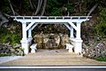
Dwightwood Spring, on Mackinac Island's eastern shore
-

Marquette Park on Mackinac Island

See Also
In Spanish: Isla Mackinac para niños
