Cheboygan County, Michigan facts for kids
Quick facts for kids
Cheboygan County
|
||
|---|---|---|

|
||
|
||

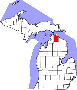
Location within the U.S. state of Michigan
|
||
 Michigan's location within the U.S. |
||
| Country | ||
| State | ||
| Founded | 1840 (authorized) 1853 (organized) |
|
| Seat | Cheboygan | |
| Largest city | Cheboygan | |
| Area | ||
| • Total | 885 sq mi (2,290 km2) | |
| • Land | 715 sq mi (1,850 km2) | |
| • Water | 170 sq mi (400 km2) 19%% | |
| Population
(2020)
|
||
| • Total | 25,579 | |
| • Density | 37/sq mi (14/km2) | |
| Time zone | UTC−5 (Eastern) | |
| • Summer (DST) | UTC−4 (EDT) | |
| Congressional district | 1st | |
Cheboygan County is a county located in the state of Michigan in the United States. A county is like a smaller region within a state, with its own local government. In 2020, about 25,579 people lived here.
The main town, or county seat, of Cheboygan County is Cheboygan. The county was first created in 1840. Its government officially started in 1853, combining with another area called Wyandot County.
Contents
What Does "Cheboygan" Mean?
The name "Cheboygan" comes from the Cheboygan River. The exact meaning of the name is not fully known today. It might come from an Ojibwe word, zhaabonigan, which means "sewing needle". Another idea is that it comes from Chabwegan, meaning "a place of ore". People often say it was a Native American word first used for the river.
Exploring Cheboygan County's Geography
Cheboygan County covers a total area of 885 square miles. Most of this is land (715 square miles), but a good part (170 square miles) is water. This means about 19% of the county is covered by water. Cheboygan County is considered part of the beautiful Northern Michigan region.
Neighboring Counties Around Cheboygan
Cheboygan County shares its borders with several other counties.
By land:
- Presque Isle County to the east
- Montmorency County to the southeast
- Otsego County to the south
- Charlevoix County to the southwest
- Emmet County to the west
By water:
- Mackinac County to the north
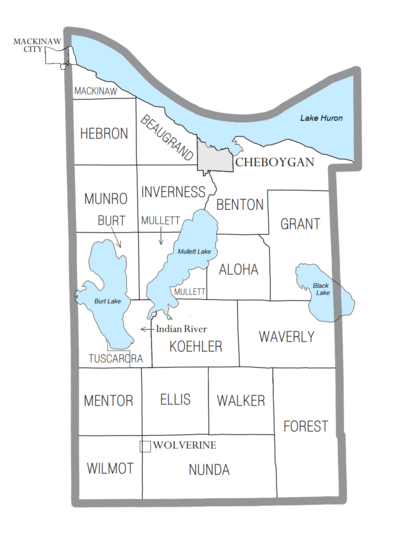
Towns and Communities in Cheboygan County
Cheboygan County has several different types of communities, from cities to small villages and other places where people live.
Cities in Cheboygan County
- Cheboygan (This is the county seat, the main town for the county's government.)
Villages in Cheboygan County
- Mackinaw City (part of this village is in Cheboygan County)
- Wolverine
Civil Townships in Cheboygan County
Townships are smaller local government areas within a county.
- Aloha Township
- Beaugrand Township
- Benton Township
- Burt Township
- Ellis Township
- Forest Township
- Grant Township
- Hebron Township
- Inverness Township
- Koehler Township
- Mackinaw Township
- Mentor Township
- Mullett Township
- Munro Township
- Nunda Township
- Tuscarora Township
- Walker Township
- Waverly Township
- Wilmot Township
Census-Designated Places
These are areas that the U.S. Census Bureau defines for gathering population data, but they don't have their own separate local government like cities or villages.
- Indian River
- Tower
Other Unincorporated Communities
These are smaller communities that are not officially part of a city or village.
- Afton
- Aloha
- Alverno
- Birchwood
- Burt Lake
- Cordwood Point
- Dow
- Elmhurst
- Fingerboard Corner
- Freedom
- Geyersville
- Giauque Beach
- Grand View
- Haakwood
- Long Point
- Mullett Lake
- Mullett Lake Woods
- Orchard Beach
- Point Landing
- Pries Landing
- Riggsville
- Rondo
- Royal Oak
- Silver Beach
- Topinabee
- Veery Point
- Wildwood
Indian Reservations
Who Lives in Cheboygan County?
The population of Cheboygan County has changed over the years. In 1860, only 517 people lived there. By 1900, the population grew to over 15,000. In 2020, the county had 25,579 residents.
Most people living in Cheboygan County are White (94.80% in 2000). About 2.55% are Native American. A small number of people are Black, Asian, or from other racial backgrounds. About 0.76% of the population is Hispanic or Latino.
In 2000, the average age of people in the county was 41 years old. About 23.70% of the population was under 18.
Historical Markers in Cheboygan County
There are eight special historical markers in Cheboygan County. These markers tell important stories about the county's past.
- Forty Mile Point Lighthouse / Graveyard of Ships
- Inland Waterway
- Jacob J. Post House
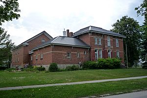
- Jail and Sheriff's Residence
- Newton-Allaire House
- Old Cheboygan County Courthouse
- St. Bernard Catholic Church
- St. Mary's Church
Getting Around: Transportation in Cheboygan County
Cheboygan County has several important roads and an airport to help people travel.
Major Highways
 I-75
I-75 US 23
US 23 US 31
US 31 M-27
M-27 M-33
M-33 M-68
M-68- M-212
County-Designated Highways
These are roads managed by the county.
 C-58
C-58 C-64
C-64 C-66
C-66 F-05
F-05
Airports
The Cheboygan County Airport is a private airport located in Cheboygan. For commercial flights, people usually travel to nearby airports. These include Alpena County Regional Airport, Chippewa County International Airport (near Sault Ste. Marie), and Cherry Capital Airport (in Traverse City). Delta Air Lines offers daily flights from the Pellston Regional Airport, which is also close by.
See also
 In Spanish: Condado de Cheboygan para niños
 | Valerie Thomas |
 | Frederick McKinley Jones |
 | George Edward Alcorn Jr. |
 | Thomas Mensah |


