Otsego County, Michigan facts for kids
Quick facts for kids
Otsego County
|
||
|---|---|---|
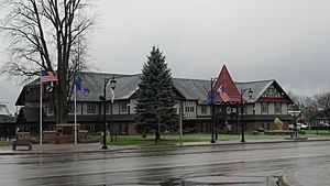
Otsego County Building in Gaylord
|
||
|
||
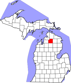
Location within the U.S. state of Michigan
|
||
 Michigan's location within the U.S. |
||
| Country | ||
| State | ||
| Founded | 1840 (created) 1875 (organized) |
|
| Seat | Gaylord | |
| Largest city | Gaylord | |
| Area | ||
| • Total | 526 sq mi (1,360 km2) | |
| • Land | 514 sq mi (1,330 km2) | |
| • Water | 11 sq mi (30 km2) 2.1%% | |
| Population
(2020)
|
||
| • Total | 25,091 | |
| • Density | 47/sq mi (18/km2) | |
| Time zone | UTC−5 (Eastern) | |
| • Summer (DST) | UTC−4 (EDT) | |
| Congressional district | 1st | |
Otsego County is a special area in the U.S. state of Michigan. It's like a smaller region within the state. In 2020, about 25,091 people lived here. The main town, or county seat, is Gaylord. This county was first created in 1840 and officially started working in 1875.
Contents
Understanding the Name Otsego
The name Otsego might come from Native American words. It could mean "place of the rock." Another idea is that the name comes from a lake and a county in New York state. Those names might mean "clear water" or "meeting place."
A Look at Otsego County's Past
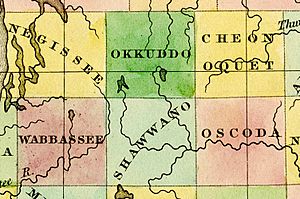
Otsego County was first created in 1840. Back then, it was called Okkuddo County. This name meant "sickly water," but no one knows why it was chosen. In 1843, the name changed to Otsego. This new name came from a county in New York. The word Otsego itself comes from an old Native American language. It means "place of the rock." The county officially started operating in 1875.
A big event happened on May 20, 2022. A strong tornado hit Gaylord, the county seat. It caused a lot of damage to the downtown area and a mobile home park.
Exploring Otsego County's Geography
Otsego County covers about 526 square miles. Most of this area, about 515 square miles, is land. The rest, about 11 square miles, is water. Even though it's in the lower part of Michigan, it's considered part of Northern Michigan.
Lakes and Rivers
Otsego County has more than 370 lakes! Most of these lakes are in the southern part of the county. Otsego Lake is the biggest. It covers about 1,972 acres.
Many lakes here are called 'kettle lakes.' They formed when huge blocks of ice from glaciers melted. This melting created dips in the ground that filled with water.
Several important rivers start in Otsego County. These include the Au Sable, Black, Manistee, Pigeon, and Sturgeon Rivers. The Au Sable River area is the largest river system in the county.
Neighboring Counties
Otsego County shares its borders with several other counties:
- Cheboygan County to the north
- Montmorency County to the east
- Oscoda County to the southeast
- Crawford County to the south
- Kalkaska County to the southwest
- Antrim County to the west
- Charlevoix County to the northwest
Population and People
| Historical population | |||
|---|---|---|---|
| Census | Pop. | %± | |
| 1880 | 1,974 | — | |
| 1890 | 4,272 | 116.4% | |
| 1900 | 6,175 | 44.5% | |
| 1910 | 6,552 | 6.1% | |
| 1920 | 6,043 | −7.8% | |
| 1930 | 5,554 | −8.1% | |
| 1940 | 5,827 | 4.9% | |
| 1950 | 6,435 | 10.4% | |
| 1960 | 7,545 | 17.2% | |
| 1970 | 10,422 | 38.1% | |
| 1980 | 14,993 | 43.9% | |
| 1990 | 17,957 | 19.8% | |
| 2000 | 23,301 | 29.8% | |
| 2010 | 24,164 | 3.7% | |
| 2020 | 25,091 | 3.8% | |
| 2023 (est.) | 25,747 | 6.6% | |
| US Decennial Census 1790-1960 1900-1990 1990-2000 2010-2018 |
|||
In 2020, Otsego County had 25,091 people living there. This means about 47 people lived in each square mile.
Most people in the county are White (97.51% in 2000). Other groups include Native American, Asian, and Black or African American. Many families have German, Polish, Irish, English, or American backgrounds. Most people in Otsego County speak English.
About 34% of households had children under 18 living with them. The average age of people in the county was 38 years old.
Local News and Media
The main newspaper for Otsego County is the Gaylord Herald Times. It comes out twice a week. This newspaper is the oldest business still running in the county. It started in 1875, the same year the county was officially organized.
Towns and Communities
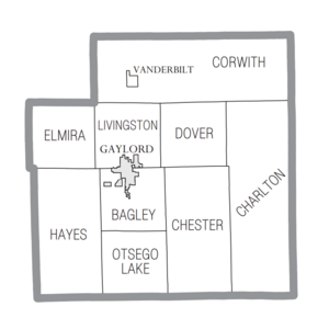
Otsego County has one city and one village. It also has several townships and smaller, unincorporated communities.
City
- Gaylord (This is the county seat, the main town for county government.)
Village
Civil Townships
- Bagley Township
- Charlton Township
- Chester Township
- Corwith Township
- Dover Township
- Elmira Township
- Hayes Township
- Livingston Township
- Otsego Lake Township
Unincorporated Communities
These are smaller places that are not officially cities or villages.
- Arbutus Beach
- Elmira (partially)
- Eyedylwild Beach
- Farrar Landing
- Green Timbers
- Hetherton (partially)
- Johannesburg
- Lower Chub Landing
- Oak Grove
- Otsego Lake
- Pearll City
- Sparr
- Vienna Corners (partially)
- Waters
- Whites Landing
Getting Around Otsego County
There are several important roads and an airport in Otsego County.
State Highways
 I-75 is a major highway that goes north and south through the middle of Otsego County. It goes around Gaylord. This road connects cities like Detroit and Flint to Northern Michigan.
 BL I-75 is a special road that loops through Gaylord. It helps people visit businesses and tourist spots.
 M-32 is a road that goes east and west across Northern Michigan. It connects Gaylord to other towns like East Jordan and Alpena.
County Roads
The county also has its own roads, which are called County-Designated Highways.
 C-38 connects Otsego Lake to US Highway 131.
 C-42 is a shortcut between M-32 near Gaylord and US 131.
 C-48 connects Boyne Falls to Old US 27 and Vanderbilt.
 F-01 runs along the border between Otsego and Montmorency counties.
 F-38 serves the southeastern part of Otsego County.
 F-42 goes around the south side of Gaylord, next to M-32.
 F-44 runs north of M-32, east of Gaylord.
 F-97 goes north and south through southern Otsego County.
Airport
The Gaylord Regional Airport is on the southwest edge of Gaylord. Otsego County owns and runs this airport. It's an important airport for general use in Michigan.
See also
 In Spanish: Condado de Otsego (Míchigan) para niños
 | Sharif Bey |
 | Hale Woodruff |
 | Richmond Barthé |
 | Purvis Young |


