Crawford County, Michigan facts for kids
Quick facts for kids
Crawford County
|
|
|---|---|
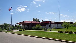
Crawford County Building in Grayling
|
|
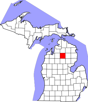
Location within the U.S. state of Michigan
|
|
 Michigan's location within the U.S. |
|
| Country | |
| State | |
| Founded | 1840 |
| Named for | William Crawford |
| Seat | Grayling |
| Largest city | Grayling |
| Area | |
| • Total | 563 sq mi (1,460 km2) |
| • Land | 556 sq mi (1,440 km2) |
| • Water | 7.0 sq mi (18 km2) 1.2%% |
| Population
(2020)
|
|
| • Total | 12,988 |
| • Density | 25/sq mi (10/km2) |
| Time zone | UTC−5 (Eastern) |
| • Summer (DST) | UTC−4 (EDT) |
| Congressional district | 1st |
Crawford County is a county in the state of Michigan, USA. It's like a special area within the state with its own local government. In 2020, about 12,988 people lived here. The main town and county seat (where the county government is) is Grayling. This is the only official town in the county.
Crawford County is located in the northern part of Michigan's Lower Peninsula. It has land that is part of three big river systems: the Au Sable, Manistee, and Muskegon rivers. A large part of the county (about 75%) is public land. This means it's owned by the government, like the United States Forest Service or the State of Michigan, and is often used for forests or military training.
Contents
History of Crawford County
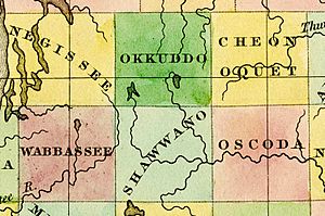
Crawford County was first created in 1840 by the Michigan Legislature. It was originally called Shawono County. This name came from an Ojibwe word, zhaawanong, which means "from the south."
Later, in 1843, the county was renamed Crawford County. It was named after Colonel William Crawford. He was a soldier in the Revolutionary War. The county government officially started in 1879.
Because Crawford County is in a rural area of northern Michigan, it grew a lot in the 1800s. This was mainly due to the lumbering industry. People cut down many trees like pine, birch, and maple. After most of the trees were gone, tourism became the main way people made money.
In the 1870s, Crawford County became famous for fishing. People came to catch the Michigan grayling fish in the Au Sable River. The local newspaper, the Crawford County Avalanche, even put a fishing story on its first front page in 1879! Sadly, by the end of the 1800s, the grayling fish disappeared. This happened because of too much fishing, changes to the river from logging, and new fish like brown trout being introduced. Today, the Au Sable River is still a top spot for trout fishing, with many brown and rainbow trout.
Life in the Early 1900s
A book from 1912 described Crawford County as having rolling hills, which were good for farming. The Au Sable River and its smaller streams flowed through the county, providing water for farms and places to raise animals. It was also great for trout fishing.
Back then, the main way to travel was by train. Half of the county's land had gravelly soil, which was good for growing crops like potatoes and clover. Growing clover seed was a very profitable crop. Fruit trees, especially apples, also grew well.
People used the grassy "Plains" areas for raising sheep and cattle. Over a hundred years ago, many people visited northern Michigan for relaxation and health. Hunting was also very popular. Even with many deer being hunted, the deer population stayed healthy because the new forests provided good food and shelter.
Grayling Winter Sports Park
The Grayling Winter Sports Park (GWSP) opened in 1929. It started as a place for tobogganing and grew into Michigan's first ski resort. After the popular 1932 Winter Olympics, Grayling built a 66-foot ski jump in 1934.
A few years later, they started a Winter Carnival. This event included a parade, an ice sculpture contest, and a Snow Queen pageant. The park became so popular that a "Snow Train" brought skiers to Grayling from all over the state.
Flat-bed trucks helped people get from their lodges in Grayling to the park. The park also had special trails for Cross-country skiing and snowshoeing.
In 1941, a newspaper noted that Grayling had the best public toboggan setup in the United States. It had unique steel slides. The park also had ski tows to pull skiers up the hills.
Crawford County ran the GWSP until the late 1960s. Then, a businessman named Fred Bear and others took over and renamed it Bear Mountain. They tried to make it a big commercial ski area. But after a legal challenge in 1973, the county got control back. Since then, it has been run as the Hanson Hills Recreation Area.
Military Presence
In 1913, a lumber businessman named Rasmus Hanson gave 147,000 acres of land to the state of Michigan for military training. Most of this land is in Crawford County.
Soldiers first started training there in 1914. This place is now known as Camp Grayling. It is the main training center for the Michigan National Guard and is the largest National Guard training facility in the entire United States.
Hartwick Pines State Park
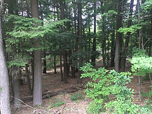
Edward Hartwick grew up in Grayling. He became an Army Major and served in World War I. Sadly, he passed away in France. In 1927, his wife, Karen Michelson Hartwick, bought 8,000 acres of land. She donated it to the state of Michigan to honor her husband. This land included the last 85 acres of untouched, old-growth pine forest in Michigan's Lower Peninsula.
This special land became Hartwick Pines State Park. It is the largest state park in the Lower Peninsula of Michigan.
Geography and Nature
Crawford County covers about 563 square miles. Most of this (556 square miles) is land, and a small part (7.0 square miles) is water. Even though it's in the lower part of Michigan, it's considered part of "Northern Michigan."
The county has land within three of Michigan's biggest watersheds (areas where water drains into a river system): the Au Sable, Manistee, and Muskegon rivers.
Crawford County doesn't have many lakes, but the ones it has are mostly in the northern part. Lake Margrethe is the biggest lake in the county, covering about 1,920 acres. Other lakes include Big Bradford Lake, Big Bear Lake, and Shupac Lake. Some of these are "kettle lakes," which formed when blocks of ice from glaciers melted and created dips in the ground. The Manistee River flows along the western edge of the county, and parts of the Au Sable River flow through the rest of the county.
The county is also part of the Au Sable State Forest and parts of the Huron National Forest. Long ago, glaciers shaped this area, creating a special natural environment. Much of the area is a sandy plain with pine forests.
Rivers in Crawford County
- Au Sable River: This river starts in Otsego County, Michigan and flows through Crawford County before reaching Lake Huron.
- Manistee River: This river starts in Antrim County, Michigan and flows through Crawford County before reaching Lake Michigan.
Neighboring Counties
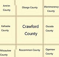
Crawford County shares borders with these other counties:
- Otsego County - north
- Montmorency County - northeast
- Oscoda County - east
- Ogemaw County - southeast
- Roscommon County - south
- Missaukee County - southwest
- Kalkaska County - west
- Antrim County - northwest
Protected Natural Areas
Crawford County is home to several important natural areas:
- Huron National Forest (part of it)
- Au Sable State Forest
- Huron–Manistee National Forests
- Kirtlands Warbler Wildlife Management Area (a special place for a rare bird)
State Parks in Crawford County
Communities in Crawford County
City
Townships
Crawford County has several townships, which are smaller local government areas:
- Grayling Charter Township
- Beaver Creek Township
- Frederic Township
- Lovells Township
- Maple Forest Township
- South Branch Township
Smaller Communities
There are also many smaller, unincorporated communities (places without their own local government) in the county:
- Babbits Resort
- Collens Landing
- Danish Landing
- Deerheart Valley
- Eldorado
- Five Corners
- Forbush Corner
- Frederic
- Ishaward
- Lake Margrethe
- Louis Cabin Landing
- Lovells
- McIntyre Landing
- Rasmus
- Skyline Village
- Wildwood
Historic Ghost Towns
Some places in Crawford County used to be towns but are now abandoned:
- Bucks
- Deward
- Pere Cheney
Population and People
| Historical population | |||
|---|---|---|---|
| Census | Pop. | %± | |
| 1880 | 1,159 | — | |
| 1890 | 2,962 | 155.6% | |
| 1900 | 2,943 | −0.6% | |
| 1910 | 3,934 | 33.7% | |
| 1920 | 4,049 | 2.9% | |
| 1930 | 3,097 | −23.5% | |
| 1940 | 3,765 | 21.6% | |
| 1950 | 4,151 | 10.3% | |
| 1960 | 4,971 | 19.8% | |
| 1970 | 6,482 | 30.4% | |
| 1980 | 9,465 | 46.0% | |
| 1990 | 12,260 | 29.5% | |
| 2000 | 14,273 | 16.4% | |
| 2010 | 14,074 | −1.4% | |
| 2020 | 12,988 | −7.7% | |
| 2023 (est.) | 13,538 | −3.8% | |
| U.S. Decennial Census 1790-1960 1900-1990 1990-2000 2010-2018 |
|||
In 2000, there were about 14,273 people living in Crawford County. The population density was about 26 people per square mile. Most people (96.38%) were White. Other groups included Black or African American, Native American, and Asian people. About 1% of the population was Hispanic or Latino.
Many people in Crawford County have German (24.8%), English (12.5%), American (10.1%), Irish (8.9%), Polish (7.4%), and French (5.9%) backgrounds. Almost everyone (97.7%) spoke English as their first language.
In 2000, about 24.5% of the population was under 18 years old. The average age was 41 years.
Economy and Jobs
The biggest employer in Crawford County is Camp Grayling, the military training facility. The local hospital, Munson Healthcare, is also a major employer.
Since the county has a smaller population, it doesn't have many very large stores. However, there are some new businesses like microbreweries and an art gallery. Tourism, especially in the summer, continues to bring money to the area.
Banking Services
Crawford County has several banks and credit unions. These include branches of larger banks like Fifth Third Bank and Huntington Bank, as well as local banks and credit unions.
Local News
The local newspaper for Crawford County is The Crawford County Avalanche. It has been publishing news for Grayling since 1879.
Military Impact
Camp Grayling is very important to the county's economy. It is the largest training facility for the Michigan National Guard in the United States.
Education and Learning
Crawford County has a small population, so it has one main school district: the Crawford AuSable School District. This district serves students in one high school, one middle school, and one elementary school. The school board makes decisions about how to provide the best education for students.
- The Crawford AuSable School District serves about 1,619 students.
- There is also a small private school, Grayling Adventist Elementary School.
Higher Education
Crawford County is home to Kirtland Community College in Grayling. This is a public community college where students can take classes after high school.
Public Library
The Deveraux Memorial Library in Grayling is the public library for all of Crawford County.
Transportation and Utilities
Getting Around
Crawford County does not have regular bus service or many taxis. However, the Crawford County Transportation Authority offers a "dial-a-ride" service, which means you can call for a ride at a low cost.
Air Travel
Crawford County does not have commercial airlines. The Grayling Army Airfield (airport code: GOV) is a public and military airport near Grayling. It's owned by the United States Army and mainly used for military training and private planes.
Bus Connections
Indian Trails provides daily bus service in Grayling. You can catch a bus here to travel between St. Ignace (to the north) and East Lansing (to the south).
Main Roads
Several important highways run through Crawford County:
 I-75: This major interstate highway runs north-south through the county, passing east of Grayling. It connects to Detroit in the south and the Mackinac Bridge to the north.
 BL I-75: This is a business loop that goes through Grayling itself.
 US 127: This highway comes from the south and ends at I-75 in Crawford County.
 M-72: This is one of only three roads that go all the way across Michigan from Lake Huron to Lake Michigan. It passes through Grayling.
 M-93: This road connects Camp Grayling with Hartwick Pines State Park.
Bicycle Routes
Some roads in the county have special lanes for bicycles. The Grayling Bicycle Turnpike starts at Hartwick Pines State Park and goes for 6.5 miles, ending in Grayling.
Utilities and Services
The City of Grayling provides water and sewer services to its residents. Other parts of the county use well water and private septic systems.
Electricity in the county is provided by Consumers Energy or Great Lakes Energy Co-op. Natural gas is provided by DTE Energy.
|
See also
 In Spanish: Condado de Crawford (Míchigan) para niños
 | William M. Jackson |
 | Juan E. Gilbert |
 | Neil deGrasse Tyson |


