
Boyne Falls, Michigan facts for kids
Quick facts for kids
Boyne Falls, Michigan
|
|
|---|---|
|
Village
|
|
| Village of Boyne Falls | |
.jpg)
Looking north along U.S. Route 131
|
|

Location within Charlevoix County
|
|

Boyne Falls, Michigan
Location in Michigan

Boyne Falls, Michigan
Location in the United States
|
|
| Country | United States |
| State | Michigan |
| County | Charlevoix |
| Township | Boyne Valley |
| Settled | 1874 |
| Incorporated | 1893 |
| Government | |
| • Type | Village council |
| Area | |
| • Total | 0.57 sq mi (1.47 km2) |
| • Land | 0.56 sq mi (1.45 km2) |
| • Water | 0.01 sq mi (0.02 km2) |
| Elevation | 722 ft (220 m) |
| Population
(2020)
|
|
| • Total | 358 |
| • Density | 637.01/sq mi (246.14/km2) |
| Time zone | UTC-5 (Eastern (EST)) |
| • Summer (DST) | UTC-4 (EDT) |
| ZIP code(s) |
49713
|
| Area code(s) | 231 |
| FIPS code | 26-09840 |
| GNIS feature ID | 2398158 |
Boyne Falls is a small and friendly village located in Charlevoix County, in the state of Michigan, USA. In 2020, about 358 people lived here. The village is part of Boyne Valley Township.
Contents
History of Boyne Falls
Boyne Falls started as a settlement in 1874. This happened when the Grand Rapids and Indiana Railroad built a railway line through the area. A. D. Carpenter opened the very first store that same year.
The village got its first post office on September 5, 1874. William Nelson was the first person in charge of it. The name "Boyne Falls" was chosen by John Miller. He named it after the nearby Boyne River, which has waterfalls. The river itself was named after a famous river in Ireland.
Boyne Falls officially became a village in 1893. This meant it could have its own local government.
Today, the railway line is used by the Great Lakes Central Railroad. However, the train station in Boyne Falls has been closed since 1973.
The village is also famous for its annual Boyne Falls Polish Festival. This fun event takes place during the first week of August. In 2023, they celebrated their 48th festival!
Geography and Location
Boyne Falls is a small place, covering about 0.57 square miles (1.47 square kilometers). Most of this area is land, with a tiny bit of water.
Just southeast of the village, you'll find Boyne Mountain Resort. This is a popular place for skiing and other outdoor activities. The village is also located along the Boyne River. This is where the river's north and south branches meet.
Main Roads in Boyne Falls
- U.S. Route 131 runs through the western part of the village. It goes from south to north.
- Michigan Highway 75 briefly enters the village. It ends when it meets US 131.
- County-Designated Highway C-48 shares its path with M-75 and then US 131. It then turns east along Thumb Lake Road at the northern edge of the village.
Boyne Falls Climate
Boyne Falls has a climate with big changes in temperature throughout the year. Summers are usually warm to hot, and sometimes humid. Winters are cold, and can be very cold. This type of weather is called a humid continental climate.
Population of Boyne Falls
| Historical population | |||
|---|---|---|---|
| Census | Pop. | %± | |
| 1900 | 431 | — | |
| 1910 | 325 | −24.6% | |
| 1920 | 241 | −25.8% | |
| 1930 | 199 | −17.4% | |
| 1940 | 213 | 7.0% | |
| 1950 | 236 | 10.8% | |
| 1960 | 260 | 10.2% | |
| 1970 | 347 | 33.5% | |
| 1980 | 378 | 8.9% | |
| 1990 | 369 | −2.4% | |
| 2000 | 370 | 0.3% | |
| 2010 | 294 | −20.5% | |
| 2020 | 358 | 21.8% | |
| U.S. Decennial Census | |||
According to the 2010 census, there were 294 people living in Boyne Falls. There were 133 households, which are groups of people living together. Most people living in the village were White (95.2%).
About 27.8% of households had children under 18 living with them. The average age of people in the village was 41.7 years old.
Education
The village of Boyne Falls has its own school district, called the Boyne Falls Public School District. This district also serves parts of nearby areas. The main office for the district is in the village. The school campus is located just west of the village along M-75.
Images for kids
-

Historic image of the Boyne Falls Station -
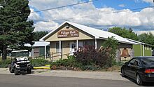
Boyne Falls Village Hall -
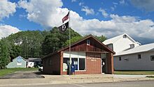
U.S. Post Office in Boyne Falls -
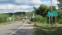
Road signage along M-75 / C-48
.jpg)


See also
 In Spanish: Boyne Falls para niños
