Cheboygan River facts for kids
Quick facts for kids Cheboygan River |
|
|---|---|

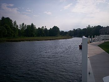
Cheboygan River flowing through Cheboygan
|
|
| Country | United States |
| Physical characteristics | |
| Main source | Mullett Lake 594 ft (181 m) |
| River mouth | Lake Huron at Cheboygan 581 ft (177 m) |
| Length | 7.0 mi (11.3 km) |
The Cheboygan River (pronounced shi-BOY-gun) is a short but important river in the state of Michigan, in the United States. It flows into Lake Huron, one of the Great Lakes.
This river is about Seven miles (11.3 km) long. It starts at the northern end of Mullett Lake and flows all the way to the Straits of Mackinac. The river forms a natural border between Benton Township and Inverness Township. Then, it flows right into the city of Cheboygan. The biggest river that flows into the Cheboygan River is the Black River.
The Cheboygan River is entirely located within Cheboygan County. The main city of the county, Cheboygan, is found right where the river meets Lake Huron. This river is very important for the city. It acts as the port of Cheboygan. You can catch a ferry boat here to Bois Blanc Island. The Coast Guard cutter Mackinaw also docks here.
Cheboygan was first built as a town for cutting down trees. Workers would float logs down the Cheboygan River to sawmills near the river's mouth. Today, most of those old mills are gone. Now, one of the biggest activities on the river is pleasure boating. The Cheboygan River is a key part of the Inland Waterway. This is a special chain of waterways in northern Michigan that boats can travel through.
The river gave its name to both the city and the county. The name "Cheboygan" sounds just like "Sheboygan", a city in Wisconsin.
Exploring the Cheboygan River
The Cheboygan River drops about 13 feet (4.0 m) along its 6-mile (9.7 km) path. It starts at 594 feet (181 m) above sea level, which is the same level as Mullett Lake. It then flows down to Lake Huron, which is 581 feet (177 m) above sea level. To help boats travel along the river and other parts of the Inland Waterway, there are special gates called locks. The United States Army Corps of Engineers takes care of these locks. They help boats move between different water levels.
Wildlife Along the River
About 3.5 miles (5.6 km) south of Cheboygan, the Black River flows into the Cheboygan River. This spot is famous for seeing amazing birds like bald eagles. You might also spot other raptors, which are birds that hunt and eat fish.
Bridges and Landmarks
In the city of Cheboygan, U.S. Highway 23 crosses the river. It uses the Cheboygan Bascule Bridge. This is a special type of bridge called a Scherzer rolling lift bridge. It was built in 1940 and was added to the National Register of Historic Places in 1999. In 2009, the city also built a raised pedestrian bridge near the river's mouth. This bridge is just for people to walk across.
The entrance of the Cheboygan River into Lake Huron is marked by a lighthouse called the Cheboygan Crib Light. It helps guide boats safely into the river.
 | Victor J. Glover |
 | Yvonne Cagle |
 | Jeanette Epps |
 | Bernard A. Harris Jr. |

