Porch Fields facts for kids
|
Goirt Péirse
|
|||||||||||

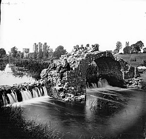
View over the Boyne looking at Porch Fields. Photo from the late 19th century.
|
|||||||||||
| Alternative name | Porchfields, Porchfield | ||||||||||
|---|---|---|---|---|---|---|---|---|---|---|---|
| Location | Trim, County Meath, Ireland | ||||||||||
| Region | Boyne Valley | ||||||||||
| Coordinates | 53°33′18″N 6°47′04″W / 53.554921°N 6.784334°W | ||||||||||
| Altitude | 59 m (194 ft) | ||||||||||
| Type | Area of land with medieval roadway | ||||||||||
| Area | 37.4 ha (92 acres) | ||||||||||
| History | |||||||||||
| Periods | Late Middle Ages | ||||||||||
| Site notes | |||||||||||
| Ownership | Public | ||||||||||
| Public access | yes | ||||||||||
| Designation |
|
||||||||||
The Porch Fields is a special area of old farmland near Trim, Ireland. It has a historic road from the Middle Ages. This whole area is so important that it is protected as a National Monument. Imagine walking where people farmed and traveled hundreds of years ago!
Contents
Where Are the Porch Fields?
The Porch Fields are a beautiful green space in the town of Trim. They are located on the north side of the River Boyne. You can find them between the old town wall and the Sheep Gate on one side. On the other side, they stretch towards Newtown Abbey. It's a peaceful spot with lots of history.
A Look Back at History
The Porch Fields connect two old towns: Trim and Newtown Trim. Trim was founded around 1180. Newtown Trim was built a bit later, around 1220. These two towns were linked by a special medieval road. This road was about 1 kilometer (⅔ mile) long. It was a "sunken lane," meaning it was lower than the land around it.
Why the Name "Porch Fields"?
When Newtown Trim was created, new settlers called "burgesses" received land. Each person got about 3 acres of land. They used a farming method called ridge and furrow to grow their crops. This created long, narrow strips of land. Each strip was about one "perch" wide, which is about 5 meters (16½ feet). Some people think this is how the name "Porch Fields" came about.
Another idea is that the name comes from the French word porte. This word means "door" or "gate." It might refer to the nearby Sheep Gate, which was an entrance to the town. On an old map from the 1800s, the area was even called "Portual Field." So, the name has a few possible origins!
A Famous Visitor
It is believed that Oliver Cromwell's soldiers once set up their camp here. This happened before a big battle in 1649. The Porch Fields would have been a busy place with many soldiers during that time.
 | James Van Der Zee |
 | Alma Thomas |
 | Ellis Wilson |
 | Margaret Taylor-Burroughs |


