
Port Chiapas facts for kids
Quick facts for kids Puerto Chiapas (Port Chiapas) |
|
|---|---|
  |
|
| Lua error in Module:Location_map at line 530: Unable to find the specified location map definition: "Module:Location map/data/yes" does not exist. | |
| Location | |
| Country | Mexico |
| Location | Tapachula, Chiapas |
| Coordinates | 14°41′49″N 92°24′40″W / 14.697°N 92.411°W |
| Details | |
| Opened | 1975 |
| Operated by | Port Chiapas Port Authority |
| Type of harbor | bulk (coffee, minerals, gas), container, cruise |
| Size of harbor | 950 m × 350 m (3,120 ft × 1,150 ft) |
| Land area | 60,000 square metres (6.0 ha; 15 acres) container storage |
| Available berths | 625 metres (2,051 ft) |
| Director General | Alfonso Perez |
| Statistics | |
| Annual revenue | $1.5 million (2009) |
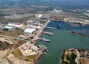
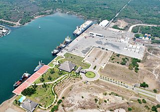
Port Chiapas (also known as Puerto Chiapas in Spanish, or Puerto Madero) is a busy port located in Puerto de San Benito, Mexico. It's in the Tapachula area, which is part of the Soconusco region in the southern state of Chiapas. This important port is about 13 kilometers (8 miles) northwest of the Suchiate River. This river forms the border between Mexico and Guatemala.
The port is well-connected by Highway 225. This road links it to the Tapachula International Airport and the city of Tapachula. Since it first opened in 1975, Port Chiapas has been a key spot for fishing and moving farm products.
Contents
Port Development and Growth
Over the years, Port Chiapas has grown a lot. In 2005, the government started making big improvements. These upgrades added new facilities for cruise ships and larger cargo.
Efforts by Local Leaders
Two governors played a big role in developing the port. Governor Pablo Salazar Mendiguchía was very interested in improving the old port. Later, Governor Juan Sabines Guerrero ordered even more development. Their goal was to attract more businesses to Chiapas, which is one of Mexico's poorer states.
Cruise Ship Arrivals
Today, many famous cruise lines visit Port Chiapas. These include Holland America Line, Regent Seven Seas Cruises, Norwegian Cruise Line, Oceania Cruises, and Princess Cruise Line. This shows how important the port has become for tourism.
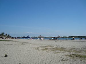
What to Do Near the Port
When cruise ships arrive, passengers can find a few things to do. Right outside the dock, there is a small market where you can buy local crafts.
Exploring Nearby Attractions
The closest city, Tapachula, is a few miles inland. Many tours are available from the port. You can visit Izapa, which is a very large ancient site. It has many carved stones and monuments from the Maya civilization. The Volcán Tacaná volcano can be seen from the port. There are also several old ruins and nature reserves that you can visit from Port Chiapas.
Gallery
- Port Chiapas
-
-
-


See also
 In Spanish: Puerto Chiapas para niños
- Puente Rodolfo Robles
