Port Clarence Bay facts for kids

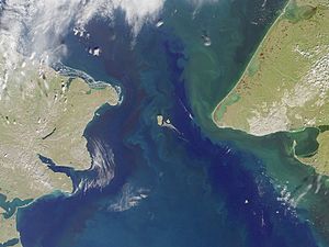
Port Clarence Bay is a large bay in Alaska, a state in the United States. It's a very important place because it has the only safe harbor for big ships on the Seward Peninsula. This bay is about 25 miles southeast of a place called York.
The bay is shaped almost like a circle and has deep water. A long, low sand spit separates it from the open sea. This sand spit ends at a spot called Point Spencer, which marks the entrance to the bay. On the north side of Port Clarence Bay, there's a shallow lagoon. It's separated from the main bay by a narrow sand spit. The small village of Port Clarence, Alaska is also located right on the bay.
Contents
Bay Features and History
The harbor at Port Clarence Bay is very calm, meaning it doesn't have big ocean waves. Because of this, it used to be a popular meeting spot for ships from the Arctic whaling fleet. These were ships that hunted whales in the cold northern waters.
The bay usually becomes free of ice around June 25 to 30 each year. In the past, there were three native villages on the northeast side of the bay. People from these villages would gather at Point Spencer in early July to trade with the whaling ships.
How the Bay is Formed
Port Clarence Bay is created by a long sand spit. This sand spit stretches from the mainland, first going west and then north. It ends at Point Spencer. The entrance channel to the bay, between Point Spencer and Point Jackson on the north shore, is about 4 miles wide. It's safe for ships and has depths of 7 to 9 fathoms (about 42 to 54 feet).
The northern part of the bay is generally deep, while the southern part gets shallower as you get closer to the shore. The northern shore is safe to approach.
Connecting to Grantley Harbor
At its northeast end, Port Clarence Bay connects to another body of water called Grantley Harbor. Grantley Harbor is about 3 to 4 miles wide and 12 miles long. It also connects to a large lake further inland through a narrow channel.
Ships that draw 12 feet or less (meaning they need at least 12 feet of water to float) can use a channel to enter Grantley Harbor. Inside Grantley Harbor, the water is generally 2.5 to 3 fathoms deep (about 15 to 18 feet). Ships have even gone into Grantley Harbor to make repairs on the north sand spit.
Fresh Water and Anchorage
You can find fresh water in several places around Port Clarence. One of the best spots is from a stream on the east side, south of Cape Riley.
The whaling fleet used to anchor in a spot just inside Point Spencer, where the water was about 5 fathoms deep (30 feet).
Weather and Ocean Conditions
In this area, fog is very common, especially in the summer when it can be very thick.
Southwesterly winds (winds blowing from the southwest) tend to make the tide higher. On the other hand, northeasterly winds (winds blowing from the northeast) tend to make the tide lower.
Outside of Point Spencer, the ocean current usually flows northwestward. It moves at a speed of 1 to 2 knots (about 1 to 2.3 miles per hour).
There is a shallow area about 5 miles offshore, roughly halfway between Cape Douglass and Point Spencer. Ships should stay far away from this spot to avoid getting stuck. There's also a ridge with a hard bottom that extends from this shallow area towards Cape York.
 | Sharif Bey |
 | Hale Woodruff |
 | Richmond Barthé |
 | Purvis Young |

