Potosi, Texas facts for kids
Quick facts for kids
Potosi, Texas
|
|
|---|---|

Location of Potosi, Texas
|
|
 |
|
| Country | United States |
| State | Texas |
| County | Taylor |
| Area | |
| • Total | 18.5 sq mi (47.8 km2) |
| • Land | 18.5 sq mi (47.8 km2) |
| • Water | 0.0 sq mi (0.0 km2) |
| Elevation | 1,821 ft (555 m) |
| Population
(2020)
|
|
| • Total | 3,947 |
| • Density | 213.4/sq mi (82.57/km2) |
| Time zone | UTC-6 (Central (CST)) |
| • Summer (DST) | UTC-5 (CDT) |
| ZIP code |
79602
|
| Area code(s) | 325 |
| FIPS code | 48-59108 |
| GNIS feature ID | 1344423 |
Potosi is a community in Taylor County, Texas, United States. It is called a census-designated place (CDP), which means it's an area defined by the government for counting people, but it's not an official city. In 2020, about 3,947 people lived there. Potosi is also part of the larger Abilene metropolitan area, which is a group of towns and cities connected together.
Contents
Where is Potosi Located?
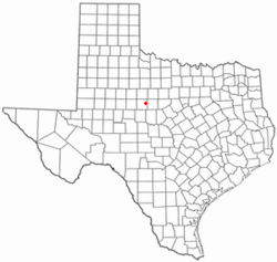
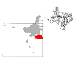
Potosi is located in Texas, about nine miles south of the city of Abilene. You can find it along FM 1750. The community covers an area of about 18.5 square miles (47.8 square kilometers), and all of it is land.
Potosi's Climate
Potosi has a type of weather called a humid subtropical climate. This means it usually has hot and sticky summers, and winters that are generally mild to cool. Potosi is also close to a semiarid climate region. This means it can have long, hot summers and short, moderate winters, with less rain.
The History of Potosi
The first families to settle in the Potosi area were the Pollard family in the 1870s. In 1893, a man named R.A. Pollard asked for a post office to be built there. He named the place Potosi after a city in Mexico called San Luis Potosí.
By 1896, about 100 people were living in the community. In 1940, Potosi had about 80 residents, a school, a church, and a few businesses. In 1949, Potosi's school joined with the Wylie Independent School District.
The number of people living in Potosi went down to 20 during the 1950s. However, it started to grow again, reaching 149 people by 1968. A lot of growth began in the late 1980s, partly because Potosi is close to Abilene. By 1992, 1,441 people lived in Potosi. This growth has continued, and new neighborhoods are being built along FM 1750, which is the main road through Potosi. Some of these new areas include Deerwood, Pack Saddle Prairie, Blackhawk Estates, Pack Saddle Farms, Seven Winds, and Pack Saddle Meadows.
Who Lives in Potosi?
| Historical population | |||
|---|---|---|---|
| Census | Pop. | %± | |
| 2020 | 3,947 | — | |
| U.S. Decennial Census 1850–1900 1910 1920 1930 1940 1950 1960 1970 1980 1990 2000 2010 |
|||
The 2020 census showed that 3,947 people lived in Potosi. There were 1,266 households and 1,032 families.
Potosi's Population by Race (2020)
| Group | Number of People | Percentage |
|---|---|---|
| White (not Hispanic) | 3,112 | 78.84% |
| Black or African American (not Hispanic) | 42 | 1.06% |
| Native American or Alaska Native (not Hispanic) | 13 | 0.33% |
| Asian (not Hispanic) | 61 | 1.55% |
| Pacific Islander (not Hispanic) | 11 | 0.28% |
| Some Other Race (not Hispanic) | 21 | 0.53% |
| Mixed/Multi-Racial (not Hispanic) | 176 | 4.46% |
| Hispanic or Latino | 511 | 12.95% |
| Total | 3,947 |
Education in Potosi
The students in Potosi attend schools that are part of the Wylie Independent School District in Abilene.
Community Services
The people living in Potosi get their water from the Potosi Water Supply Corporation. The community is protected by the Potosi Volunteer Fire Department.
See also
 In Spanish: Potosí (Texas) para niños
 | Bessie Coleman |
 | Spann Watson |
 | Jill E. Brown |
 | Sherman W. White |

