Taylor County, Texas facts for kids
Quick facts for kids
Taylor County
|
|
|---|---|

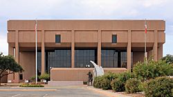
New Taylor County Courthouse in Abilene
|
|

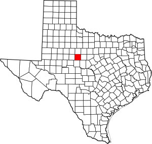
Location within the U.S. state of Texas
|
|
 Texas's location within the U.S. |
|
| Country | |
| State | |
| Founded | 1878 |
| Named for | Edward, George, and James Taylor |
| Seat | Abilene |
| Largest city | Abilene |
| Area | |
| • Total | 919.3 sq mi (2,381 km2) |
| • Land | 915.6 sq mi (2,371 km2) |
| • Water | 3.8 sq mi (10 km2) 0.4% |
| Population
(2020)
|
|
| • Total | 143,208 |
| • Density | 160/sq mi (60/km2) |
| Time zone | UTC−6 (Central) |
| • Summer (DST) | UTC−5 (CDT) |
| Congressional district | 19th |
Taylor County is a county in the U.S. state of Texas. As of 2020, about 143,208 people live here. Its main city, called the county seat, is Abilene. The county was first created in 1858 and officially started in 1878. It is named after three brothers, Edward, George, and James Taylor. These brothers bravely died at the famous Battle of the Alamo.
Taylor County is part of the Abilene area, which is a larger group of cities and towns. It is also considered to be in the West Texas region.
Contents
A Look at Taylor County's History
Long ago, the Penteka people lived in this area. In 1849, Captain Randolph Marcy from the U.S. Army explored this region. He was looking for routes from West Texas to California.
The Texas government officially created Taylor County in 1858. It was formed from parts of Bexar and Travis Counties. The county is named for the Taylor brothers who fought at the Alamo. A mail route called the Butterfield Overland Mail had a stop here until 1861.
Early Settlers and Growth
By 1872, the first cattle ranchers came to what is now Taylor County. Six years later, in 1878, Taylor County was officially organized. The town of Buffalo Gap was chosen as the first county seat.
In 1880, the Texas & Pacific Railroad decided to build tracks through the area. This led to the creation of the city of Abilene in 1882. Abilene was named after a city in Kansas. In 1883, Abilene became the new county seat. That same year, ten Baptist families arrived in the county by wagon.
Developing the County
In 1890, the Abilene Board of Trade was formed to help businesses grow. At that time, there were 587 farms and ranches in the county. The next year, Hardin-Simmons University opened as Abilene Baptist College. Lytle Lake was created in 1897.
In 1904, a special hospital for people with epilepsy opened in Abilene. In 1906, Abilene Christian University started as Childers Classical Institute. The 1920s saw more growth. Hendricks Medical Center opened in Abilene in 1924. The West Texas Historical Association was also started here.
The first students from McMurry University graduated in 1926. A few years later, in 1929, oil was discovered in the county. This was a big boost for the local economy. In 1933, Abilene gave land for the Civilian Conservation Corps. This group helped people find jobs during tough times.
Modern Times
Dyess Air Force Base was built in 1942. It was first called Abilene AFB. It is named after Lieutenant Colonel William Dyess, a Texas hero who survived the Bataan Death March. The Abilene Philharmonic Orchestra, which plays classical music, started in 1950. The Buffalo Gap Historic Village, a place where you can learn about the past, opened in 1956.
Geography of Taylor County
Taylor County covers a total area of about 919 square miles. Most of this area, about 916 square miles, is land. The rest, about 3.8 square miles, is covered by water.
Main Roads
These are the major highways that run through Taylor County:
 Interstate 20
 Interstate 20 Business
 U.S. Highway 83
 U.S. Highway 84
 U.S. Highway 277
 State Highway 36
 State Highway 153
 State Highway 351
 Loop 322
Neighboring Counties
Taylor County shares borders with these other counties:
- Jones County (north)
- Shackelford County (northeast)
- Callahan County (east)
- Coleman County (southeast)
- Runnels County (south)
- Nolan County (west)
- Fisher County (northwest)
People of Taylor County
The population of Taylor County has grown a lot over the years. Here's how it has changed:
| Historical population | |||
|---|---|---|---|
| Census | Pop. | %± | |
| 1880 | 1,736 | — | |
| 1890 | 6,957 | 300.7% | |
| 1900 | 10,499 | 50.9% | |
| 1910 | 26,293 | 150.4% | |
| 1920 | 24,081 | −8.4% | |
| 1930 | 41,023 | 70.4% | |
| 1940 | 44,147 | 7.6% | |
| 1950 | 63,370 | 43.5% | |
| 1960 | 101,078 | 59.5% | |
| 1970 | 97,853 | −3.2% | |
| 1980 | 110,932 | 13.4% | |
| 1990 | 119,655 | 7.9% | |
| 2000 | 126,555 | 5.8% | |
| 2010 | 131,506 | 3.9% | |
| 2020 | 143,208 | 8.9% | |
| U.S. Decennial Census 1850–2010 2010 2020 |
|||
In 2020, there were 143,208 people living in Taylor County. The county is made up of people from many different backgrounds. This makes it a diverse place to live.
Communities in Taylor County
Taylor County has several cities, towns, and other communities.
Cities
- Abilene (This is the county seat, and a small part of it is in Jones County)
- Tuscola
- Tye
- Merkel
Towns
Other Communities
- Potosi (a special type of community called a census-designated place)
- Caps (unincorporated)
- Ovalo (unincorporated)
- View (unincorporated)
- Wylie (unincorporated)
Military Base
- Dyess AFB
Education in Taylor County
Many school districts serve the students of Taylor County:
- Abilene Independent School District
- Blackwell Consolidated Independent School District
- Clyde Consolidated Independent School District
- Eula Independent School District
- Jim Ned Consolidated Independent School District
- Merkel Independent School District
- Trent Independent School District
- Winters Independent School District
- Wylie Independent School District
The county is also part of the Cisco Junior College District, which offers higher education.
See also
 In Spanish: Condado de Taylor (Texas) para niños
 | Jackie Robinson |
 | Jack Johnson |
 | Althea Gibson |
 | Arthur Ashe |
 | Muhammad Ali |


