Potters Hill, North Carolina facts for kids
Quick facts for kids
Potters Hill, North Carolina
|
|
|---|---|
| Country | United States |
| State | North Carolina |
| County | Duplin |
| Area | |
| • Total | 5.35 sq mi (13.87 km2) |
| • Land | 5.35 sq mi (13.86 km2) |
| • Water | 0.00 sq mi (0.00 km2) |
| Elevation | 92 ft (28 m) |
| Population
(2020)
|
|
| • Total | 437 |
| • Density | 81.64/sq mi (31.52/km2) |
| Time zone | UTC-5 (Eastern (EST)) |
| • Summer (DST) | UTC-4 (EDT) |
| Area codes | 910, 472 |
| GNIS feature ID | 1025627 |
Potters Hill is a small place in Duplin County, North Carolina, United States. It is known as an "unincorporated community" and a "census-designated place" (CDP). This means it's a group of homes and businesses that isn't officially a town or city, but the government still counts its population. In 2020, about 437 people lived there.
About Potters Hill
Potters Hill is a quiet community located in the eastern part of Duplin County. It's a place where people live and work, even though it doesn't have its own town government.
Where is Potters Hill?
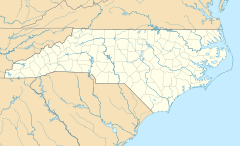
Potters Hill is found along North Carolina Highway 41. This road connects it to other places. If you go northeast for about 5 miles, you'll reach U.S. Route 258. If you travel southwest for about 5 miles, you'll get to North Carolina Highway 24 in Beulaville. The northeastern part of Potters Hill is very close to Jones and Onslow counties.
How Many People Live Here?
The number of people living in Potters Hill is counted every ten years by the United States Census.
| Historical population | |||
|---|---|---|---|
| Census | Pop. | %± | |
| 2020 | 437 | — | |
| U.S. Decennial Census | |||
In 2020, the census showed that 437 people called Potters Hill home.
See Also
- In Spanish: Potters Hill (Carolina del Norte) para niños
 | Isaac Myers |
 | D. Hamilton Jackson |
 | A. Philip Randolph |


