
Onslow County, North Carolina facts for kids
Quick facts for kids
Onslow County
|
|||||
|---|---|---|---|---|---|

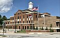
Onslow County Courthouse
|
|||||
|
|||||

Location within the U.S. state of North Carolina
|
|||||
 North Carolina's location within the U.S. |
|||||
| Country | |||||
| State | |||||
| Founded | 1734 | ||||
| Named for | Arthur Onslow | ||||
| Seat | Jacksonville | ||||
| Largest community | Jacksonville | ||||
| Area | |||||
| • Total | 905.20 sq mi (2,344.5 km2) | ||||
| • Land | 762.08 sq mi (1,973.8 km2) | ||||
| • Water | 143.12 sq mi (370.7 km2) 15.81% | ||||
| Population
(2020)
|
|||||
| • Total | 204,576 | ||||
| • Estimate
(2023)
|
213,676 | ||||
| • Density | 268.44/sq mi (103.65/km2) | ||||
| Time zone | UTC−5 (Eastern) | ||||
| • Summer (DST) | UTC−4 (EDT) | ||||
| Congressional district | 3rd | ||||


Onslow County is a place in North Carolina, a state in the United States. In 2020, about 204,576 people lived here. The main town and county seat is Jacksonville. Onslow County became an official county in 1739, after being known as Onslow Precinct since 1734. The southern part of the county touches the Atlantic Ocean.
Contents
Discovering Onslow County's Past
People from Europe, mostly England, first settled in this area in 1713. Back then, it was part of larger colonial regions called Carteret and New Hanover. Onslow County was officially created in 1734. It was named after Arthur Onslow, who was a very important speaker in the British government.
Moving the County Seat
In 1752, a strong hurricane hit the area. Because of the damage, the county courthouse had to move. It moved from Town Point to a place called Wantland's Ferry. This settlement later became a town in 1842 and was named Jacksonville. It was named after President Andrew Jackson.
Onslow County During World War II
For many years, Onslow County was mostly a quiet, rural area. People worked on farms or by the sea. But in the early 1940s, during World War II, things changed a lot. The United States Army built Camp Davis and the Marine Corps Base Camp Lejeune. These military bases brought many new people to the county. This led to more homes and businesses being built.
Today's Onslow County
Onslow County is located in the southeastern part of North Carolina, near the coast. It's about 120 miles (193 km) east of Raleigh. The county is home to over 200,000 people. Besides Jacksonville, other towns include Holly Ridge, Richlands, Swansboro, North Topsail Beach, and part of Surf City. There's also the unincorporated community of Sneads Ferry. A large part of the county, about 156,000 acres (631 km2), is taken up by Camp Lejeune. Over 43,000 Marines and sailors are stationed there.
Exploring Onslow County's Geography

Onslow County covers about 905 square miles (2,344 km2). Most of this is land, about 762 square miles (1,974 km2). The rest, about 143 square miles (370 km2), is water. The county shares borders with Jones County, Carteret County, Pender County, and Duplin County.
Amazing Wildlife in Onslow County
The New River and nearby areas are home to some cool animals. You might spot bald eagles flying overhead. In the water, you could see dolphins swimming or cownose rays gliding along.
Protected Natural Areas
Onslow County has many special places that are protected to keep nature safe. These include:
- Hammocks Beach State Park
- North Carolina National Estuarine Research Reserve
- Onslow Beach
- Permuda Island
- Sandy Run Savannas State Natural Area (part)
- Sea Turtle Sanctuary
Major Waterways
The county has several important bodies of water:
- The Atlantic Ocean forms its southern border.
- The Intracoastal Waterway runs through the area.
- The New River is a major river.
- White Oak River
Important Roads and Transportation
Onslow County has several major highways that help people travel around:
 US 17
US 17 US 258
 NC 24
NC 24 NC 50
NC 50 NC 53
NC 53 NC 111
 NC 172
 NC 210
Key Infrastructure
The county also has important facilities for travel and defense:
- Albert J. Ellis Airport: This airport in Richlands has flights from two airlines.
- Amtrak Thruway: You can connect to Amtrak train services from Jacksonville.
- Marine Corps Air Station New River: A military air base in Jacksonville.
- Marine Corps Base Camp Lejeune: A large military training base in Jacksonville.
People of Onslow County
| Historical population | |||
|---|---|---|---|
| Census | Pop. | %± | |
| 1790 | 5,387 | — | |
| 1800 | 5,623 | 4.4% | |
| 1810 | 6,669 | 18.6% | |
| 1820 | 7,016 | 5.2% | |
| 1830 | 7,814 | 11.4% | |
| 1840 | 7,527 | −3.7% | |
| 1850 | 8,283 | 10.0% | |
| 1860 | 8,856 | 6.9% | |
| 1870 | 7,569 | −14.5% | |
| 1880 | 9,829 | 29.9% | |
| 1890 | 10,303 | 4.8% | |
| 1900 | 11,940 | 15.9% | |
| 1910 | 14,125 | 18.3% | |
| 1920 | 14,703 | 4.1% | |
| 1930 | 15,289 | 4.0% | |
| 1940 | 17,939 | 17.3% | |
| 1950 | 42,047 | 134.4% | |
| 1960 | 82,706 | 96.7% | |
| 1970 | 103,126 | 24.7% | |
| 1980 | 112,784 | 9.4% | |
| 1990 | 149,838 | 32.9% | |
| 2000 | 150,355 | 0.3% | |
| 2010 | 177,772 | 18.2% | |
| 2020 | 204,576 | 15.1% | |
| 2023 (est.) | 213,676 | 20.2% | |
| U.S. Decennial Census 1790–1960 1900–1990 1990–2000 2010 2020 |
|||
In 2020, the census counted 204,576 people living in Onslow County. There were 63,604 households and 46,202 families.
Diversity in Onslow County
Onslow County is home to people from many different backgrounds.
| Race | Number | Percentage |
|---|---|---|
| White (non-Hispanic) | 129,499 | 65.7% |
| Black or African American (non-Hispanic) | 26,939 | 15.8% |
| Native American | 1,019 | 0.5% |
| Asian | 4,508 | 2.2% |
| Pacific Islander | 777 | 0.38% |
| Other/Mixed | 14,193 | 6.94% |
| Hispanic or Latino | 27,641 | 12.9% |
Education in Onslow County
Most schools in the county are part of Onslow County Schools. However, students living on Camp Lejeune and Marine Corps Air Station New River go to schools run by the Department of Defense Education Activity (DoDEA).
Communities in Onslow County
Onslow County has several towns and communities:
Towns and Cities
- Jacksonville (This is the county seat and the biggest town.)
- Holly Ridge
- North Topsail Beach
- Richlands
- Surf City
- Swansboro
Unincorporated Communities
These are smaller communities that are not officially towns:
Census-Designated Places
These are areas identified by the census for statistics:
Images for kids
-
Onslow County Courthouse
See also
 In Spanish: Condado de Onslow para niños
