
Carteret County, North Carolina facts for kids
Quick facts for kids
Carteret County
|
|||
|---|---|---|---|

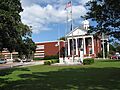
Carteret County Courthouse
|
|||
|
|||

Location within the U.S. state of North Carolina
|
|||
 North Carolina's location within the U.S. |
|||
| Country | |||
| State | |||
| Founded | 1722 | ||
| Named for | Sir George Carteret | ||
| Seat | Beaufort | ||
| Largest community | Morehead City | ||
| Area | |||
| • Total | 1,330.41 sq mi (3,445.7 km2) | ||
| • Land | 507.60 sq mi (1,314.7 km2) | ||
| • Water | 822.81 sq mi (2,131.1 km2) 61.85% | ||
| Population
(2020)
|
|||
| • Total | 67,686 | ||
| • Estimate
(2023)
|
69,615 | ||
| • Density | 133.35/sq mi (51.49/km2) | ||
| Time zone | UTC−5 (Eastern) | ||
| • Summer (DST) | UTC−4 (EDT) | ||
| Congressional district | 3rd | ||


Carteret County is a county in the state of North Carolina, United States. In 2020, about 67,686 people lived there. The main town and county seat is Beaufort. The county was started in 1722. It was named after Sir George Carteret, an important English person from the 1600s.
Most of Carteret County is part of the Crystal Coast. This area is famous for its beautiful beaches and coastal towns. In 2024, an old Native American settlement was found in Cedar Point. This discovery led to discussions about protecting historical sites.
Contents
History
The first English boy born in what is now North Carolina was John Fulford. He was born in 1629 in Carteret County. He lived and died there in 1729. His grave was found in a cemetery near Beaufort. It was described as being "bricked up with English brick." This special grave can still be seen today.
The Dennis family was also very important in Carteret County. William Dennis Sr. (born 1720, died 1800) was a brave landowner. He was an officer in the Revolutionary War. In 1747, he helped protect the county from Spanish pirates. During the Revolutionary War, he fought to remove the British from Carteret County in 1782. William Dennis Sr. once owned the Hammock House. This house became famous as the home of the pirate Blackbeard.
His son, William Dennis Junior, was also a captain in the army. He was at Valley Forge during the Revolutionary War. In 1790, William Dennis Sr. was one of the biggest landowners in the county. Many members of the Dennis family, and related families like the Bells, Watsons, and Pelletiers, lived in the area for a long time. Some later moved to other states like Mississippi and Texas.
Geography
Carteret County is a large county. It has a total area of about 1,330 square miles (3,445 square kilometers). A big part of this area, about 61.85%, is water. This makes it the third-largest county in North Carolina by total area.
Special Protected Areas
There are many important natural places in Carteret County. These areas are protected to keep them safe for nature and people to enjoy.
National Protected Areas
- Cape Lookout Lighthouse
- Cape Lookout National Seashore
- Cedar Island National Wildlife Refuge
- Croatan National Forest (part of it)
State and Local Protected Areas
- Fort Macon State Park
- North Carolina Aquarium at Pine Knoll Shores
- North Carolina Maritime Museum at Beaufort
- Rachel Carson Reserve
Major Water Bodies
Carteret County is known for its many bays, sounds, and rivers. These water bodies are important for wildlife and local life.
- Atlantic Ocean
- Back Sound
- Bogue Sound
- Core Sound
- Newport River
- Neuse River
- Pamlico Sound
- White Oak River
Neighboring Counties
Carteret County shares borders with these counties:
- Jones County – to the north
- Craven County – to the north
- Pamlico County – to the north
- Hyde County – to the northeast
- Onslow County – to the west
Main Roads
 US 70
US 70 NC 12
NC 12 NC 24
NC 24 NC 58
NC 58
Important Places and Transportation
- Carteret County Speedway (a race track)
- Cedar Island–Ocracoke Ferry (a ferry that takes people and cars to Hyde County)
- Michael J. Smith Field (an airport)
- Port of Morehead City (a busy port for ships)
Population Information
| Historical population | |||
|---|---|---|---|
| Census | Pop. | %± | |
| 1790 | 3,734 | — | |
| 1800 | 4,399 | 17.8% | |
| 1810 | 4,823 | 9.6% | |
| 1820 | 5,609 | 16.3% | |
| 1830 | 6,597 | 17.6% | |
| 1840 | 6,591 | −0.1% | |
| 1850 | 6,939 | 5.3% | |
| 1860 | 8,186 | 18.0% | |
| 1870 | 9,010 | 10.1% | |
| 1880 | 9,784 | 8.6% | |
| 1890 | 10,825 | 10.6% | |
| 1900 | 11,811 | 9.1% | |
| 1910 | 13,776 | 16.6% | |
| 1920 | 15,384 | 11.7% | |
| 1930 | 16,900 | 9.9% | |
| 1940 | 18,284 | 8.2% | |
| 1950 | 23,059 | 26.1% | |
| 1960 | 30,940 | 34.2% | |
| 1970 | 31,603 | 2.1% | |
| 1980 | 41,092 | 30.0% | |
| 1990 | 52,556 | 27.9% | |
| 2000 | 59,383 | 13.0% | |
| 2010 | 66,469 | 11.9% | |
| 2020 | 67,686 | 1.8% | |
| 2023 (est.) | 69,615 | 4.7% | |
| U.S. Decennial Census 1790–1960 1900–1990 1990–2000 2010 2020 |
|||
In 2020, Carteret County had 67,686 people living there. There were about 28,962 households, which are groups of people living together.
| Race | Number | Percentage |
|---|---|---|
| White (not Hispanic) | 57,538 | 85.01% |
| Black or African American (not Hispanic) | 3,208 | 4.74% |
| Native American | 252 | 0.37% |
| Asian | 584 | 0.86% |
| Pacific Islander | 63 | 0.09% |
| Other/Mixed | 2,922 | 4.32% |
| Hispanic or Latino | 3,119 | 4.61% |
Education
Carteret County has many schools for students of all ages.
Schools for Kids and Teens
The Carteret County Public Schools system has 16 schools. These schools teach students from pre-kindergarten all the way to twelfth grade.
- 3 high schools
- 4 middle schools
- 9 elementary schools
There are also other schools in the county:
- Tiller School: A public charter school in Beaufort for grades K-5.
- Saint Egbert School: A Catholic school in Morehead City for grades K-5.
- Grace Christian School: A school in Newport for grades K-8.
- Gramercy Christian School: A school in Newport for grades K-12.
Colleges and Higher Learning
For students who want to continue their education after high school, Carteret County has:
- Carteret Community College (CCC)
- UNC-Chapel Hill Institute of Marine Sciences (UNC-IMS)
- NCSU Center for Marine Sciences and Technology (CMAST)
- Duke University Marine Laboratory
Media
The Carteret County News-Times is a local newspaper. It is based in Morehead City. The newspaper shares news and information for people living in Carteret County. It started in 1948 when two older newspapers joined together. Today, it is published three times a week. It is a good way to find out about local events, festivals, and activities.
Military
Carteret County is home to several military facilities. These places are used by the Marine Corps, Navy, Army, and Coast Guard for training and operations.
- Marine Corps Auxiliary Landing Field Bogue: This is a landing field used by the Marine Corps for practice landings.
- Marine Corps Outlying Field Atlantic: Another training field for the Marines.
- The Marine Corps also has a facility in Beaufort.
- The US Navy has an office in Morehead City.
- The US Army has a Reserve Center in Morehead City.
- The North Carolina National Guard has an Armory in Morehead City.
- The US Coast Guard has offices at Fort Macon, Emerald Isle, and Morehead City.
Communities

Carteret County has several cities, towns, and smaller communities.
Cities
- Morehead City (This is the largest community in the county.)
Towns
- Atlantic Beach
- Beaufort (This is the county seat, where the main government offices are.)
- Bogue
- Cape Carteret
- Cedar Point
- Emerald Isle
- Indian Beach
- Newport
- Peletier
- Pine Knoll Shores
Townships
- Atlantic
- Beaufort
- Cedar Island
- Davis
- Harkers Island
- Harlowe
- Marshallberg
- Merrimon
- Morehead
- Newport
- Portsmouth
- Sea Level
- Smyrna
- Stacy
- Straits
- White Oak
Census-Designated Places
These are areas that are like towns but are not officially incorporated as cities or towns.
- Atlantic
- Brandywine Bay
- Broad Creek
- Davis
- Gloucester
- Harkers Island
- Marshallberg
Unincorporated Communities
These are smaller communities that are not part of any city or town government.
- Bettie
- Cape Lookout
- Cedar Island
- Core Creek
- Gales Creek
- Harlowe
- Lola
- Merrimon
- Mill Creek
- North River
- Ocean
- Otway
- Salter Path
- Sea Gate
- Sea Level
- Smyrna
- South River
- Stacy
- Stella
- Straits
- Wildwood
- Williston
- Wiregrass
Images for kids
-
Carteret County Courthouse
See also
 In Spanish: Condado de Carteret para niños
